
I wondered why that farm worker was giving me that strange look. Maybe it was because he has a backbreaking job providing all the exercise he requires and he can’t imagine why people would walk for recreation when General Motors has gone to such trouble to provide sturdy vehicles powered by internal combustion engines.
Or maybe he already knew what I was about to find out: I was heading toward the sea when I was supposed to be heading toward the hills.
The fact that I was on a gravel road traveled by a hired hand driving a pick-up truck should’ve been a clue. “Hmm,” I thought, “that must be why this trail is so unpopular with hikers.” The fact that I was on a gentle downhill grade while my intended route was all uphill should’ve been a clue. “Heck, hiking on a gravel road ain’t so bad,” I tell myself. “Some hikers are such snobs.” Finally, when I get to a big gate and read a trail sign I had just read an hour before, I have all the clues I need. The ocean’s roar in the distance was more like a taunt.
Dammit. Seduced by a downhill trail again. Three years into my career as a devotee of walking on dirt and it’s still happening: accepting any excuse, refusing all contrary evidence, to stay on any trail so long as the incline is downward.
Fortunately this unintended loop happened at the beginning of nine hours of hiking at Big Basin Redwoods State Park. I had much better luck sticking to my plan the rest of the way, though the plan my brain concocted did not seek the advice of the body parts with would carry my bodily bulk for 18 miles. You never ask your feet for permission, because the answer is always, “what are you, nuts?”
So, the hike: I started out from the Waddell Beach entrance to Big Basin (further evidence of questionable judgment: walking away from a perfectly good beach.) This entrance has two things I like: a) free parking; b) access to little-used trails that stay that way for good reason. My one sensible choice is the gorgeous Skyline-to-the-Sea Trail, which follows Waddell Creek up to Berry Creek Falls for about six miles. I thought I might take a side trail up the ridge overlooking the valley where the creek flows, but a sign saying my destination — a knob called Chalk Mountain — was nine miles distant scared me way (turns out the sign was off by almost four miles). So I went up to the series of three waterfalls, then took a couple old gravel roads up to the Chalk Mountain Ridge and descended on the Westridge Trail and returned to Waddell Beach. This is the kind of person I”ve become: I rage at the fates for a wrong turn that creates a one-mile loop, but a loop that takes all day and leaves the soles of my feet plotting a blood vendetta, well, now, that’s a hike, by God.
Enough gabbing, let’s let some pictures do some of the talking:

The valley at this end of Big Basin is all fogged in when I arrive. It has steep, tall ridges on either side.
The signs direct hikers to stay on a single-track spur of the Skyline-to-the-Sea Trail — bikers, equestrians, wheelchair hikers and others can take the gravel road, which is where I ended up on my wrong turn.
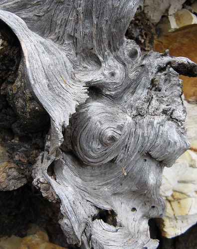
Here’s a cool, gnarly tree root I saw along the way.
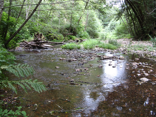
Waddell Creek, trickling towards the ocean. Signs instruct passersby not to drink from it, because it’s reclaimed waste-water. Ick. (I wonder: can it be consumed if its filtered or purified?)
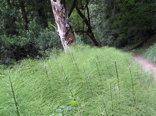
These look like tiny pine trees with ambitions of forest-hood in their future. Maybe WInehiker Russ can fill us in on the actual species.
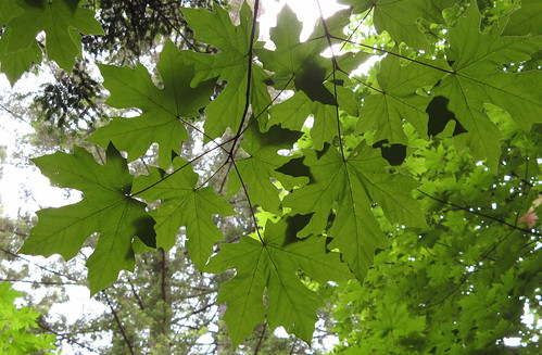
I do know a maple leaf when I see one. One of the amazing things about Big Basin is how many kinds of trees and other plants live here. The giant redwoods are far from the only attraction.
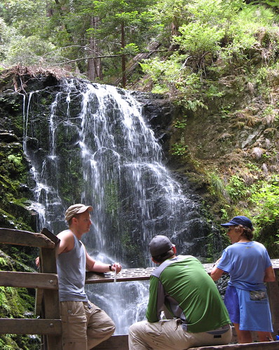
Backpackers pause at Berry Creek Falls. Note to folks who want to see the falls but don’t want to take the leg-burning up-and-down trek out from the Park HQ: the route from Waddell Beach is way, way easier. Uphill, granted, but very gently graded, and downhill all the way back.

A guy named Dana I hiked with for a couple miles up to the falls admires the Silver Falls, the second of three falls along Berry Creek.
At this point I could’ve just turned back and had about the most pleasant 12-mile hike imaginable in these parts. But some part of me said, “heck, it’s not even noon yet, why not make this thing interesting.” I saw two people in the next four hours and slogged some of the most rugged paths at Big Basin. A wrong turn on flat ground was peanuts compared to what I took on next.
One thing I did right: ate almost everything I’d bought for lunch (PB&J, carrots, one of Melissa’s monster oatmeal-raisin cookies), which seemed to help keep my strength up. Funny how that works.
I hiked up the Falls Trail to the Sunset Trail and turned left, up toward Sunset Camp (there’s a privy there, if you can stand the stink), then headed up Anderson Landing Road to Whitehouse Canyon Road, then took the Chalks Road to Chalk Mountain, then headed back down toward sea level via the
Westridge Trail and the Clark Connector.
The first few miles to Chalk Mountain roll rather gently up down on an old gravel road. The ground up here is Cliffs-of-Dover white, presumably because it used to be ocean bed millions of years ago before colliding continental plates created the Santa Cruz Mountains.
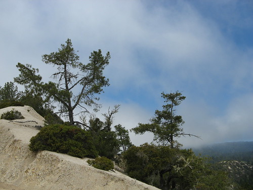
The sun burns off clouds along the Chalks Road.
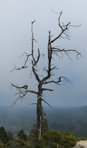
The required dead-tree pic.
There’s a privy and an overlook at Chalk Mountain that make it a good place to rest. To get back to Waddell Beach, though, you have to turn left on Westridge Trail, where rest is not happening. It’s a long string of steep drops and slogging uphills tracking a ridge for a few more miles.
This is a sane stretch of the Westridge Trail — which the map says is for horses, though I can’t imagine any person with a trace of regard for these fine beasts actually taking one up or down this trail.

Pine cones along the way.
I’d call Westridge a Harsh Mistress Trail — it has gorgeous stretches tracking through groves of new-growth redwood, then opens into sunny areas with manzanita and scrub pine. The biological diversity is pretty amazing, because each little mini-ecosystem is defined by its relationship to the sun and the sea. Shady areas near hilltops with access to sea breezes where the fog doesn’t burn off so easily get redwoods. Sunny areas get the scrub.
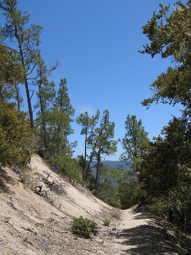
The trail goes up and down the ridge with no switchbacks — daunting enough when the general trend is downhill toward the sea; must be a real leg-burner on the way up. Then you get to the “Trail Ends” sign and have to turn left down the Clark Connector, which is unmarked. This trail is switch-backed but it is still very steep.
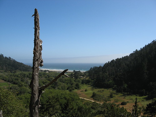
Finally, I’m back on the Skyline-to-the-Sea Trail, looking toward the ocean. The sun has done its duty and burned off most of the coastal clouds, a remarkable transition for a day that dawned gray, damp and chilly.
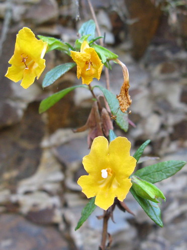
I’d be remiss without a few flowers.

Big Basin from near the Waddell Beach entrance at California Highway 1.
Imagine not hiking on a day like this.
(Fedak has done this hike, the harder way, naturally.)
… and I didn’t hike yesterday and immediately regretted it when I stepped outside in the morning to bring in my copy of the SJ Mercury News. It looked like it would be a spectacular day for a hike! Hell, it looked like the kind of day where I could have taken on the Short Cut again. Instead, I stayed home to redo my home office for working from home, getting rid of the ancient little old company laptop in favor of a a newer desktop PC and 20 inch flat screen monitor and cleaning up all the dust and paper clutter! So now I have a better work environment for working from home but looking at your pictures, I wish I had gotten out into the environment instead. . This is another one of those hikes I have not done but I plan to do. I would like to do it with a group but I’ll tackle it alone if I have to. And sometimes I wonder if Fedak is some sort of super human or something. Some of his hikes are amazing!
No picture of the “outhouse on top of the world”?
That’s the highlight of the trip 🙂
Those little “pine trees”? Horsetails – genus Equisetum. They always grow near streams, or at least where there’s constant water near the soil surface.
And the yellow flowers? They’re perhaps the last of this season’s monkeyflowers, which vary from bright yellow to salmon-orange. A sure sign of Spring in these here parts.
I admit that I used said outhouse, which might’ve been why I was less than interested in taking a picture of it. Plus, the coast was still clouded in at that point.
Russ: I knew you’d know what those green things were. I figured the blooms were monkeyflowers — they were growing out of a steep, rocky hillside like most of the other ones I’ve seen.