
My feet found fresh voice for their complaints along around mile 12. Right ankle decided with no prodding whatsoever to convey aches (and angst: what if I’ve got plantar fasciitis?) as I was working my way down the Jackson Flats trail at Butano State Park. I couldn’t stop thinking: why is taking so damned long to get back where I started?
It wasn’t till I started looking at the time stamps on my pictures that it dawned on me: I’d hiked a full eight miles before I started turning back, which meant six miles on a steep hillside heading down into Butano’s deep canyon. Fourteen miles wouldn’t be such a big deal, except that I spent July getting out of the habit of taking morning walks, and my last 10-plus mileage day happened seven weeks prior, at Big Basin.
Easy hikes aren’t much preparation for tough ones.
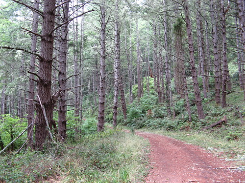
There are a few easy hikes at Butano — it has a lovely creek shrouded by impressive redwoods near the park headquarters and campgrounds, offering a few miles of relatively flat strolling. The rest, though, make their ways up and down the sides of the canyon. Not quite in the Henry Coe league, but at least 1,600 feet of climb to get up to the top of the ridge at the park’s farthest reaches.
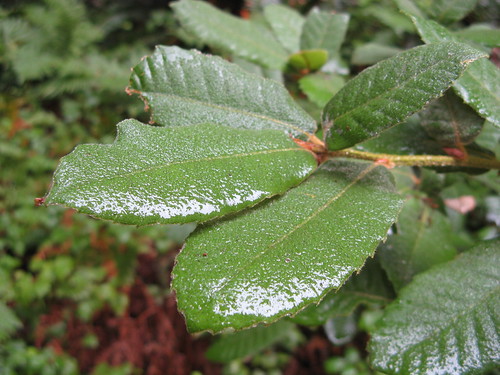
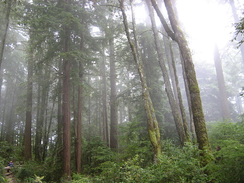
Butano has a rough charm that invites overdoing it. The terrain changes constantly — one minute you’re in manzanita scrub, the next you’re in second-growth redwoods, the next you’re under moss-covered Douglas firs, into and out of each ecosystem time and time again. I hiked more than five miles up an old fire road to a loop called the Ray Linder Memorial Trail — about a mile diving down a hillside and back up through remote second-growth redwoods. After than I headed over to the site of an abandoned airstrip, then I poked around at the backcountry campsites.
The miles had clearly gotten away from me when I turned back along the Canyon Trail/Jackson Flat Trail — an excellent route on the way in but a bit of a slog on the way out. Canyon Trail is especially dicey in few places. No big deal on fresh legs, but scary at times on rubbery ones paying the price for a life of ease this summer.
OK, let’s look at some pictures.
I set out on the Año Nuevo trail — so steep it has stairs in places — towards the Olmo Fire Road. Año Nuevo has great views of the coast on a clear day but it was all clouds yesterday, so the scenery wasn’t all that tasty. Olmo Fire road is a nice walk pretty much the whole way. All uphill, pretty much, but I’ve hiked on far worse. It has a couple single-track spur trails along the way that are worth a look. I had other dirt to trod and stayed on the old road till it intersected with the Butano Fire Road, which leads over to Big Basin and Portola state parks.
It was moist and cool all day — perfect hiking weather.
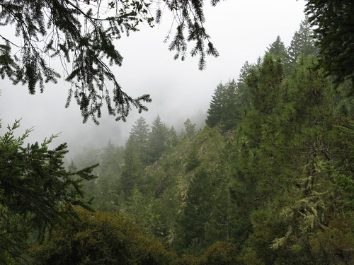
The terrain up this way is mucho steep, which is another good reason to stay on the old road. If you fall off the trail one of those spurs they might find what’s left of you in a couple months.
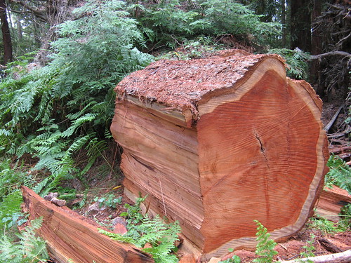
An immense redwood had apparently fallen across the trail fairly recently and had to be cut up and moved out of the way; note that at least a third of this trunk is missing.
The Butano trail map shows a little loop called the Ray Linder Memorial Trail — I figured they wouldn’t put somebody’s name on a bad trail, so I headed in for a look. It really is a nice mile or so of trail through a stand of young redwoods (and other trees, obviously). Whoever Ray Linder was, his trail is a nice tribute.

Saw more banana slugs yesterday than I had all summer.
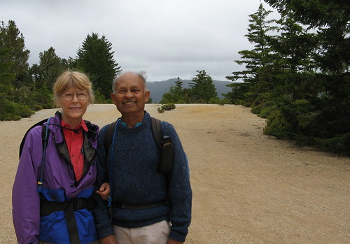
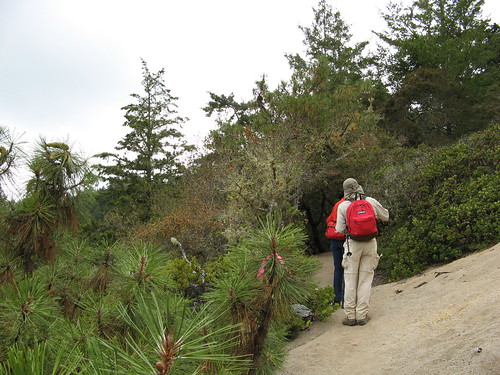
Hiking celebrity sighting! This is Dinesh Desai and his wife, Joy, who have done a raft of impressive hikes in the Bay Area, including all the trails at Henry Coe and nine peaks in nine days, climbing the equivalent of Mount Everest from sea level. They’re standing on the abandoned airstrip along the Butano Fire Road.
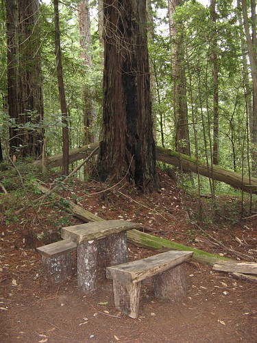
I wandered around the backcountry campsites to see if they seemed worth of an overnight stay. They have these nice bits of furniture carved from logs, but they also have no water source nearby. Dry camping isn’t my cup o’ tea, truth be told.
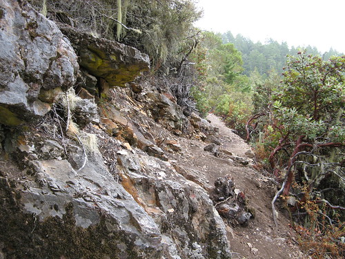
The Canyon Trail has a bunch of rough patches.
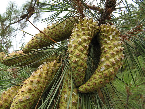
Young cones, still on the tree.
Near the Jackson Flats junction; from there it’s another 2.5 miles back to the park HQ.
Well, enough for today, but I’m thinking of dashing back out there today to check out trails I might’ve missed.
om, once again your pictures are gorgeous! Nice selection. I have never been to Butano and it looks like a park I need to check out. And I trust and hope you do not have plantar fasciitis. If you do, there is hope. I have it and I finally broke down and got my feet scanned for custom inserts for my hiking boots. My insurance would not cover them and the cost me an arm and a leg but now I can hike all day without heel pain whereas before, by the end of a hike I could barely walk! And to meet Dinesh and his wife on the trail, Wow! Talk about hiking hero’s, their July 1998 hike through Death Valley is the stuff of legends!
Awesome depth and color in your pix…..very vibrant. Gee, almost better than reality!
Tom, it was nice meeting you in Butano on Sunday.. That mysterious mushroom appears to be quite old and not easy to identify. Joy’s best guess is that it is a hedgehog mushroom.
Looks like I’ll have to put Butano on my “things to do” list! I haven’t been there since I was walking – I always welcome a “fallen tree vault” attempt or two….next 110 degree day in sunny L’more and I’m THERE!
I found this blog post looking for info on plantar fasciitis, but I’m glad I stopped to check your photos. Especially the one of the chopped down Redwood. (Being from the Midwest I don’t get to see Redwoods, let alone the inside of one.)
If you ever are looking for a good supplier of comfortable shoes that provide lots of orthopedic support, then check out http://footsourcemd.com. There’s not much in the way of hiking boots, but wearing supportive shoes every day does wonders for foot health.
Thanks for the post and good hiking to you!