
The cool thing about Wilder Ranch State Park is how you get from one side to the other: Tunnels under Highway 1 connect the coast to the backcountry. The map shows two intended for human traffic, and those who’ve been following along will already know that if there is a third, deeply inadvisable tunnel to the other side, it will be the one I find first.

This is the right tunnel, which connects the Ohlone Bluffs Trail to the Baldwin Loop Trail. I noticed it from about a half-mile away, satisfied that I’d found my way to the other side after about three hours of making my way up the coastline. Then it faded from sight after a bend in the trail.
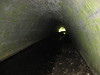 I turned left on the first trail that seemed to be going in the proper direction, expecting to see the white-framed tunnel, above. Instead I got farther and farther down an old ranch road till I hit a little stream, with a large, concrete-lined tunnel under the highway off to the right. Naturally, I had to splash blindly all the way to the other end (good news: GoreTex works!) before I concluded beyond all doubt that it couldn’t possibly be the correct tunnel. Then I had to splash blindly all the way back, all the while expecting either a) snakebite from a bathing rattler; or b) attack from a rogue Vietcong tunnel rat.
I know what you’re thinking: I walked up four miles of gorgeous coastline, past two beaches known for attracting naked sunbathers, and the best I’ve got is this wrong-tunnel routine?
Sorry, God can’t always provide nudists on command (even though it would encourage timely prayer, though I suppose praying for prune-skinned, potbellied old white guys to put some damn clothes on doesn’t really count.)
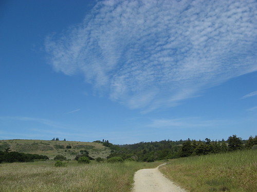
But anyway, the story on Wilder Ranch, for those who’ve never been: The coastline is pretty, though perhaps only an 8 on a 10-point spectacular-vista scale. The Marin Headlands and Point Lobos are nicer. The backcountry is mostly open in an area where you’d expect a redwood forest. If you don’t mind walking in the blazing sun and stepping aside for mountain bikers (I don’t, actually, but I know some people are finicky), stringing together a beach/backcountry hike is most likely the best way to experience Wilder Ranch.
So, let’s see some pictures from Sunday:
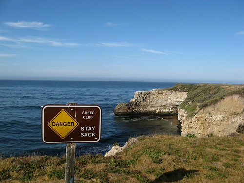
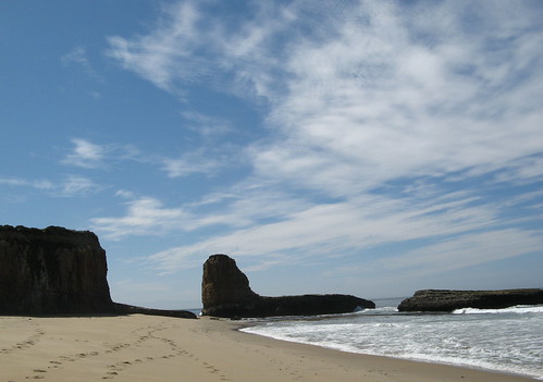
The main thing is to avoid the urge to get right up to the edge of a cliff for a peek at what it looks like down there. It looks like a beach, OK? And now I’ve saved you from an untimely demise. Hey, it’s what I do.
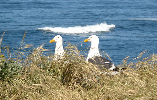
There are many seabirds.
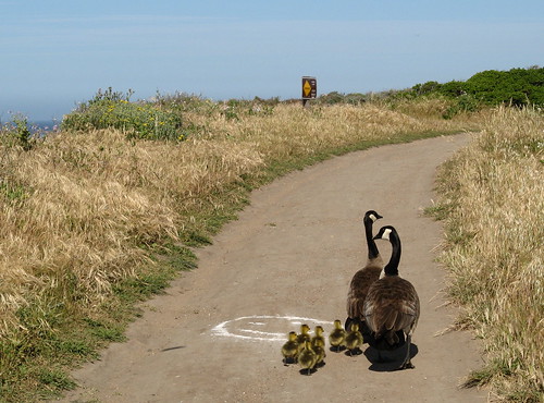
And Canada geese with their goslings.
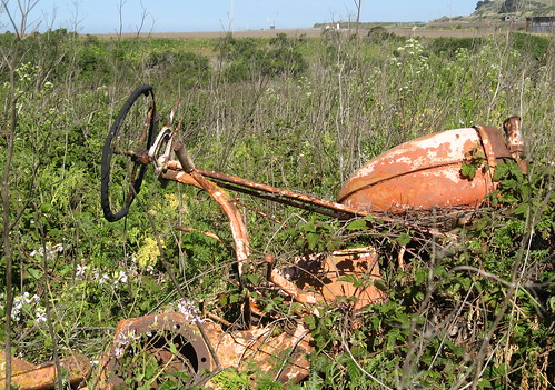
There’s much agriculture nearby, though most of the tractors are in better condition.
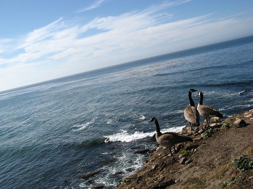
I think if I were an artist I’d title this “Canadians at America’s Edge.” Or something.
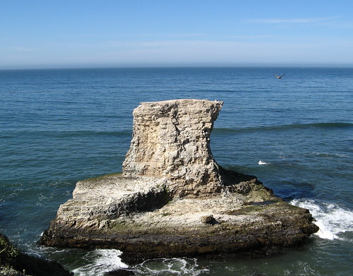
A bit of continent makes a determined stand against the ocean. Let’s be nice and think for a second that it stands a chance.
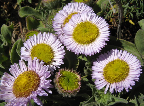
Coastside daisies (note to all you keepers of wildflower pages, could you please add this one? It took me a half-hour to figure out what it is).
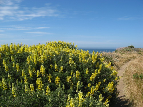
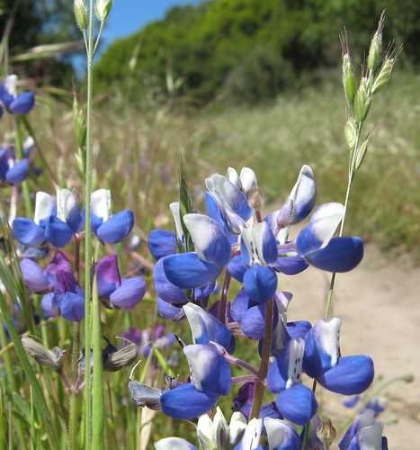
Lots of false lupines blooming.
This is Four-Mile Beach — which must be much farther than four miles by trail from the park HQ because it took me three hours to get there. OK, I took some detours and I walk at a crawl but I’m not that slow. Depending on the breaks, Four-Mile is more like six.
So, if you go this route in a grand loop, you take the Ohlone Bluffs Trail all the way back to Highway 1 and turn left when you see a “Trail” sign with a hiker icon. It goes down a little single-track and the tunnel shows up in a couple minutes. If it doesn’t, you might be on the way to my wrong-turn tunnel.
Once you get to the other side via the proper tunnel, you pass somebody’s farm house and wander up to the Baldwin Loop Trail. I didn’t really know which way I wanted to go, so I just turned right at the first single-track trail that seemed to be heading in the approximate direction off the park HQ.
I ended up on a trail nearly overgrown with tall grass and flowering weeds.
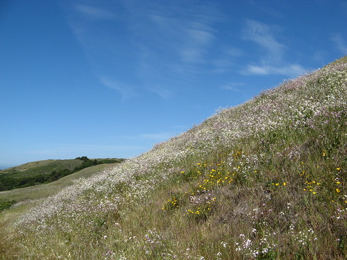
This was where I figured meadow hiking isn’t so bad, if it’s a nice meadow. It helps to have cool Pacific Ocean breezes.
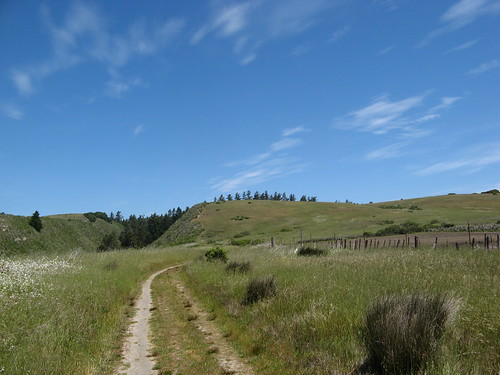
Eventually this little spur reconnects with the Baldwin Loop Trail, which makes its way up the hillside, where I found a junction that led to the Twin Oaks Trail, which worked its way back down the hillside and connected with the Wilder Ridge Trail, which went back to the HQ. Saw lots of wildflowers on this side, among them:
Lots of miniature lupines.
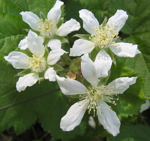
And these interesting weeds, which I couldn’t identify.
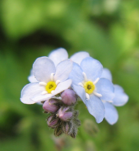
Forget-me-nots blooming in a rare shady area.
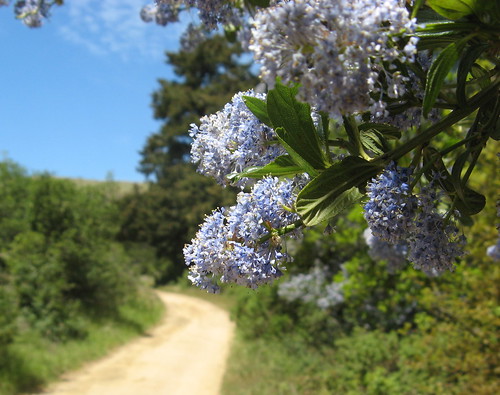
A blue-blossom bush along the Wilder Ridge Trail.
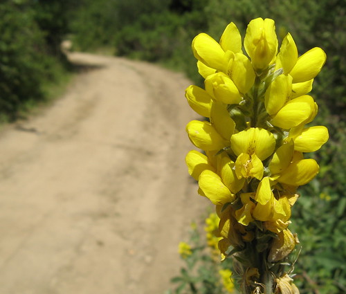
More of those false lupines.
One last look at the backcountry terrain, before taking the other correct tunnel back to the HQ.
So that’s Day One. I’ll have to go back next weekend to explore more of the backcountry for Day Two.
Selected Wilder Ranch links:
- Yelp.com user reviews.
- Jane Huber’s Bay Area Hiker page.
- California State Parks page.
- Virtual Parks page with QuickTime VR panoramas.
wow, you take amazing pics!
Well, I kinda sorta know which way to point the camera and trim out the unnecessary stuff; the terrain does the rest.
I have to second baychic Tom, your pictures really are wonderful. You’ve got a great eye. Dig it!
thanks for the report, I enjoyed my time at Wilder Ranch SP when I went. Did u go to the Fern Grotto? I liked that place. My yelp review:
http://www.yelp.com/biz/wilder-ranch-state-park-santa-cruz?rpp=40&sort_by=date_desc
Tom, your tunnel vision is crackin’ me up!
Ann: I did go to the grotto, but didn’t realize what it was till I read about it later. Seemed like an aviary in there, or perhaps a secret entrance to the Bat Cave.