
Add Pescadero Creek County Park to your must-hike list, if it isn’t there already. It’s remote, quiet, full of ambitious young redwoods and a smattering of really old ones that, oddly enough, survived the steam-powered saws of outrageous fortune.
- San Mateo County Parks page.
- County parks map. (free PDF)
- Virtual Parks shaded relief map. ($1 to download; worth every penny).
- Redwood Hikes Pescadero Creek hike.
- Mondo map of trails in Pescadero, Portola, Memorial and Sam McDonald parks. ($6.95, from Redwood Hikes, above)
- Kevin Gong’s hike.
If you’ve hiked next door at Portola Redwoods State Park or the neighboring San Mateo County parks — Sam McDonald and Memorial — then you pretty much know the second-growth redwood vibe. Now matter how grouchy I get from working all week in an industry whose operative description is “smoking death spiral,” walking in these regenerated forests cheers me up. If the redwoods can come back, maybe people will someday read newspapers again.
Could happen. I’m not betting the rent on the idea, but I suspect lovers of redwoods weren’t exactly brimming with optimism 100 years ago when all these hills were clear-cut.
Pescadero is a hike-in park; you can’t drive to its interior, unless you’re dropping off scofflaws at the county jail (an oddity that adds to the place’s charm). There’s only one trail head with a parking lot; otherwise you walk in from Portola, Memorial, or Sam McDonald.
So, anyway, my hike: I started at the lone parking area at Tarwater Loop Trail Head, which is at an optimal elevation of just over 1,000 feet — no matter how far you march down into the woods, you never have to worry about climbing more than 1,000 feet on the final return leg. The parking lot is at the end of Camp Pomponio Road (which is about a quarter mile past the Portola State Park entrance on Alpine Road, if you’re coming from Skyline Boulevard). From here you’ve got two options:
- Into the woods from the trail near the parking lot.
- Crossing the road and crossing a meadow for about a mile before entering the timber.
I did the former, but I’d recommend the latter, so you can finish your hike in the shade vs. the sun. Trails hiked: Tarwater, Pomponio, Bear Ridge, Canyon, Tarwater; miles: 8 or so.
Let’s see some pictures.
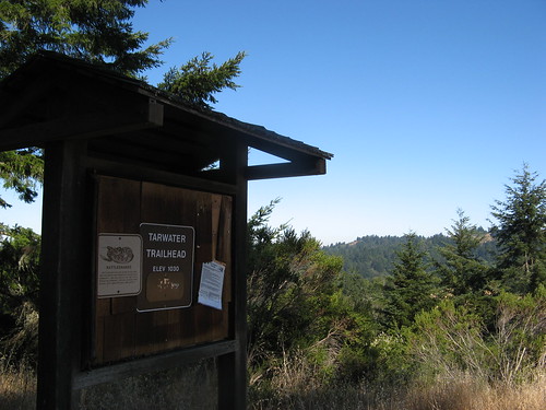
Trail board at the Tar Water Loop Trail Head. It’s all downhill from here. Coming back this way is shadier, but it might be a bit steeper than the sunny route.
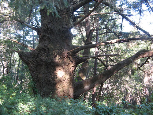
This immense Douglas-fir is one of my favorite trees in these hills.
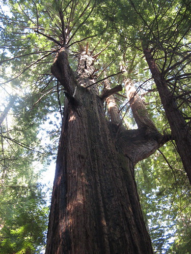
This looks like an old-growth redwood that somebody neglected to cut down. Note the odd elbow-shaped branch over at the right; I wonder if it dates to the 1906 earthquake, which caused quite a few trees in these parts to take strange turns.
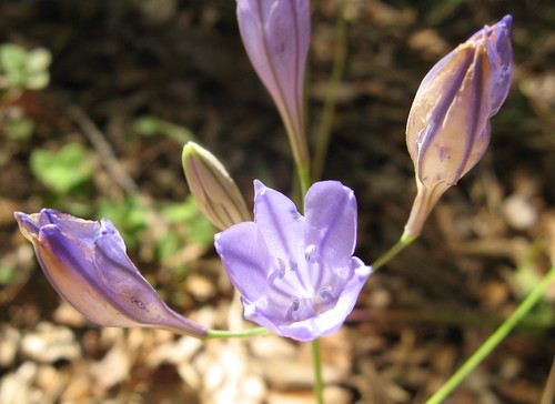
Still wildflowers happening this year, especially in the shade.
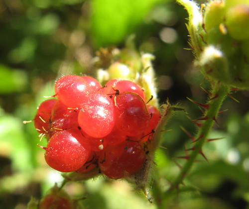
And a few berries. Actually the woods around here fill up with edible berries later in the summer.
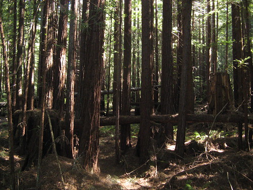
The redwoods get thicker the farther you get down the Tarwater Trail. They’re really growing like weeds here … I took this picture mainly to convey how dense they are.
Tarwater Loop Trail bottoms out at the Pomponio Trail, which heads back uphill after you cross a bridge over a creek. Just under a mile up, there’s a key trail junction that gave an option of hiking deeper into the park on Pomponio Trail, or heading in the general direction of where I started out. I started heading back on the Bear Ridge Trail, which connected to the Canyon Trail. These two trails are extremely remote and populated with the stumps of countless giants cut down in the logging era. Bear Ridge and Canyon again prove that you have to go deep to find the best trails.
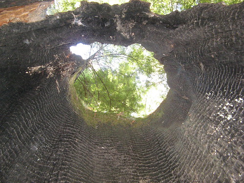
A burnt trunk on the Bear Ridge Trail.
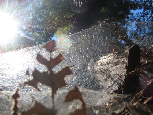
The spider webs on Redwood trunks always offer cool picture-taking opportunities.
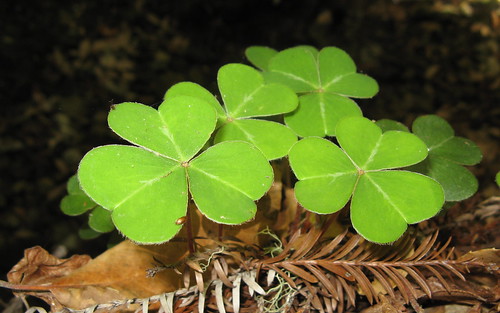
Clovers grow near a creek where I paused for lunch at the bottom of the Canyon Trail.
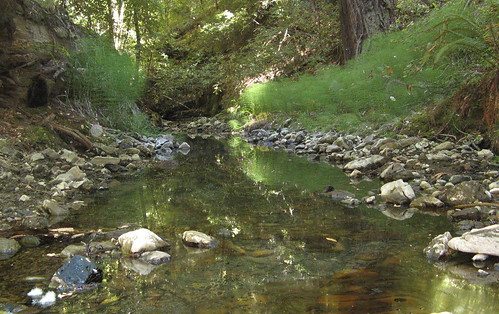
The Tarwater Creek doesn’t have much water in it right now, but it’s probably a gusher in the winter. I imagine this crossing must be waded across.
Once I got back to the Tarwater Loop, I turned left and headed back uphill toward the parking lot.
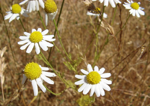
A few sun-loving wildflowers survive as well.
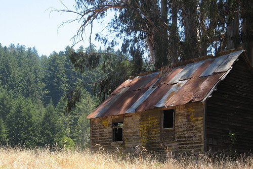
Old shacks are oddly photogenic.
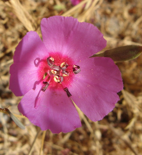
These examples of “farewell to spring” were everywhere — especially along the road to the parking lot.
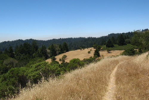
The last mile and a half track through a pretty meadow … though it is a bit warm in the sun, which is why I suspect it might be better to start out this way rather than finish up in the sun. (This, of course, assumes you start out in the morning. If you start out in the afternoon with the idea of finishing around dusk, this might be a nice return leg).
When I finished I bumped into Mike Wimble of FOMFOK fame, who was rambling about with some geocaching buddies of his, who note there are quite a few caches along the Tarwater Trail, if you know where to look. I hiked with Mike and company on the Tarwater section last summer.
Here’s a Google map if you feel like trying this hike:
Your old shack reminded me that I’ve been accumulating shots of old rusty objects, mostly cars. My buildings are a little more decrepit. It’s interesting how at some point trash turns into art. I even like finding rusty tin cans that some packer left fifty years ago.
I very much enjoyed viewing these photos, and some day hope to hike that area.
hikingfun
http://www.HealthyHikerGear.com
Nice pictures, Pescadero Creek Park has some great hikes. The Portola trail which starts on the Old Haul Road from the Iverson Trail in Portola State Park has a great waterfall on Fall Creek about half a mile from the Haul Road. If you continue up to the top of Butano Ridge the best view is actually just off park property east of the gate at the top of the ridge.