
Garin-Dry Creek Pioneer Regional Park is mostly former ranch land, like most of the East Bay parks, which means a fair share of old Jeep trails better attuned to the internal combustion engine. The park is in lies in the short hills on the east edge of Union City between Fremont and Hayward: Suburbia bumps right up next to a fair stretch of its western edge — the sound of traffic on Mission Boulevard is audible for a quarter mile past the trailhead I started out from — but there’s acre upon acre of quiet, open country once you hit the interior.
I had a fair amount of mud, but I also had gorgeous skies that begged a return to still photography this week (first thing I saw when I left the house was a rainbow stretching from the Oakland hills to San Francisco; how’s that for a good-luck omen?).
My last stop was the site of a 1951 airliner accident that killed 50 people. I knew it was there, knew there would be nothing to see, twisted-metalwise (who wants to be haunted now that Halloween’s over?), but knew I had to go anyway.
One of my favorite things about Garin-Dry Creek: It has a new, no-fee parking lot at the park’s southern end right off Whipple Road from Mission Boulevard. All the best hiking is in the Dry Creek Pioneer half of the park, and this trailhead puts you right in the middle of it. The Garin section to the north is more a take-the-family-picnicking park (even has a meadow for kite flying) with a nice pond to gaze upon waterfowl.
I started out at this staging area and headed up to the Garin section via the High Ridge Loop, then circled around Jordan Pond and headed back south on the Dry Gulch Trail (which is shady and gorgeous after the rain). From there I took the Meyers Ranch Trail to the Tolman Peak Trail summit at, you guessed it Tolman Peak (the 1951 plane clipped a knob near the peak and disintegrated into the canyon below). From there I took the South Fork Trail, another very nice single-track and headed back to the trailhead. I was out five hours and probably covered eight or nine miles.
The hills at Garin are not high, but they add up, particularly if you haven’t been out on a real hike in awhile. In fact, if you’ve been a slob like I’ve been for the past month and you live nearby, it’d be a great place to reacquaint your lower extremities with the realities of going up and downhill.
Let’s get to the pictures. (Here’s a Flickr slideshow if you’d rather skip the commentary.)
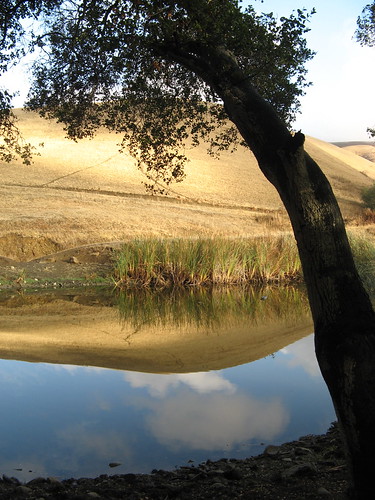
I had excellent morning light when I happened across this cattle pond at the junction of the May and High Ridge Loop trails. There’s a bunch of trail in the park’s interior along the Pioneer Trail and the far eastern segment of the High Ridge Loop that I never got to … I’m sure it all has potential.
More nice morning light. I headed up the segment of the High Ridge Loop that takes the most direct path to the Garin section. It’s a bit close to civilization for my taste, but it has excellent views of the East Bay and beyond.
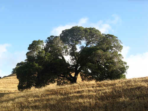
A pretty oak tree along the way.
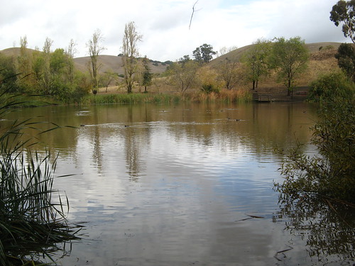
Here’s Jordan Pond, about a mile and a half from the Whipple parking lot. Lots of coots making coot-like sounds. Nobody around except a couple joggers and an old guy walking with an umbrella. I felt a few sprinkles but otherwise, no rain.
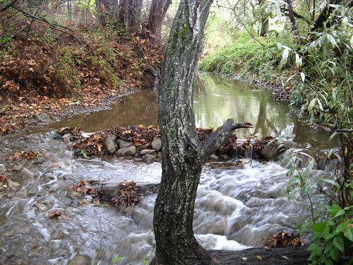
Dry Creek’s not so dry after a day of rain. There several nice picnic spots along the creek bed … all that much nicer to lunch by when the water’s running.
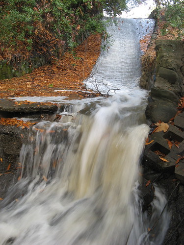
Water cascades down from the Jordan Pond spillway. Closest we get to a waterfall in these parts.
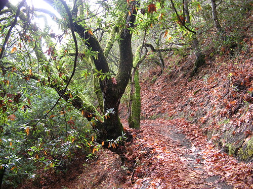
I headed down the Dry Creek Trail, which was the nicest stretch of dirt all day.
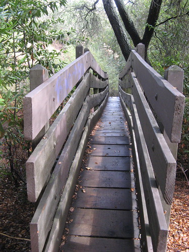
You might have to diet for a few weeks to get across these bridges. If I didn’t know better, I’d say they were deliberately put there to thwart horses and mountain bikers.
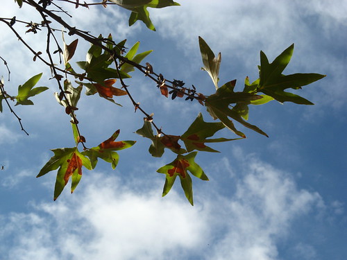
Some fall color along the way.
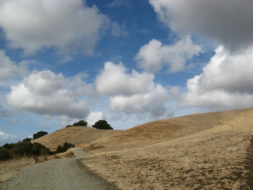
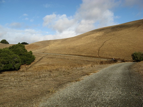
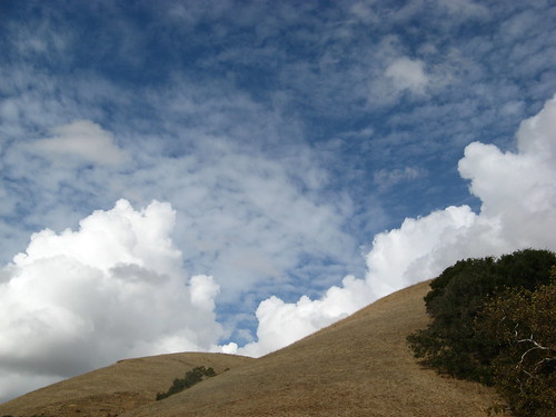
And great sky. Gravel paths are a blessing after a rainy weekend.
So, on to Tolman Peak.
If you were standing right here before dawn on the morning of August 21, 1951, you’d have seen a large, four-engine aircraft come tumbling over the hill just to the right of this hilltop. Then you’d have been obliterated in a hail of flame, fuel and fuselage from United Flight 615, a coast-to-coast redeye on final approach to Oakland’s airport. It hit the ground 26 feet below the Tolman Peak crest and spread wreckage in a swath 900 feet wide and 1640 feet long. (Neil Mishalov’s page has more details. He was up there a few years back).
Here’s a page naming those who died in the crash. Here’s the co-pilot’s profile:
First Officer George A. Jewett, 35, of Redwood City, CA
Raised in Ames, Iowa, he had been flying for United Air Lines for five years, having been a veteran of 37 bombing mission in the B-17 ‘Flying Fortress’ during World War II, leaving the service as a captain.
A qualified captain for United for over two years, he was receiving familiarization training in the DC-6B before captaining his own.
Guy survives 37 B-17 missions — typically the most dangerous air duty of World War II — and perished because his pilot is flying 26 feet too low. Also: a mother and her three children, and two brothers who caught the flight at the last minute. I can’t imagine the heartbreak of their survivors.
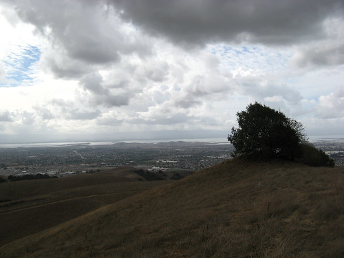
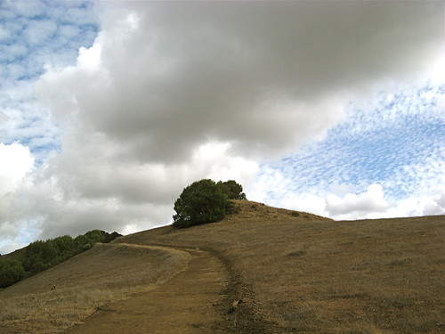
Another look at Tolman Peak and the Bay Area beyond.
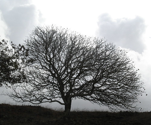
A tree on the peak.
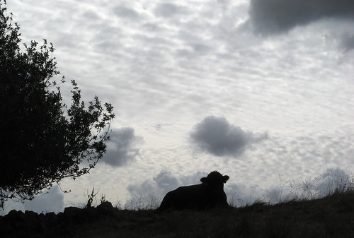
So, anyway, from there I took the South Fork Trail, snapped a shot of this angus bull in repose, and headed down a step, pretty single-track.
Quite a bit of fall color along the way.
And more amazing sky.
This trail eventually made its way back to where I started at the Whipple road parking area.
All in all, a nice place to get the legs working again. Garin-Dry Creek certainly isn’t the sexiest of the East Bay parks, but it is quiet and uncrowded, even on weekends, and the views open up nicely the farther you hike in.
Here’s my first post on Garin-Dry Creek. It has more links and a map to get there.
Tom, that is a stunning, and inspirational set of photographs… thank you for sharing them and your adventure with your readers!
Cheers,
Mungo
Nice post, Tom.
Thanks.
… I had a text warning on the post, however, stating: We’re sorry, this site is blocked.
Some advertising that did not get through in Firefox?
Wow, nice, Tom . . . a prettier place than I’d ever imagined. I’m surprised at the amount of water after such a piddly little rain. . .and amazing shots of it all!
Actually the pictures might exaggerate the picturesqueness of the place … Las Tampas is far nicer, for instance. But I did catch a break with the water running.
Well, the pictures have still inspired me to get over there in the near future. One of my running friends goes to Garin often and now I’m willing to drive down and run– gorgeous pictures!
Actually, Garin/Dry Creek is a pretty awful place. It’s basically a cattle ranch where humans are allowed to wander. Trails are destroyed by cattle. It does not have much redeeming value other than it’s nearby…