
I had crazy-great weather — sunny and clear with cool breezes — for Sunday’s hike at Henry Coe State Park’s Dowdy Ranch Visitors Center. The trails near Dowdy Ranch, which opened two years ago, are classic Coe: straight up and down the hills, which seem to go on forever.
Henry Coe regulars typically carry the big, plastic-coated map printed in 2002. The latest map update was in 2006. At the park the other day I asked a volunteer what was different in the new one. She pointed to a tiny section in a remote corner of the park that no sane human being would attempt to visit on foot.
Bottom line: Your 2002 version is fine (if you don’t mind hauling its considerable bulk). You could buy the newer map on Amazon and send a few dimes my way, but I must note it’s much pricier online (which is odd, given Amazon’s reputation for discounts.) Buying the map benefits the Pine Ridge Association, Henry Coe’s No. 1 supporter.
If you don’t own the map you can always buy one at the visitors center at the main Dunne Avenue entrance or at the Dowdy Ranch visitors center if it’s open.
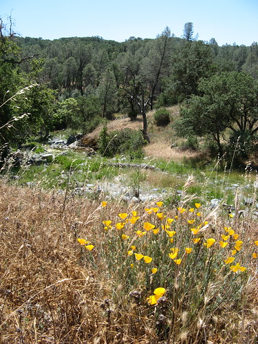
Nevertheless, there’s fine dirt-walking from this destination. I clocked six miles with about 1800 feet of ascent/descent, soaking in excellent vistas from the ridge tops, abundant wildflowers the whole way, and a wonderful riparian romp along the North Fork of the Pacheco Creek. Saw several deer, a few butterflies and the required bugs and lizards. Speaking of species with more than four legs: it’s still tick season at Coe; I must’ve brushed a dozen of them off my pants along the way.
A bit of backstory: Dowdy Ranch Visitors Center opened two years ago to great hopes that it would open vast remote corners of Henry Coe State Park to hikers, bikers and horseback riders. The fact that it’s taken me two years to do any hiking there should tell you something (beyond me being too damn lazy). It’s so far from everything — at the end of seven miles of dirt road accessible from Highway 152 south of Gilroy — that the drive from the nearest population center discourages all but the most determined Coe fans. Few visitors means weekend-only staffing of the visitor’s center so, well, you’ve read “Catch-22,” right?
The Dowdy Ranch page at Coepark.org says they try to keep it open from May through October, which misses my favorite Coe season: February to April, when the wildflowers start to pop and there’s still running water in the creeks.
When Dowdy Ranch is open, you still have to get there between around noon on Fridays and Sunday evenings before sunset. A gate at Bells Station blocks the road to the visitors center the rest of the time. (If you’re planning a backpacking trip from Dowdy Ranch, call (408) 779-2728 first to make sure the gate will be open.) You should be able to get a Friday/Saturday/Sunday trip in, but those of us who have odd days off are outa luck. There is one glass-half-full outlook on the weekend hours: it might motivate you to spend an entire week in the Coe backcountry, which would be cool in its own right.
Perhaps the nicest thing about Dowdy Ranch is its elevation: at 1,600 feet, it’s only 800 feet of vertical descent down to Pacheco Creek, so you can do a couple moderate loops that involve admittedly arduous climbs that are mercifully short by Coe standards. My hike was a clockwise loop taking in Hersman Pond Trail to Center Flats Road to Scherrer Trail to North Fork Trail to Mack’s Corral Trail — six miles and change depending on how distracted you get. (It’s the second hike on this PDF from Coepark.org.) You can also add a little over a mile by bagging Burra Burra peak from Center Flats Road; I avoid deliberately adding elevation gain to a Henry Coe hike on general principles.
OK, so let’s hit the trail and see some pictures.
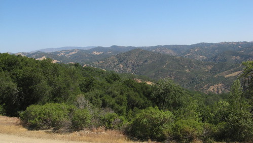
The wilderness stretching forever vibe is strong from the beginning.
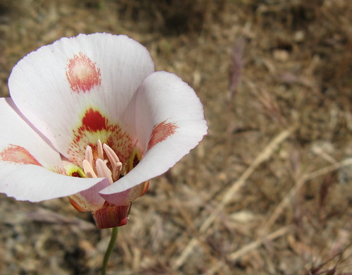
It’s a wonderful year for Mariposa lillies — I saw more on this hike than in all my previous Coe outings combined.
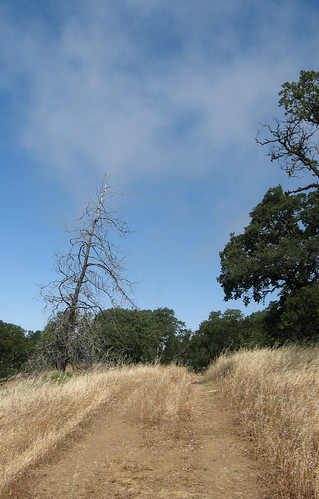
Center Flats Road may be in the center of a ridge, but it is not remotely flat (how could it be? This is Coe after all).
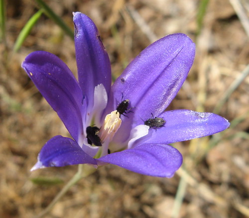
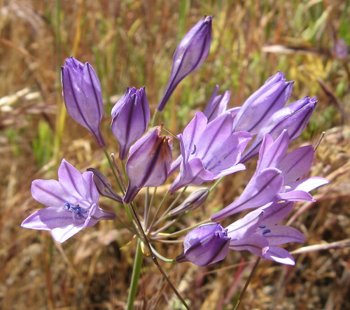
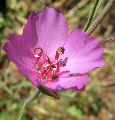
I like a few bugs with my elegant brodeia — it discourages people from stealing my pictures. This is on the Scherrer Trail, which was rife with wildflowers on Sunday. There’s supposed to be a spur trail to a pond along this trail but I didn’t see it. Frankly it’s more a rumor of trail most of the way, which makes the hiking more interesting.
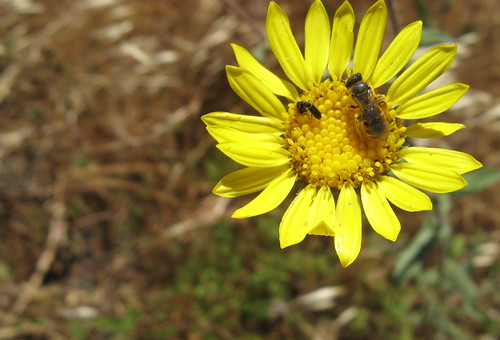
Bugs go well with sunflowers, too. (I guess these are wild sunflowers; send corrections if you’ve got a better guess).
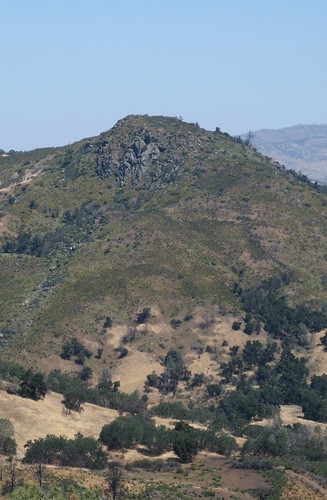
I couldn’t help noting all the green on this distant peak — wondered if perhaps it was regrowth from that nasty fire we had a couple years back.
Ithuriel spears are going like mad at Coe this year.
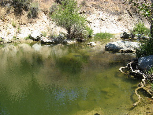
Scherrer Trail dives steeply to Kaiser-Aetna road. From there it’s a left turn and a short stroll to the North Fork of Pacheco Creek. There’s a cool swimming hole at the crossing. I headed up the North Fork Trail, a rich riparian path that required several creek crossings.
Poppy bush along the North Fork Trail.

Another pretty water hole on the North Fork.
They call these farewell to spring; one of the nice things about summer’s approach.
North Fork Trail runs into Mack’s Corral Trail, with 800 feet of climb in 1.2 miles back to Dowdy Ranch. It’s steep but mostly shady. Tiring but not rage-inducing like some Coe trails.
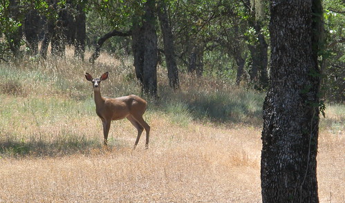
I scared several deer along the Mack’s Corral Trail. Here’s a doe making sure I’m not carrying a hunting rifle.
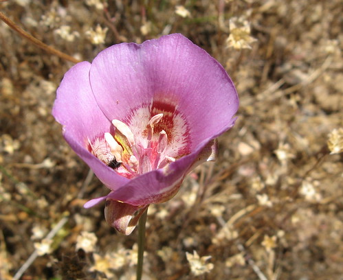
Another variety of Mariposa lily. Who comes up with these colors?
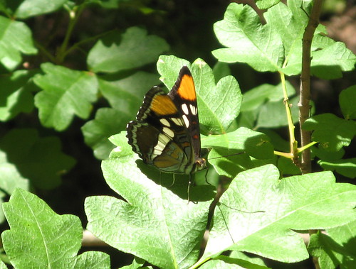
A rare (for me) butterfly shot. Either they scare too easily or I’m too easily distracted to wait around for one to pause for its close-up.
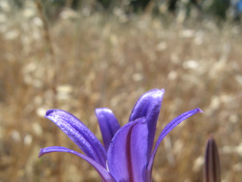
Some petals of an elegant brodeia.
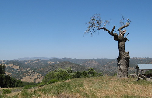
One last vista from Dowdy Ranch.
Here’s a Google map of the Dowdy Ranch trailhead.
View Dowdy Ranch Visitors Center in a larger map
Need more on Henry Coe? Check out EveryTrail’s Destination Page.
Back to the insanely hot summer Coe hikes, eh? 🙂
This one was actually insanely cold, at first anyway. Warmed up fine but never got crazy hot all day.
Nice pictures, Tom – I haven’t been there in about 3 years and I’m itchin’!
Henry Coe’s wildflower array was similar earlier this week (June 16, 2010). I mountain biked from Coyote Creek to China Hole. This 16.5-mile trip is arduous but delightful because the China Hole Trail is magnificent and China Hole is a delight for wading, massaging one’s feet on the smooth pebbles, sunning oneself on the beach there, and generally imbibing some of the best of California’s low-elevation wildlands. This trip, by the way, explains one reason I like mountain biking so much. It’s much more work than hiking, but the ride took 2 hours 15 minutes, whereas hiking it would have taken at least a full day. Thanks also for the explanation of the 2006 versus 2002 map—I was searching for that information and that’s how I discovered this page. Question: a later edition of the map has since come out (maybe in 2008?) and I would like to know if anyone knows what changes were made on it.