
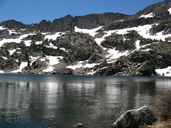
 Shimmering waters of Lake Winnemucca
 “I can breathe up here.” So said my allergy-prone wife, Melissa, whom I had talked into an “easy” jaunt down to Lake Winnemucca from Carson Pass.
It was an odd thing to hear 9,000 feet up in the Sierra Nevada from somebody who can can barely walk three miles on Bay Area sidewalks before allergies tie her lungs in knots. Five miles with 1,000 feet of elevation gain all above 8,000 feet is a comparative breeze, however.
The things you learn on the trail.
I’ve had a burning itch to get up into the real mountains for the past several weeks but other stuff kept getting in the way. Early Monday morning I woke up with no plausible excuses not to head up there. I asked Melissa if she was game for a road trip; she was, and packed us a picnic lunch and off we drove toward Highway 88.
I wasn’t absolutely sure I was going to hike, but we arrived at Carson Pass under perfect skies and friendly breezes that made up my mind for me. Before I knew it I was asking Melissa — Ms. Gridlock For Lungs — if she was up for a quick walk down to Winnemucca. The sign said 1.5 miles one way — how hard could that be? The last time I tried something like this, we discovered her redwood allergy right in the middle of the biggest redwoods in the Bay Area, but she was in a go-for-it mode, so off we went.
For once fortune smiled on my foolishness. I kept waiting to look back and see her gasping for breath, bathed in sweat and begging to turn back. Never happened. According to my GPS it’s more like 2.5 miles down to Winnemucca from the Carson Pass trail head — uphill the whole way; perhaps a thousand feet of climb in the whole out-and-back, but still a moderate hike by any stretch. I got the racing heartbeat I always get hiking at altitude; I’m not sure Melissa’s ever got going that fast.
Score one for the magic of mountain air.
The cool thing about Carson Pass around the Fourth of July is that the Pacific Crest Trail through-hikers are starting to pass through. We saw at least a half-dozen.
You can pretty much always tell the through-hikers: they just have an aura (and, of course, odor) of having been walking for a very long time. As I passed two on the trail, I yelled out “how long you guys been out?”
Since the middle of April, they said. Asking is the other way to tell. It’s perhaps better not to think about: Half of April, all of May, all of June, a week into July and they’re not even half-way to Canada.
This is Blue Eyes, left, and Socks. They both have Trail Journals, it turns out. His | Hers.
We also met a guy called “Two Weeks and Three Days.” That’s how long his wife figured he’d last on the Appalachian Trail, he told us. Guess he’s showing her now. Melissa gave a pair of her impossibly tasty oatmeal chocolate chip monster cookies to a hiker named Paul (no trail name). We also saw a couple trying to thumb a ride into Tahoe. We weren’t heading that way, so we missed that trail-angel opportunity.
OK, let’s see some of that High Sierra scenery:
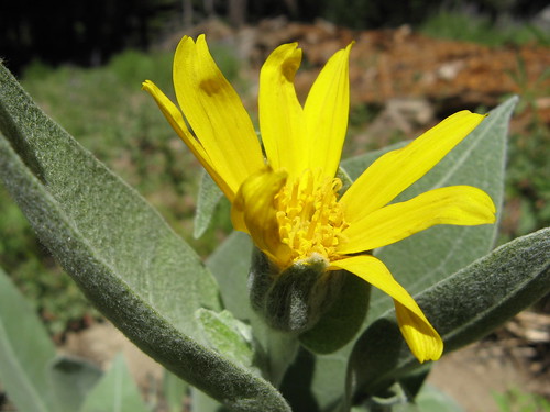
I’m too lazy to look this up: anybody want to identify it for me?
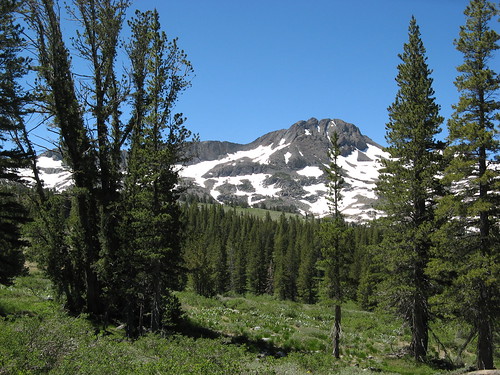
Round Top in the distance. Lake Winnemucca is at its base.
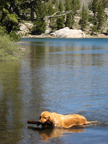
A trail runner was sending her dog fetching a stick in Frog Lake, which is less than a mile from the trail head.
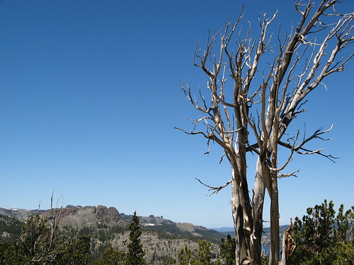
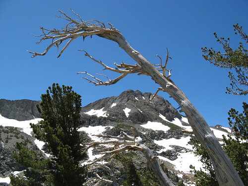
Abundant photogenic snags.
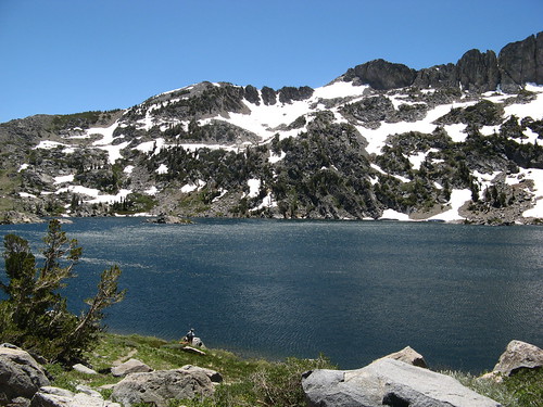
We stopped here at Lake Winnemucca — the breezes flowed in distinct patterns across the surface of the icy waters.
I tried to get a little arty here. Not sure it worked.
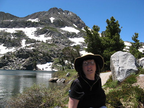
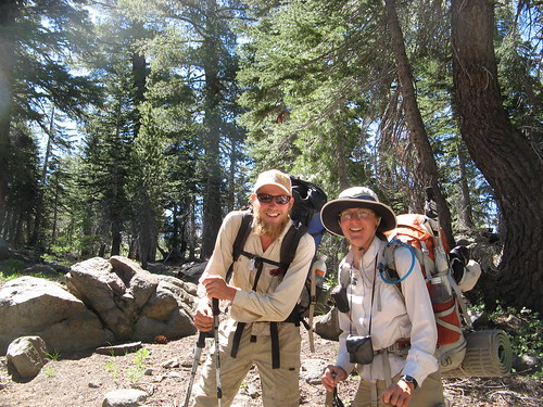
Melissa wanted photographic evidence that she had successfully hiked all this way.
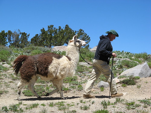
Always fun to see llamas on the trail. They walk with incredible poise — like they were bred for incredibly narrow Andean footpaths where their ancestors had two choices: develop good balance or die trying.
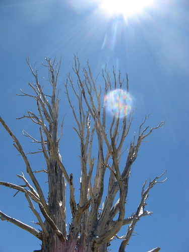
More sun and snag action.
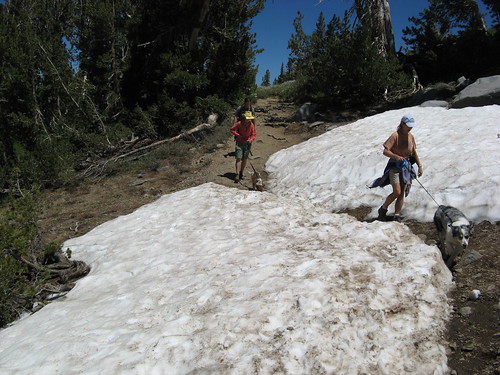
Hikers and dogs dash through a patch of remaining snow.
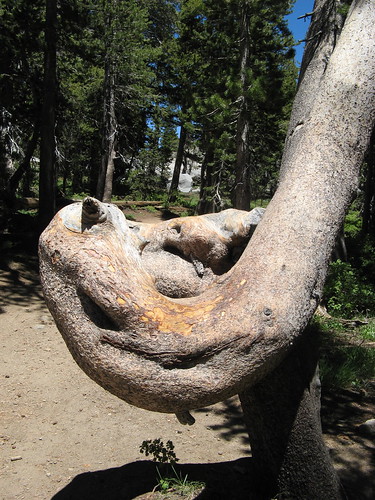
I cannot resist oddly bent trees.
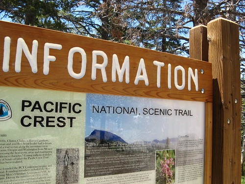
Here we are back at the Carson Pass trail head sign board.
I’m hoping I can get back up to the Sierra at least a few more times this summer, but gas prices are a bit of a buzz-kill. We’ll see. (If people start buying stuff, I’ll start ponying up for sexier trips. Till then, though, it’s gonna be hikes around these parts).
Before I close, I want to send a shout-out to Stuart at Trailspotting, who gamely bagged Round Top last year and created a nice little hike write-up.
Related links:
- 24 Hours at Carson Pass: Snow camping with Steve of the WildeBeat.
- What’s in Those Pine Needles Anyway: Taking Melissa on an ill=fated redwoods hike.
- GPS plot and slideshow at Everytrail.
Here’s a Google map if you’re thinking of heading up that way.
View Carson Pass Trail Head in a larger map
Hey! I was a mile or two north of you this afternoon 🙂
I passed Paul (no trail name) about 4pm about 1mi north of Carson Pass. (And then about 6 more thru-hikers after him in the mile back to the trailhead.)
http://www.fedak.net/albums/RedLakeStevens.html
Tom,
Great writeup and looks like a great hike. I haven’t been up to that part of the Sierra’s yet.
I believe the unnamed wildflower you saw is a Wooly Mule Ear(Wyethia mollis). I’ve come across them many times.
Tom, this is one of my favorite spots in the Sierra. I’ve mostly been exploring my home territory near Mount Shasta for the last few years, but I do miss the Sierra Nevada.
The shot of the golden retriever fetching the stick from the water brought back sweet memories of my long-departed golden Hana, who looked just about the same.
Thanks for the Frog Lake reminder. I remember passing it when we did that section of the pct, and thinking it would be a great place for an introductory kid’s backpack trip.
Love the write-up and the photos. Love this area too.
From the Woods Lake campground there’s another great trail that leads to Lake Winnemucca too, and a slog up to the summit of Round Top .. http://www.trailspotting.com/2008/06/round-top-winnemucca-lake.html
That is a great looking hike! How far is of a drive is it from Sacramento?
Adam: about 100 to 110 miles depending on your route. Click on the blue push-pin in the Google map to get the dialog for driving directions to the trailhead.
The route Google recommends is not the shortest possible, but it is a pretty fantastic drive, scenery wise.
Very nice, Tom! I’m envious – ain’t made it up there yet this year. . .am planning a 395 spine trip in early September, though!
Just hiked Round Top yesterday (07/15/09)….looking at approx July 23rd for wild flower peak doing Lake Winnemecca and Round Top