
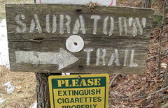
 So it’s back to real hiking this week: up-and-down slogs, feet slipping into creeks, sticks poking me in the face. The first three sections of the Sauratown Trail run west out of Hanging Rock State Park — notable for its 2,500-foot knobs and array of craggy rock faces — through timber, along streams, with nary a flat stretch. My GPS unit logged a generous 1,700 feet of elevation gain over 9.5 miles; I doubt it was that hilly, but this one does tiptoe into strenuous territory.
This weekend’s hike completes eight of the Sauratown Trail’s 16 sections. Sections 1-3 are clearly the best so far, with one caveat: a butt-ugly clear-cut in the middle of Section 3 (otherwise the nicest section of the eight I’ve seen). Otherwise, though, these sections have a smattering of small waterfalls and multiple chances to rock-hop across streams. Abundant forest canopy means the vistas are scant, but at least the terrain has enough variety for a decent workout.
I also found out over the weekend that the trail has a Facebook fan page, where trail volunteers have been posting updates of recent maintenance projects. Our winter from hell has been keeping them very busy. Storms wiped out a hanging bridge and left dead-falls all up and down the trail. Most have been cleared; I saw just one requiring complicated route-finding.
Speaking of playing find-the-trail: I’m getting better at detecting the slight indent of a cleared trail beneath six inches of fallen leaves. It’s subtle, but matching it up with a narrow, unnatural corridor between the trees usually gets me back on track. On to the trail, by sections:
Section 1
Under a half-mile and all downhill – nice walking to begin, but a leg-burner on the return leg if you’ve already logged nine miles.
The signs at the Tory’s Den parking area point the way till you start seeing white blazes that mark the rest of the trail; after about a quarter mile you’ll hit a trail junction and a sign pointing to Booth Loop — best to take a left there; I ran out of trail on the Booth Loop after about a half-mile and nearly got lost. Unless you’re into route-finding, stay on the main trail.
Section 1 ends at Mickey Road and continues about 25 yards up the road to the left.
Section 2
Section 2 is about a mile and a half of mostly rolling terrain. This section plunges into a small canyon (OK, a big ravine) with a small creek pretty well shrouded behind the trees. Here’s one glimpse:
Keep in mind if you’re coming this way: the trailhead at Tory’s Den Parking Area is around 1450 feet, and the end of Section 3 is about 950, so an out-and-back will be all uphill on the return leg. Sections 2 and 3 have the most climb. It’s tiring but not terrible.
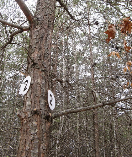
Trail volunteers recently added these blazes with numbers for each section of the trail. Handiest for thru-hikers or equestrians who shuttle their trucks and trailers and do it all in a day.
Section 2 ends at Moore Springs Road; it’s another left turn and short jaunt to the next section.
Section 3
This section is the best of the bunch (with the exception noted above). It’s more downhill into a smaller canyon, with a larger creek. Note the Tucker Loop on Section 3 has been closed because of a change in land ownership; the sign for the loop is still there — ignore the urge to hike it anyway.
I was amazed at how clear the water is — it’s pretty much all green/brown everywhere else.
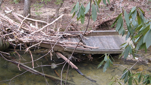
This looks like it might be the remains of one of the water crossings on the trail. At one crossing (rock-hopping mandatory) I was so intently watching my feet that I walked right into a twig from a small tree that jabbed me in the upper lip. I wanted to punch it back, but it was only a twig. And I stepped in the water anyway.
Just down the trail is the clear-cut area, which is as appalling as you might expect: stumps of hardwoods cut down in their prime; piles of saplings killed because they were in the way. Gray tree matter and red-clay mud; just a mess, really. Small consolation to know it’ll all grow back someday.
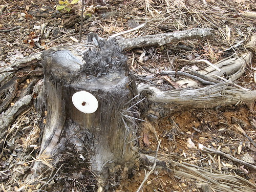
Perhaps the best commentary, courtesy of the trail keepers: a blaze nailed to a stump.
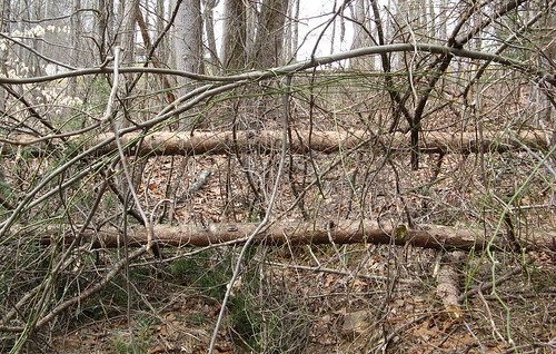
Two pines tumbled in parallel near the west end of Section 3. Had to pick my way through the usual briers and brambles to get to the end of the section at State Highway 66. Then it was back the way I came.
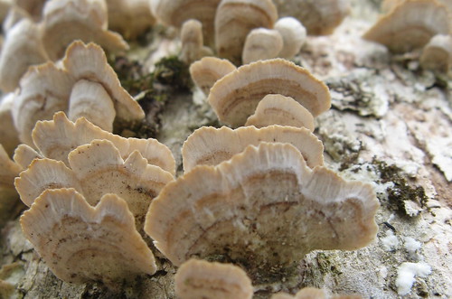
I’m taking a liking to these mushrooms that grow on tree stumps — they look like they ought to be in a coral reef somewhere.
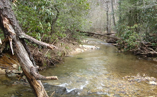
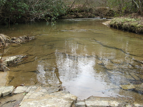
Nice stretch of creek on Section 3.
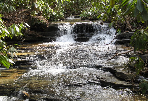
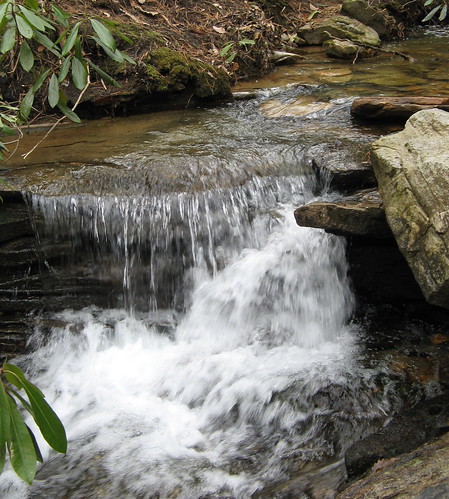
This bit of waterfall on Section 2 hides behind a thick cordon of stickers, trees and other flora that had the nerve to block my view. I elbowed my way in there anyway because I figured my devoted readers would expect no less.
Sauratown Trail links
- GPS tracks at EveryTrail.com
- EveryTrail Destination page.
- My hike on Sections 12-13
- My hike on sections 14-16
- Sauratown Trail Association’s Facebook page
- Sauratown Trail Association home page.
- Google map for all sections hiked
Google map for Sections 1-3.