
If I had little kids, I’d bring ’em here and drive ’em batty with “did you feel that? … did you feel that …” — scarring them for life because that is a parent’s sacred duty.
The San Andreas Fault runs right through the middle of Los Trancos, a 274-acre park that looks pretty much like all the other parks around here, except there are places where hillsides seem to be going in the wrong direction because of massive shifts in the earth beneath. Low-lying spots along the fault line — called sag ponds — gather water in the rainy season. Now and again you’ll see what looks like an old trail or road and then realize it’s a depression that happened when the deeper layers of earth gave way in a quake.
All very subtle and not very exciting, I suppose, but you could really spook the kids by telling them they’re in Earthquake Central and keeping ’em on their toes with exclamations such as “you know, it could give way at any time.” Look, civilization collapses if parental duties are shirked.
So let’s gaze upon a few pictures:
Nicest day for hiking so far this year, which of course means we’re due for another 10-day storm. I started out with a warm welcome from an Open Space Authority ranger who told me not to leave any valuables in the car because there had been a rash of car burglaries — including two yesterday morning across the road at Monte Bello. My luck was better.
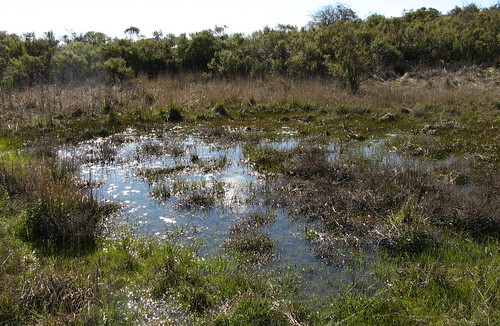
One of those low places where water gathers.
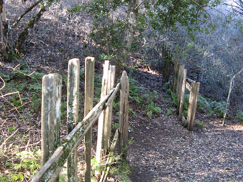
Not a real gap caused by an earthquake — this is a simulation built with vintage fence scraps found nearby — but it does reflect historical photos from the 1906 San Francisco Earthquake that showed how far the earth moved along the fault.
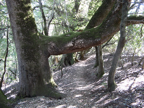
The park brochure says this phenomenon was caused by the ’06 quake knocking the tree on its side, but leaving enough roots in the ground to keep it alive. Branches bending toward the sun created this odd elbow effect.
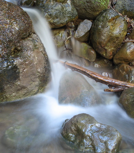
The nicest part of Los Trancos is the Lost Creek Trail Loop … it’s about mile deep into the park and you end up hiking about four miles by the time you get back. It has running water this time of year, but otherwise it’s shady, pleasant walking without much grade change. The picture above is a two-second time exposure using my handy Gorillapod.
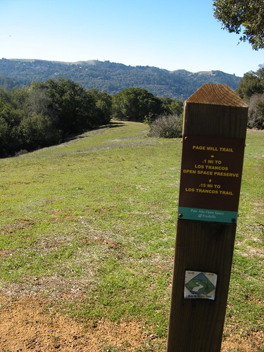
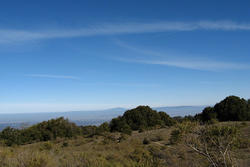
From the Lost Creek Trail you can take the Page Mill Trail over to Foothills Park, which is open only to residents of Palo Alto. I half expected guard towers and razor wire to keep the riffraff out, but it was open and welcoming, which means the Palo Alto city brass has calculated that once you’ve hiked three miles to get into the park you won’t have much energy left for mischief.
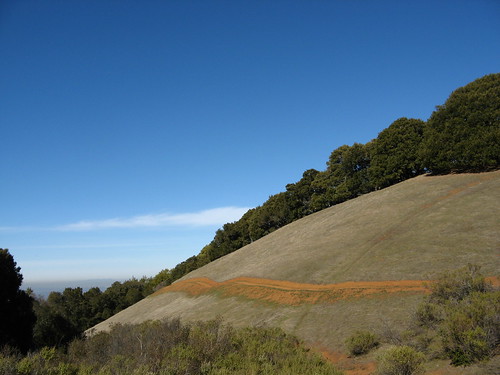
Another nice view from the Page Mill Trail.
It feels like tempting fate to hike along an active earthquake zone but I figure the greatest danger in a quake is having a building or bridge fall on you, so it might be one of the safest places to be when the Big One hits.
More Los Trancos links:
- Peninsula Open Space District page.
- Jane Huber’s Bay Area Hiking page.
- KQED’s Los Trancos page at flickr.com
It’s cool to see the surface manifestations of fault activity, and the SF peninsula certainly offers them. Of course nearly any hike you can do along the peninsula, the East Bay and points south along the Diablo Range hold the potential for a little shake-rattle-and-roll, but then we tempt that fate here every day whether we are hikers or – tell me it ain’t true! – couch potatoes.
Have no fear about hiking into Foothills Park now even if you’re not a Palo Alto resident. There is the Bay to Ridge Trail that starts at Palo Alto Baylands Preserve and eventually (but not yet continuously) goes through Arastradero Preserve, Foothills Park, Los Trancos Preserve and thence to Monte Bello Preserve and Skyline Blvd. Hikers, regardless of residence, can enter Foothills either from Los Trancos or from Arastradero. So no rangers will come and harm you. Also, if you hike with your dog, note that dogs are allowed in Foothills on weekdays only and not on weekends and holidays.