
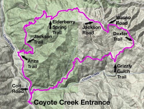
Winehiker Russ broke out his absurdly huge Henry Coe State Park map and found this untried route from the Coyote Creek entrance:
Typically I figure folks can find their own way if they use common sense and grab a map at the trailhead, but this route was above-the-call-of-duty cool and deserves special treatment. I’ll add pictures later but I wanted to chat up this route while it was still fresh in the brain.
The main caveat for Henry Coe’s Coyote Creek entrance is there may not be anyplace to park and you could get stuck parking a couple miles down the road at Hunting Hollow. But if you can find a parking place (no big deal during the week or early on a Sunday morning when the faithful are in church, but a potential deal breaker on a Saturday).
Once you get there, you wander north on Coit Road for a stretch till you see a sign advertising the 1775-76 travels of the De Anza Expedition. Hang a right there on the Anza Trail, which zigzags up the hill through oak woodland and abundant wildflowers.
Eventually you’ll come to the Jackson Trail Junction. Hang a right and keep working your way up the hill. This, too, is an excellent patch of trail — it’s all uphill this way but not especially arduous by Henry Coe standards.
Jackson Trail eventually tops out on a ridge and turns into an old Jeep road. Great place to rest from the climb. The intersection with the Elderberry Spring Trail is on the left. Turn there for one of the best trails at Coe — certainly the best trail I had never heard of — a gradual climb through more hills, trees, flowers (Chinese houses are rampant this year) and gorgeous vistas.
The serious climbing ends back on Jackson Road, where you hang a left and go down to Wasno Road, then take a right and head for the Dexter Trail, and begin a knee-crushing descent back to Grizzly Gulch Trail, where you turn right and dive downhill some more and follow it till you’re back on Coit Road, where it’s a left turn and less than a quarter-mile back to the road.
My GPS put this in at around 9 miles with over 2,000 feet of elevation gain, so it’s a typical Henry Coe workout with one atypical difference: lots of single-track zigzagging its way up the hill. This would be an excellent route up to Kelly Lake if you’re backpacking — it’s only a mile or so beyond Wasno Road in the top right section of the map. The hike down Dexter and Grizzly Gulch trails is a beast if you’ve got tender knees, so this might be even nicer as an out-and-back: hike to the end of Elderberry Spring Trail and retrace your steps.
Tom Clifton has a write-up now about Sunday’s hike for those who haven’t seen it. Here are mine:
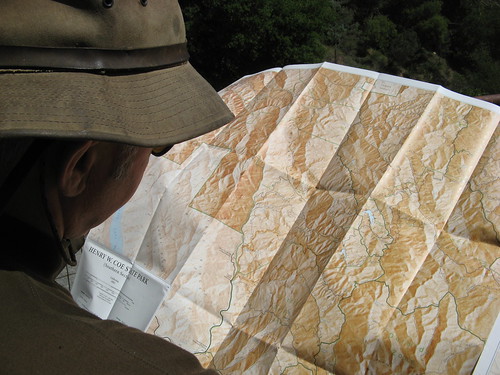
Winehiker Russ consults his map. Russ counted every fraction of every mile in little red lettering and came up with 8.5 miles of dirt-walking excellence.
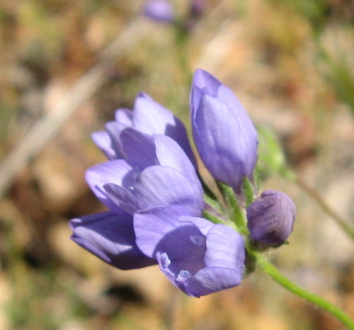
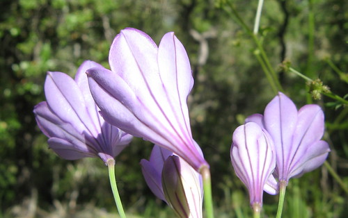
We saw many of these purple blooms that flowered in bunches like a blue dick or an Ithuriel’s spear but didn’t look quite like either of them.
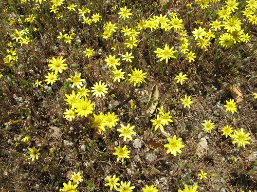
Yellow blooms were abundant as well.
Back sides of Ithureil’s spears look very cool, too.
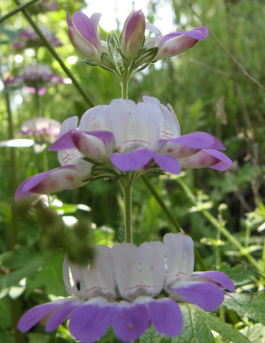
One of the countless Chinese houses. “It’s the Hong Kong of Henry Coe,” Russ declared near one notably large swath of them.
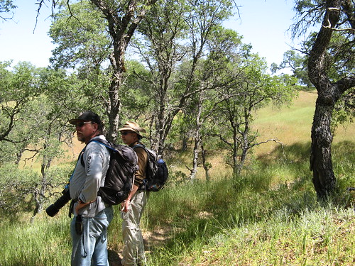
Russ and Tom enjoy the view.
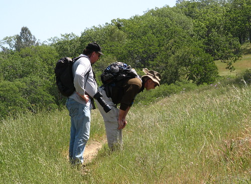
Russ likes something down there.
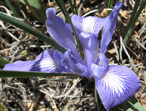
Sneaky photographers cut all the blades of grass away to get clear shots of ground-dwelling irises. I saw some of these last week that had been dyed ghost-white in the sun.
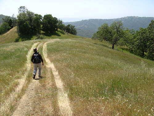
Russ walks a crooked mile on the steep descent back down toward Henry Coe’s Coyote Creek entrance.
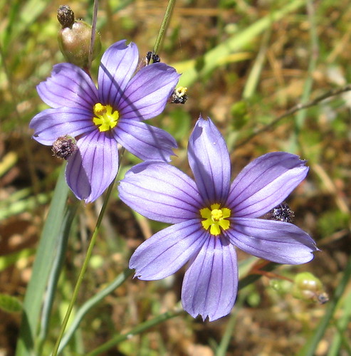
Blue-eyed grass always comes out purple in my pictures.
Randy Lloyd hiked many of the same trails on Saturday, and bumped into Rebecca Bond, who was out backpacking.
Henry Coe links:
Here’s a Google map of the Coyote Creek trailhead.
View Henry Coe State Park Coyote Creek Trailhead in a larger map
UBER-COOL, boys! I’ve hike – and mountain biked! – those trails several times!
What a coincidence. We were hiking those same exact trails last Saturday, except for the Dexter trail. We went a slightly longer route.
http://randyswaypoints.blogspot.com/2009/04/grizzly-gulch.html
Real nice pics, Tom. I’ll say one thing for that absurdly large map: it doesn’t require batteries!
Randy, in hindsight, we could have walked an unmarked single-track trail that would have taken us right next to a cow pond below Dexter Trail; perhaps the slightly longer route you took? Next time I hike this loop, that pond will be on the itinerary.
seems like that was a popular route that day, good to hear you had a better time than some of the others that decided to take a similar route
http://www.morganhilltimes.com/news/255642-injured-mountain-biker-rescued-from-henry-coe-park