Context for today’s travels: A great-grandmother (or perhaps great-great; Mom, can you clear this up?) of mine was a full-blooded Cherokee whose people came to the Midwest on the Trail of Tears, a forced march from the area we now call — how’s this for irony — North Carolina.
I thought of her again and again traveling through the Indian Nations of Oklahoma, where billboard after billboard advertised a “Cherokee”-themed emporium of American Indian kitsch. What I thought of was one of my people dragged from their homes and ordered at musketpoint to relocate in a foreign land where they knew none of the local flora, fauna and hunting spots, where they had no survival traditions, where they were utterly dependent the U.S. government.
Back in the Bay Area it is of course quite fashionable to receive knowing glances from fellow intellectuals when you observe that the United States was built on twin foundations of forced labor and forced relocation. Interestingly, it’s deeply unfashionable to say such things in the company of the descendants of those who were doing the forced relocating.
All I’m saying: My one-sixteenth (or one-thirtysecondth) of Cherokee blood boiled all across Oklahoma. Of course things were cooled by the fifteen-sixteenths (or thirty-one thirtysecondths) of regular white-guy blood — though come to think of it, my Irish ancestors came to this land on Coffin Ships after the monstrous British injustice inflicted by the Great Potato Famine.
Such is the magic of America: Repression be damned, I came out just fine.
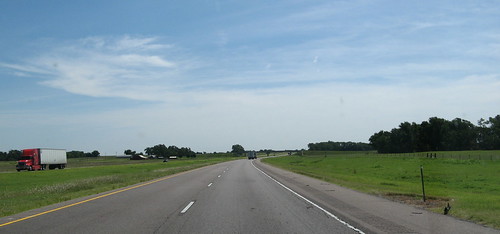
OK, history lesson over, let’s see some pics. They’re not super sexy because the drive was mostly flat, with farmland on both sides. A nice thunderstorm and tornado would’ve gotten the ol’ blood flowing, but it would’ve made the drive suck pretty badly, so I’m not whining too much.
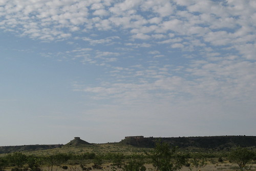
This is just over the Texas border in the Panhandle east of Amarillo. You’re expected to be made of stern stuff when you drive across the Panhandle: only two rest areas with toilets the whole way; the other stops are “parking areas” or “picnic areas.” Hey, Texas has a lot of ground to cover.
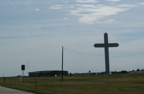
This cross east of Amarillo is billed as the biggest of its kind in the Western Hemisphere.
The terrain greens up almost as soon as you cross the Oklahoma border. You’d scarcely guess there was a Dust Bowl here.
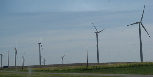
This immense wind farm was hard to miss. Appropriate when you consider how much oil was discovered in Oklahoma.
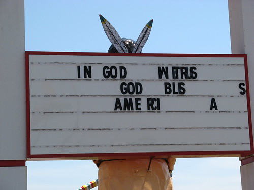
That whole Wind Whipping over the Plains of Oklahoma makes it hard to keep inspiring messages on sign boards outside gift shops attempting to cash in on our rich American Indian heritage.
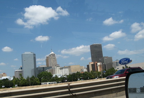
Oklahoma City has a nice skyline — I-40 runs right next to it.
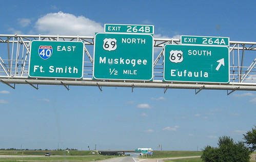
Posted in honor of Merle Haggard, who I suspect never stepped foot in Muskogee, Oklahoma, before penning his famous hit song about a town where even squares can have a ball. (Imagine being one of the Cool Kids of Muskogee — they probably still haven’t lived down the shame).
One other observation for those considering west-to-east traverses on Interstate 40: The terrain flattens from the Texas Panhandle all the way to the Arkansas border, which makes for unremarkable terrain but very easy driving. After two days of mountains and deserts, it’s a nice break.
Next stop: 100 miles east of Nashville by way of Memphis. Lands of our rock ‘n’ roll heritage; can’t wait.