Author Archive for tmangan

45th anniversary …

… of the day I came squawling into this world (and haven’t stop complaining since).

To all who’ve sent birthday greetings: Thanks a bunch. To all who’ve failed to send me the riches and fame I so justly deserve: what are you waiting for? I’m not getting any younger.

Ten years ago, in the autumn of 1996 — back in that halcyon era before Bill stained Monica’s dress — I posted my first Web page. Since then I can’t imagine how many pages, how many paragraphs, how many words, how many links I’ve posted. Most of the stuff on my first page is out of date, The cats have passed on; we’ve moved 2,000 miles to California. I’m still newspapering, and my siblings are married to the same people, that much is still true.

Back in the day I posted a page called “Toxic Emissions” in which I stated things I considered inerrant. An example:

Tom On Politics: It’s the natural state of
existence for a Republican to be an enemy of the common people and a
Democrat to be an enemy of common sense. (12,327 Brownie points to
the person who tells me the wit who said this first. It sounds so
familiar I could not have invented it on my own.)

Criminal Element Corollary: A man who will not steal you
blind and swear it is for your own good has no right to call himself
a politician.

I stand by these remarks.

My accomplishments of these past 45 years have not been remarkable, but these pages of mine have given me one thing which belongs to nobody else: The first “Tom Mangan” listing in Google. Every other personage on this planet who shares my name is in line behind me. An obscure honor, for sure, but still nice to have. If only one of those other Tom Mangans would get busy so I could enjoy the pleasure of being mistaken for somebody who is rich and famous.

Welcome to the black hills

They’re not only in the Dakota country. As of last night they were barely more
than a hundred yards from our front porch.

About 250 acres burned in the brushfire; no homes were lost but there were
some traffic jams getting past the firefighting equipment last night. One of
the neighbors has one of these nifty plastic picket fences; now it’s melted
in places.

Bit of a scare but we’re thankful that so much of the available fuel has now
been burned, making it less likely that another blaze will make it to our place.

Vacationing in Southern Utah: final observations

I forgot to mention all the Joshua trees. I saw my first a week ago Saturday in the land between Death Valley and Mount Whitney, the lowest and highest points in the continental United States. The trees look otherworldly, with bunches of needles jutting out in strange directions.

They were hundreds of miles from Joshua Tree National Park. They grew like mad across the wind-pounded expanse of the Mojave Desert — but only at certain elevations. A lesson in biodiversity that just happens to be the name of a popular U2 album.

I never took a single picture of a Joshua tree, though. They were always growing along the routes between where I’d been and where I was headed.

I can’t say for sure whether Joshua Trees even grow in Southern Utah, but they do seem to symbolize what I remember most about spending a week there: Patches of green in the desert. It was surprising to find pine forests covering vast swaths of the region. Green meadows are not out of the ordinary; farming happens, assuming there’s access to irrigation. Trees grow from between cracks in giant
stone monoliths.

If you come expecting a moonscape, you’ll be disappointed.

More random thoughts:

  • If the Grand Canyon seems to be proof of a Higher Power, then Bryce Canyon seems to be evidence of Alien Intelligence — with a sense of humor. The stone formations called hoodoos look like they might be statues of previous tenants from another dimension.
  • The waters of Zion canyon are as interesting as the cliff walls — especially the water seeping through the walls. You wonder how something as huge as Zion could be carved by river erosion alone, then you learn that water seeping into seams between layers of sandstone freezes and expands every winter, forming cracks that weaken the rock. After a few winters (or maybe a few thousand), gravity does the rest of the work, pulling down chunks of canyon wall.
  • You could spend several vacations just gaping at rock formations visible from your car. I can’t imagine how much totally cool stuff must be visible from the backcountry trails and dirt roads.
  • It’s OK to be a tourist. We did a few short hikes on this trip but my main goal was to see the main attractions. Those canyons will still be there the next time I stop by.
  • It’s OK if it all doesn’t fit in the viewfinder. Close-ups are more fun
    anyway.

Them’s the Breaks

"So where are you off to," the innkeeper asked us.

"Cedar Breaks."

"It’s COLD up there. Take your coats."

"Thanks, we have our coats."

Actually, we had jackets designed for a spring or autumn chill, not parkas that would stave off a freezing mountaintop gale. Parkas would’ve been much preferred when we arrived at the Cedar Breaks National Monument, a giant, semicircular gash in the landscape of Southern Utah. Much of what we’ve seen elsewhere — Bryce Canyon’s hoodoos, Zion’s multicolored rock, the pink-striped cliffs throughout the region — is on display at Cedar Breaks. What the other places don’t have is the bone-chilling winds of the Breaks.

One view of the Breaks.

A close-up on the wacky stone formations far down into the canyon.

A branch of a bristlecone pine; another section of the Breaks has a bristlecone that’s over 1600 years old, but it required a mile of hiking in the cold to reach it, so I decided I’d leave that for another trip.

Yet another view over the Breaks.

A steep canyon divides one section of the Breaks. There are no trails below the rim, so it all has to be seen up here in the direct wind.

Trees reflect the cooling weather.

Looks like autumn — feels like winter, though. The monument is above 10,000 feet, another reason for the chill.

If you’re thinking of a sight-seeing trip to Southern Utah, Cedar Breaks might be a good place to visit first and get an idea of what’s in store at the other more famous locales.

The view from the canyon floor

On Wednesday it came time to check out Zion Canyon in Zion National Park.
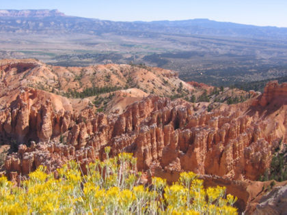
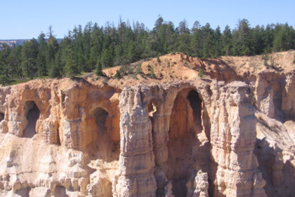
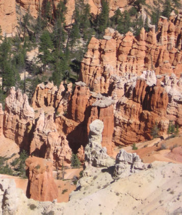
Having seen the Grand Canyon from the top and Bryce Canyon from the middle,
it seemed only fitting to see Zion from the canyon floor. Zion is a huge park
with plenty to see on its backcountry trails and slot canyons, but just as you
can’t really "do Yosemite" without swimming among the schools of tourists
in the Valley, you can’t "do Zion" without a trip through the Canyon.

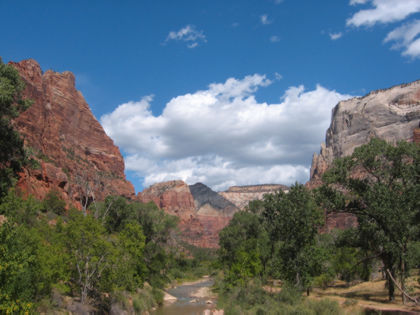
There are crowds at canyon-floor level, but all the action’s happening up on
those steep canyon walls, colored a hundred shades of brown, black and gray.
When you look up, you might spot a hiker high atop the canyon rim, but otherwise
you won’t be troubled by puny humans. Shuttle buses make regular stops at trailheads
throughout the canyon — one way to do the canyon in a day is to just get off
at each stop, wander around till you’re ready to see something new, and wander
back to the shuttle stop and do it all over again at the next stop.

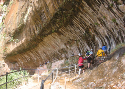
We took the shuttle to the last stop and walked about a mile of paved trail
to the end of Zion’s famous Narrows Trail. The Narrows Trail obliges hikers
to wade through miles of cold, occasionally deep water. It’s considered one
of the great scenic wonders of the Southwest — it’s definitely on my list for
a future Zion visit.

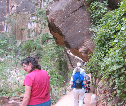
Melissa takes in the sights along the paved trail toward the Narrows.

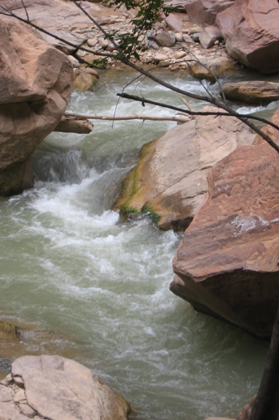
The Virgin River doesn’t seem like much, but it helped carve out the is whole
canyon.

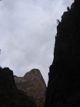
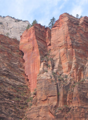
Towering canyon walls near the entrance to the Narrows. The sky was cloudy
when we arrived — the views got much better after the clouds started to clear.

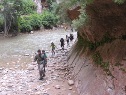
A guy leads a large youth group across the river after their Narrows adventure.

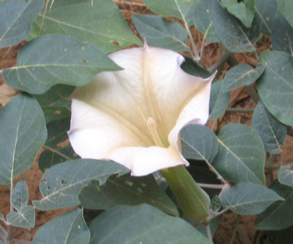
The canyon is full of interesting plant species — trees, bushes, flowers.
You’d never know it’s in the middle of a desert.

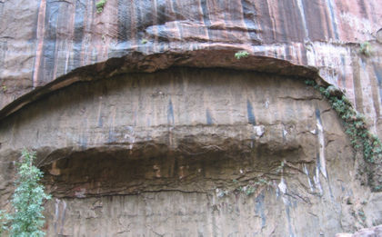
Stripes on the canyon walls come from water that seeps into the rock high above
and escapes via small cracks. In the winter the water freezes and creates large
cracks in the walls, speeding the erosion process.

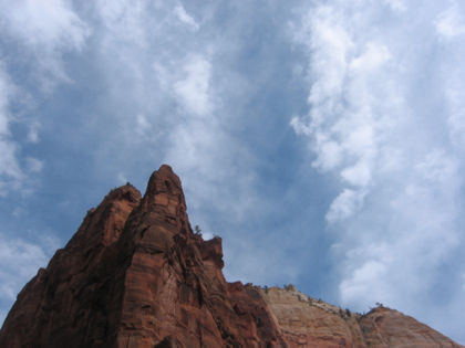
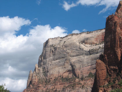
Skies start to clear above Angels Landing; we could barely make out hikers
on the canyon rim. This is at a shuttle stop called Big Bend. It has no trails
nearby but from here you can just admire the vastness of the canyon rising to
the sky. Few people get off at this stop, but those who do are treated to perhaps
the truest canyon-floor experience.

One of the large cracks between columns of rock is visible here.

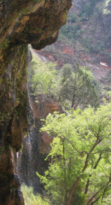
Water droplets pour from the cliff side at Weeping Rock. A tour guide told
us the water can take more than a thousand years to reach the canyon walls.

Tiger-striped canyon walls at Weeping Rock.

The clouds cleared, creating excellent vistas. This is looking up-canyon near
the Zion Lodge.

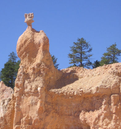
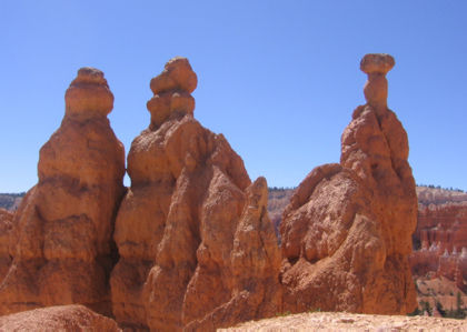
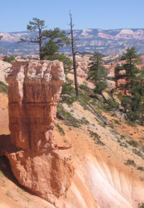
A sampling of the many rock colors — grays, oranges, browns among them.

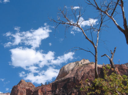
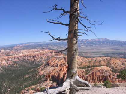
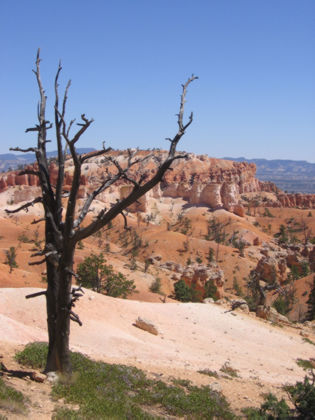
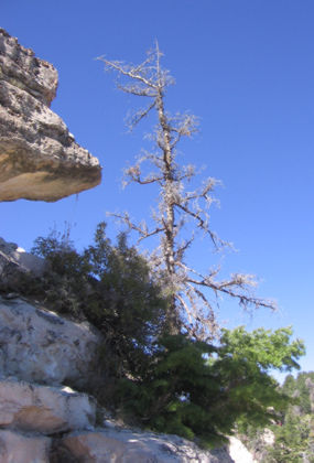
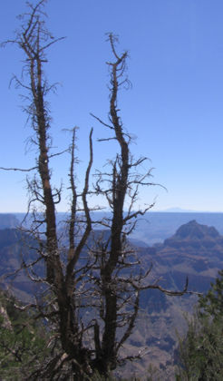
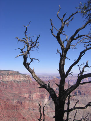
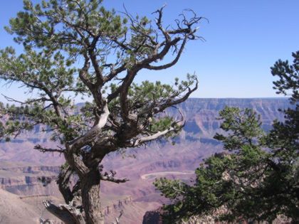
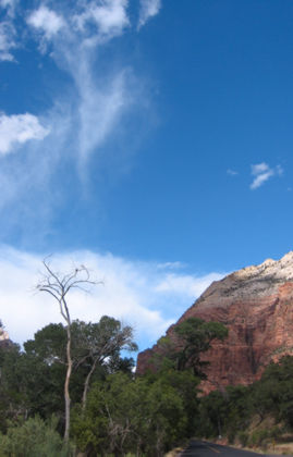
I’m working on controlling my urge to photograph dead trees. Honest.

All kinds o’ color happening here.

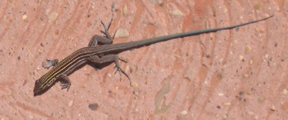
A lizard paused to pose for a pic.

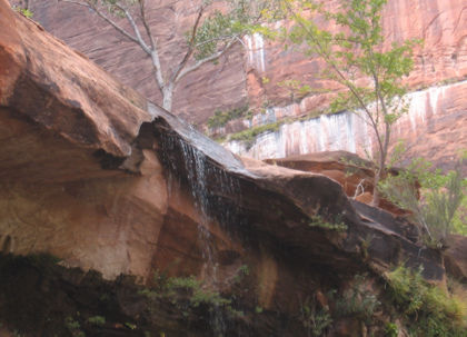
A small waterfall near the Lower Emerald Pool. Probably more interesting in
the spring, when the water runs stronger.

Clouds do a dance near a site called Court of the Patriarchs.

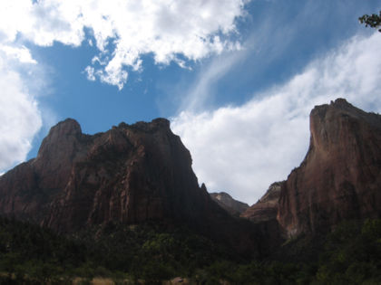
A couple of said Patriarchs. They’re named after famous men of the Old Testament.

We were done touring the canyon and walking back to the car when I looked up
and saw this scene behind the Visitors Center.

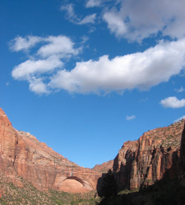
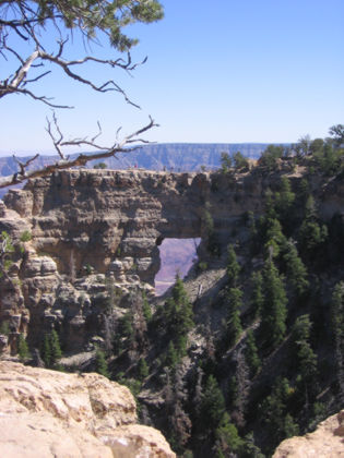
An arch in the rock near the road taking us out of the park.

We ended up passing through the park three times in our travels — initially,
the tourist crowds and the steep canyon walls felt like Yosemite Lite, but as
the first impressions wore off the charms of the place started to grow on us.
An amazing place, and we saw a mere sliver of it. Can’t wait to get back and
see more.

Wait a minute…

… I’m supposed to be on vacation here.

I’ve got a bunch of swell pix from Zion National Park but it’s turning into a chore to post daily updates, so how about this: tune in next Monday and I’ll have more highlights from Southern Utah and points nearby.

The coolest place in Southern Utah

The Grand Canyon has a majestic, composed grandeur that reminds me of classical
music. That booming intro to Beethoven’s Fifth is the Grand Canyon in four notes.
Bryce Canyon, by comparison, is pure jazz. If you’ve ever heard a Charlie Parker
saxophone solo — with millions of notes going every which way but somehow hanging
together in some magical semblance of a melody — you can relate to Bryce Canyon.

Bryce represents the remnants of a sea floor that’s millions of years old.
Ages upon ages of erosion have created whimsical sandstone shapes called hoodoos.
Like the best jazz, they are way cool.

Hoodoos by the hundreds stand beyond Bryce Point in Bryce Canyon National
Park.

Stone arches are another consequence of seashore erosion.

My camera on full zoom captures a few of the Bryce Point hoodoos. We hiked
down among the hoodoos from another location called Sunrise Point. More on that
to come.

It’s like they leave all these dead trees around for my convenience. Nice to
see my tax dollars put to good use.

OK, here’s a hoodoo below Sunrise Point.

Look, Ma, a whole family of them!

Some look like they’re growing right out of the hillside.

One stand of them towers above Melissa.

If you go to Bryce, you have to get off the rim trails and down among these
things. The easiest hike is just under a mile with 320 feet of elevation gain
on the return trip. A nice workout in addition to being surrounded by wacky
stone shapes.

Melissa at trail’s end. We had some fun climbing back out.

Easiest thing to say is: wow.

See previous caption

A dead, burnt tree with scenery like this — what more could I ask for?

So those are the Bryce Canyon highlights. On the advice of our innkeeper, we
drove about 80 miles down Utah Highway 12, which was described as one of the
most amazing drives in the country. It didn’t disappoint. Terrain changed constantly
along the way; at one point the road went right across the top of a tall ridge
with huge drop-offs on both sides. It had amazing land forms and gorgeous canyons.
It always seemed to me I was seeing the most stunning scenery in places where
there was noplace to pull off and snap a picture. The few pictures I’ve posted
don’t really do it justice.

One of the canyons along the way. This is a few miles up the road from a hamlet
called Boulder.

Layers of sediment pushed into unexpected angles.

A so-so pic of the Grand Staircase.

A cliff wall about 15 miles down the road from Bryce Canyon.

So those are Tuesday’s highlights. Tomorrow we take on Zion Canyon.

There’s such a thing as too big

There’s really no point taking a camera to the Grand Canyon. The damn thing
is too big for the human brain to process; mere digital cameras have no chance.
You take your snapshots knowing full well they cannot be reproduced at a resolution
that conveys one five-hundredth of the vastness of that gash in the planet.

I took pictures anyway because that’s what I do, but as you look over these
pix, imagine them filling the largest wall in your home rather than a few pixels
on your computer screen.

We checked out the North Rim of the Grand Canyon because it’s only about a
hundred miles down the road from where we’re staying. If all you know about
the canyon is the barren desert of the South Rim, the North will come as a major
surprise. It’s situated on the edge of the Kaibab National Forest, which has
more in common with the forests of Yellowstone than the sage brush and Joshua trees
of southern Utah.

The meadows along the road to the park are gorgeous. The trees are predominantly
pine. Elevation here is over 8500 feet, which may have something to do with
the cooler temperatures and predominance of high-country plants. The weather
was perfect — sunny, in the high 70s with mild breezes. There’s nothing "desert"
about the place at this time of year.

Some of the non-pine species are showing their fall colors.

The North Rim, looking out from Bright Angel Point. This is the must-see point
from the North Rim, and just a quarter-mile out from the visitor center. It
does look like all the pictures you’ve seen, but you have to stand here to appreciate
the stupendous grandeur.

I had better luck shooting certain features — rocks and trees, my favorite
things — with the canyon walls as a backdrop.

Plenty of dead trees in addition to the live ones. Another North Rim surprise
is how much of the nearby canyon walls are covered with greenery.

One dead tree is never enough.

A young mule deer hangs out at a roadside scenic overlook. This beast is about
as wild as your grandma’s French poodle.

A group of classic Packard owners was in the park for the day; I got stuck
behind this one for several miles. Funny how much cooler they seem when you
aren’t inhaling their exhaust fumes.

Angel’s Window.

I know, this is starting to turn in to a bad habit.

Make that a very bad habit.

Got some nice blue sky in this one.

That’s the Colorado River just above right center. I know, it seems unequal
to the task of digging a ditch this big, but it had untold millions of years
to finish the job.

So those are Monday’s highlights. Tuesday it’s either Bryce Canyon or Zion
National Park, two can’t-miss locales. Stay tuned.

Yeah, we be tourists now

We spent the night in a Nevada border town, which is to say surrounded by people
willfully handing large and small sums of money over to large buildings full
of flashing machines promising free money on the next turn of the handle. It
was good to be out of there.

We took the scenic route, adding a good hundred miles to our trip by passing
through Yosemite and heading down the eastern side of the Sierra. It’s an amazing
mountain range, even from the highway, but I was too busy driving to take pictures.

We made it to our first destination — Mount Carmel, Utah, — at about noon
and promptly took naps to sleep off the exertions of the drive (It’s harder
than you think to sit behind the wheel of a car for 800 miles.) We passed through
Zion National Park on our way, but I had destination fever, which means no stops
till we get where we’re going.

I did snap this shot at Zion while we were waiting for our turn to drive through
a tunnel carved into a mountain side.

This whole area is beguiling — the terrain is not so much amazing as it is
quizzical. It makes you wonder how the land ended up like that. From what I’ve
read this area used to be under water millions of years ago, and all the strange
land forms are the result of water eating away at the sandstone. We’ll see even
more such shapes, some of them downright wacky, in days to come.

We’re staying at a little inn surrounded by a ranch. It has an Internet connection!

Yeah, it also has horses

Hard to believe people came out here in these contraptions. Especially with
no air conditioning.

More pictures to come as we see cool stuff in Southern Utah. Stay tuned.