
I get some of my best ideas in the shower.
Sunday morning I was somewhere between the wash and rinse cycles when I realized I had to go to Mount Diablo, hike up to a knob at about 3,000 feet called Mount Olympia, and if the mood struck, continue on to North Peak and the Diablo Summit.
Seven and a half hours after starting out, I was done. Around 14 or 15 miles, somewhere north of 4,000 feet of elevation gain. On the wrong day this route at Diablo would make hell feel like the Antarctic. But on the right day, it’s one of the most amazing all-day hikes in the Bay Area.
Sunday was one of the right days.
Yeah, the wind coming in off the bay was blowing at gale-force. Sure, the trails were mercilessly steep in places. But it was a cool day with all the Bay Area to soak in from the heights. Tips of the Sierra peaks were visible off to the north. In a word: excellent.
So let’s check out the pictures:
I started out from the Regency Gate in Clayton and headed up Donner Canyon Road till the trail markers pointed me toward Mount Olympia. The first mile and a half are pretty easy; the second mile and a half are brutal. The consolation of climbing such steep terrain is that the panoramic views open up pretty quickly.
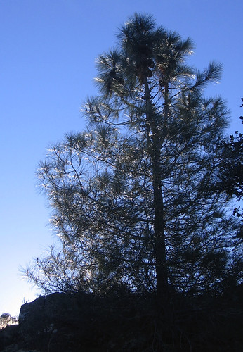
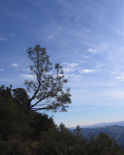
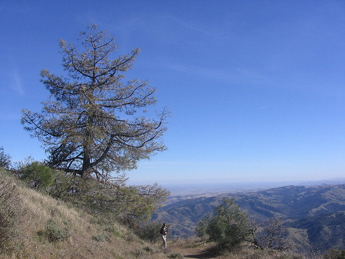
Most of the hiking is on the west face of what’s called the Diablo Massif. This means the morning sun’s on the other side of the hill till well into the morning. I caught the sun shining through this tree at a little after 9 a.m.
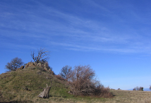
Here’s a rocky knob about a half-hour from the Olympia summit.
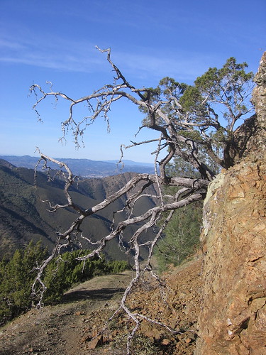
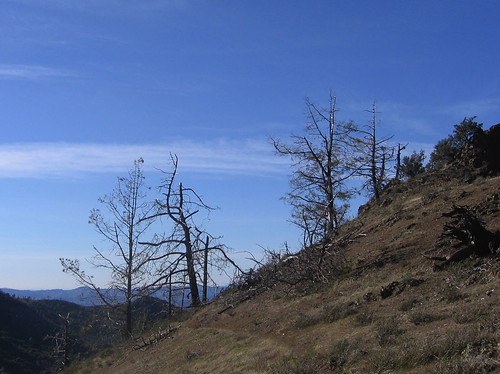
A snag over the trail not far from the Olympia summit. The trail’s mucho steep along here, which provides an excellent excuse to squeeze off a few frames. Once you get to Mount Olympia, Diablo’s North Peak beckons. It’s about another 600 feet of climb, but after the first 2000 are out of the way it seems hardly a challenge at all (fortunately I don’t have to seek my feet’s permission before making such judgments.)
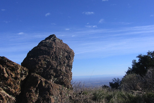
Excellent rock pinnacle along the North Peak trail. Around here the wind is blasting over the top of the peak and roaring through the pines. The trail is rocky and uneven, with traces of snow left over from a few days ago. “Man, this is hiking,” I think.
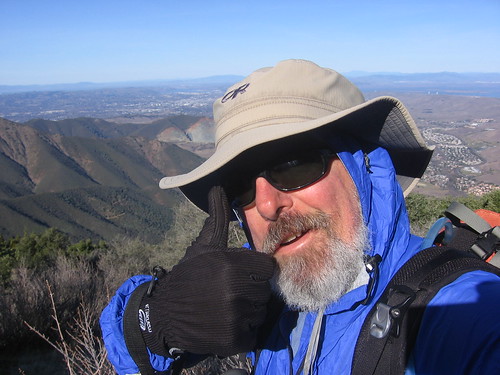
Self-portrait, along the North Peak Trail. I’d be Popsicle without my trusty windbreaker and hiking hat.
Some shots I cannot resist snapping, or posting.
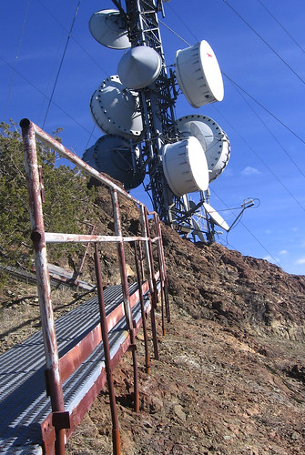
So when you get to the main road going up to the North Peak summit, you turn left and head up for about a third of a mile. And by up I mean nose-bleed steep. You get to these catwalks but if you have a trace of sanity you will not try to walk on them. Coming back down is even more fun — I figured out you have to avoid all the gravel and step on the hard bits of rock in the road. Still, harrowing. For some reason all the technology up here doesn’t bug me. It’s a kind of reassurance that others are foolish enough to come up here too.
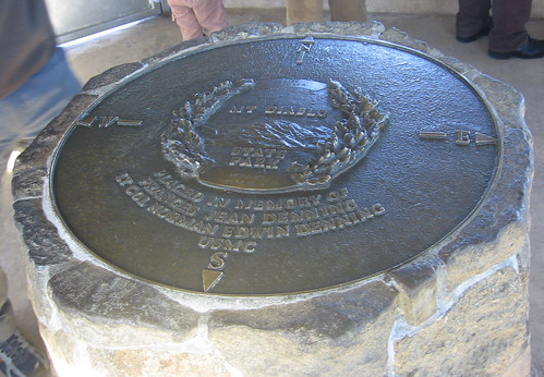
From North Peak you it’s down to Prospector’s Gap to catch the Summit Trail for a mile and a half up to the summit visitors center. The top of the center has an enclosed viewing area for taking in the sights sheltered from wind blast. This bronze plaque is in the center. of the room.
Now for the fun part: all downhill to the parking lot.
Along the Summit Trail heading back to Prospector’s Gap. Nice view, eh? At the Gap I take the Bald Ridge Trail, which has the nerve to throw in some uphill sections along its meandering mile and a third.
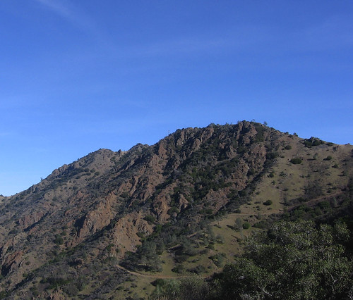
Here’s a look at North Peak from the Bald Ridge Trail.
My kinda snags, along the Bald Ridge Trail, which I take to Murchio Gap, where I pick up the Back Creek Trail. From here it’s a few more miles back to the car and I’m done.
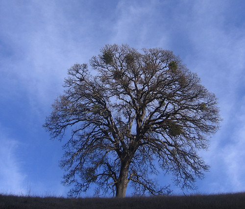
An excellent oak tree along the Back Creek Trail.
Tom, what an accomplishment! Three peaks in a single day. Not sure that I could do that, although you’ve now inspired me to try.
My favorite photo was the final one of the lone tree.
Happy trails,
Vindu
I’m in awe. The hike I did Saturday sounds like a cake walk in comparison. I hiked the Hunting Hollow entrance of Henry Coe following the Hunting Hollow Road (all flat) to the end then came back and headed up Wagon Road (maybe 1300 feet gain I think) and then back down the Phegley Trail. I was awed again by a trail runner who had run up Wagon Road and was going to do another 6 hours trail running in Henry Coe. Meanwhile I limp along with plantar fasciitis in my right foot and a bum left knee. Anyway, it sounds like you did a great hike!
Looks like great hike, and nice pics to boot.
I’m gonna have to make the trek up north one of these days.
Tom, that’s a week for me! I just did the main peak a couple of months ago, and have done North Peak in recent years. But ONE of those is an all – day adventure for me, and even an experienced hiker would be challenged doing two summits…but THREE?
I’m going to start a bit slower when the days get longer, and do the Mission to Monument Peak route in a day. THEN perhaps we’ll talk about doing Diablo – Plus One. I’ll have to give Olympia a try while it’s still so dry. I’m mucho impressed!
-4wheelbob