
From the San Jose Mercury News, October 2007
Hikers might have a hard time believing that roughly half of Henry W. Coe State Park went up in smoke last month.
Acres: 87,000
Miles of trails: 250-plus (trail closures due to Lick fire are posted at all trail heads)
Limitations: No dogs on trails
Fees: $5 for day parking at HQ; $4 at Hunting Hollow entrance
Camping: $12 per night at main campground (reservations at www.reserveamerica.com); $3 per person per night for backpackers, plus cost of parking. Backpackers must register before setting out.
Directions: Park HQ – take Highway 101 south to East Dunne Avenue exit in Morgan Hill. Turn east and drive 13 miles to park (road is very narrow and curvy).
Hunting Hollow – take Highway
101 south to Leavesley Road exit in Gilroy. Go east about 1.8 miles, turn left on New Avenue, go about 0.5 mile and turn right on Roop Road, then continue about 6.5 miles (past Coyote Lake) to the Hunting Hollow trail head on the right.
On the Web: www.coepark.org
The Lick fire scorched more than 47,000 acres, but almost all of the damage happened deep in the park’s interior, beyond view from Coe’s most popular trails. You can hike for hours and see barely a trace of the blaze.
Autumn is a great time to visit Coe. Enjoy it while the weather is mild, crowds are small and tarantulas are on the prowl.
Springtime brings throngs of backpackers and wildflower gawkers, but the wildlife sightings last all year: I’ve seen bobcats, coyotes, deer, turkeys, vultures and a raft of raptors.
Though the park’s reputation for punishing treks up its tall ridges and down into its deep canyons is well earned, it also has many sane (though challenging) trails. Coe is the wildest locale on the South Bay’s doorstep, a must visit for hiking enthusiasts.
Standard precautions: Coe is notorious for steep trails that can wear you out quickly. Always take extra water and snacks to keep your energy level up. Ticks and poison oak are common nuisances on single-track trails. Many single-tracks are open to mountain bikes, so stay alert. Get a map at the park headquarters.
Hike suggestions
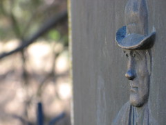
Easy: Get a taste of Coe’s infamous hills with a half-mile climb from park HQ to the Coe Monument. Take the nearby one-mile Ponderosa Trail for an amazing valley overlook, then return on Monument Trail.
Moderate: An excellent 4.8-mile loop goes up Monument Trail and down Hobbs Road to Frog Lake Trail. Rest at the serene Frog Lake and return to HQ via the Flat Frog and Corral trails.
Hard: For a vigorous 9.8-miler, hike from the park HQ to Manzanita Point, take the Madrone Soda Springs and Mile trails to China Hole and return on the China Hole Trail. Some fire damage is visible from the China Hole Trail.