
| This is the Web’s largest collection of professional-grade maps for hiking throughout the San Francisco Bay Area. While local and regional parks offer free maps at the trail head, hiking most of the region’s state and national parks require you to buy a map. Fortunately there are reams of top-quality maps that aren’t too expensive — usually no more than $10, which is money well spent if you want to camp at your campground rather than spend a night in the woods because you’re hopelessly lost.
The links below connect to one of three locations:
|
Navigate by region: | North Bay | Peninsula | South Bay | East Bay | Pacific Coast National parks: State parks: San Mateo County parks: | Huddart | Related: Why you want a map crafted by a professional rather than one cobbled together by an amateur. |
| North Bay | |
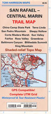 San Rafael – Central Marin Trail Map San Rafael – Central Marin Trail Map |
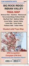 Big Rock Ridge-Indian Valley Trail Map — Includes the Indian Valley, Loma Verde and Pacheco Valley preserves. Just north of the map in the first column. Big Rock Ridge-Indian Valley Trail Map — Includes the Indian Valley, Loma Verde and Pacheco Valley preserves. Just north of the map in the first column. |
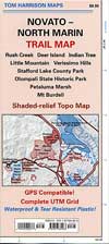 Novato-North Marin Trail Map— Includes Mount Burdell Open Space Preserve and Petaluma Marsh Wildlife Area, among others. Might be some nice Wine Country detours here. Novato-North Marin Trail Map— Includes Mount Burdell Open Space Preserve and Petaluma Marsh Wildlife Area, among others. Might be some nice Wine Country detours here.
|
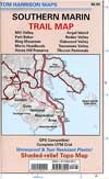 Southern Marin Trail Map: Mill Valley, Fort Baker, Ring Mountain, Marin Headlands, Horse Hill Preserve, Angel Island, Rodeo Valley, Oakwood Valley — All important Marin Headlands trails here. The Headlands are one of my favorite places on the planet. Southern Marin Trail Map: Mill Valley, Fort Baker, Ring Mountain, Marin Headlands, Horse Hill Preserve, Angel Island, Rodeo Valley, Oakwood Valley — All important Marin Headlands trails here. The Headlands are one of my favorite places on the planet.
|
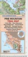 Pine Mountain Trail Map: Loma Alta, Gary Giacomini, Roy’s Redwoods, French Ranch, White Hill, Cascade Canyon, Marin Municipal Water District, A — Marin Water District is home to the excellent Cataract Creek Trail. This whole area is quite remote, probably one of the best hiking locales in Marin (except for all the other crazy-great ones). Pine Mountain Trail Map: Loma Alta, Gary Giacomini, Roy’s Redwoods, French Ranch, White Hill, Cascade Canyon, Marin Municipal Water District, A — Marin Water District is home to the excellent Cataract Creek Trail. This whole area is quite remote, probably one of the best hiking locales in Marin (except for all the other crazy-great ones).
|
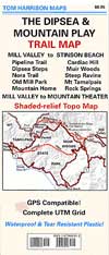 The Dipsea & Mountain Play Trail Map: Mill Valley to Stinson Beach, Pipeline Trail, Dipsea Steps, Nora Trail, Old Mill Park, Mountain Home, Cardiac Hill — The coolest trails of Mount Tamalapais are on in these parts, including the must-see Steep Ravine Trail. You can also hike over to Muir Woods if you feel the need to be around a bunch of tourists. The Dipsea & Mountain Play Trail Map: Mill Valley to Stinson Beach, Pipeline Trail, Dipsea Steps, Nora Trail, Old Mill Park, Mountain Home, Cardiac Hill — The coolest trails of Mount Tamalapais are on in these parts, including the must-see Steep Ravine Trail. You can also hike over to Muir Woods if you feel the need to be around a bunch of tourists. |
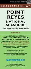 Point Reyes National Seashore and West Marin Parklands: National Seashore and West Marin Parklands, Recreation Map — You’ve gotta get up to Point Reyes at least a couple times a year, especially in autumn when the elk bulls get the mating urge. Berkeley-based Wilderness Press publishes this guide to Point Reyes. These are always well made. Point Reyes National Seashore and West Marin Parklands: National Seashore and West Marin Parklands, Recreation Map — You’ve gotta get up to Point Reyes at least a couple times a year, especially in autumn when the elk bulls get the mating urge. Berkeley-based Wilderness Press publishes this guide to Point Reyes. These are always well made.
|
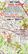 Mt Tamalpais Trail Map — If you’re camping at Mount Tam you’ll want the trail map. The view from the summit is priceless. Mt Tamalpais Trail Map — If you’re camping at Mount Tam you’ll want the trail map. The view from the summit is priceless.
|
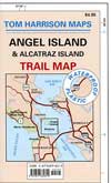 Angel Island — Angel Island has the best views of the bay because it’s right in the middle of it. Boat ride out to the island is a bit pricey (especially when you have to pay to park in Tiburon, too) but it’s worth it to check out. Angel Island — Angel Island has the best views of the bay because it’s right in the middle of it. Boat ride out to the island is a bit pricey (especially when you have to pay to park in Tiburon, too) but it’s worth it to check out.
|
Best Bay Area trail maps
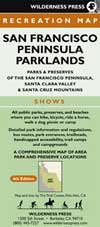 San Francisco Peninsula Parklands: Parks & Preserves of the San Francisco Peninsula, Santa Clara Valley & Santa Cruz Mountains (The Trail Center) — Palo Alto-based Trail Center provides the details for this Wilderness Press map of all the trails south of San Francisco. San Francisco Peninsula Parklands: Parks & Preserves of the San Francisco Peninsula, Santa Clara Valley & Santa Cruz Mountains (The Trail Center) — Palo Alto-based Trail Center provides the details for this Wilderness Press map of all the trails south of San Francisco.
|
 Central San Francisco Peninsula Trails: Parks & Preserves of Central San Mateo County, Second Edition (Wilderness Press Maps) — San Mateo County has excellent parks but the parks department’s maps are pretty lame, so buying a pro-grade map is a worthy investment. Includes Huddart and Wunderlich County Parks, Purisima Creek Redwoods Preserve, El Corte de Madera Creek Preserve, Edgewood County Park. Central San Francisco Peninsula Trails: Parks & Preserves of Central San Mateo County, Second Edition (Wilderness Press Maps) — San Mateo County has excellent parks but the parks department’s maps are pretty lame, so buying a pro-grade map is a worthy investment. Includes Huddart and Wunderlich County Parks, Purisima Creek Redwoods Preserve, El Corte de Madera Creek Preserve, Edgewood County Park. |
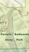 Portola Redwoods State Park — Hidden gem with towering redwoods and shady campsites. Long Peters Creek hike to ancient redwoods is worth the effort. (VP free PDF; 18×24 format) Portola Redwoods State Park — Hidden gem with towering redwoods and shady campsites. Long Peters Creek hike to ancient redwoods is worth the effort. (VP free PDF; 18×24 format) |
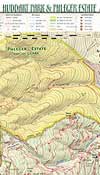 Huddart County Park and Phleger Estate — Best map of San Mateo County’s most popular park; Phleger Estate next door is a delightful redwood preserve (VP $1 download; 8.5×11 format) Huddart County Park and Phleger Estate — Best map of San Mateo County’s most popular park; Phleger Estate next door is a delightful redwood preserve (VP $1 download; 8.5×11 format) |
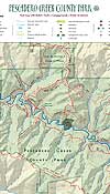 Pescadero Creek County Park — Remote, redwood-rich park with some of the best hiking on the Peninsula. (VP $1 download; 8.5×11 format) Pescadero Creek County Park — Remote, redwood-rich park with some of the best hiking on the Peninsula. (VP $1 download; 8.5×11 format) |
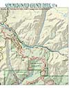 Sam MacDonald County Park — Home of the Sierra Club’s Hiker Hut, a great place to rent with your trekking pals. (VP $1 download; 8.5×11 format) Sam MacDonald County Park — Home of the Sierra Club’s Hiker Hut, a great place to rent with your trekking pals. (VP $1 download; 8.5×11 format) |
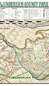 Wunderlich County Park — Excellent redwood walks just west of Woodside; founder of Folgers coffee empire kept his horses there. (VP $1 download; 8.5×11 format) Wunderlich County Park — Excellent redwood walks just west of Woodside; founder of Folgers coffee empire kept his horses there. (VP $1 download; 8.5×11 format) |
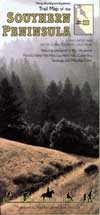 Trail Map of the Southern Peninsula (The Trail Center) — Another option for the parks west of Palo Alto in the Santa Cruz mountains. Trail Map of the Southern Peninsula (The Trail Center) — Another option for the parks west of Palo Alto in the Santa Cruz mountains. |
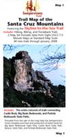 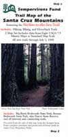 Trail Map of the Santa Cruz Mountains #1 — Pair this with Trail Map of the Santa Cruz Mountains #2 and you’ve got two great guides to the redwood forests around Big Basin Redwoods State Park. Great tool for planning a multiday backpack trip. Produced by the Semper Virens Fund; buying one helps preserve ancient redwoods. Trail Map of the Santa Cruz Mountains #1 — Pair this with Trail Map of the Santa Cruz Mountains #2 and you’ve got two great guides to the redwood forests around Big Basin Redwoods State Park. Great tool for planning a multiday backpack trip. Produced by the Semper Virens Fund; buying one helps preserve ancient redwoods.
|  Big Basin Redwoods State Park — Most of the Bay Area’s last remaining old-growth redwoods are at Big Basin, which is far more interesting than Muir Woods. (VP free download in 18×24 format; better to buy it at the park HQ. Big Basin Redwoods State Park — Most of the Bay Area’s last remaining old-growth redwoods are at Big Basin, which is far more interesting than Muir Woods. (VP free download in 18×24 format; better to buy it at the park HQ. |
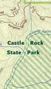 Castle Rock State Park — The most popular hiking destination in the South Bay; lots of Boy Scouts learning to backpack on the weekends. (VP free PDF; 18×24 format) Castle Rock State Park — The most popular hiking destination in the South Bay; lots of Boy Scouts learning to backpack on the weekends. (VP free PDF; 18×24 format) |
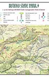 Butano State Park — Amazing biological diversity just down the highway from the famous Duartes Tavern in Pescadero. (VP $1 download; 8.5×11 format) Butano State Park — Amazing biological diversity just down the highway from the famous Duartes Tavern in Pescadero. (VP $1 download; 8.5×11 format) |
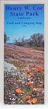 Henry W. Coe State Park Trail and Camping Map Henry W. Coe State Park Trail and Camping Map |
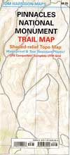 Pinnacles National Monument Trails Map — The Pinnacles represent what happens when two continental plates collide and break a volcano into many pieces. Also home to recently reintroduced California condors. Hot as the blazes in summer but sublime in the spring. Pinnacles National Monument Trails Map — The Pinnacles represent what happens when two continental plates collide and break a volcano into many pieces. Also home to recently reintroduced California condors. Hot as the blazes in summer but sublime in the spring.
|
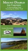 Mount Diablo Map: Los Vaqueros & Surrounding Parks Featuring the Diablo Trail— Mega-map produced by Save Mount Diablo. Big enough to carry as a temporary shelter (almost). Mount Diablo Map: Los Vaqueros & Surrounding Parks Featuring the Diablo Trail— Mega-map produced by Save Mount Diablo. Big enough to carry as a temporary shelter (almost).
|
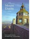 Mount Diablo State Park — Twin summits tower over the East Bay; wonderful views in winter and excellent wildflowers in spring. Bitter hot in the summer, though. (Buy via CalParks.) Mount Diablo State Park — Twin summits tower over the East Bay; wonderful views in winter and excellent wildflowers in spring. Bitter hot in the summer, though. (Buy via CalParks.) |
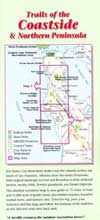 Trails of the Coastside & Northern Peninsula — Trails near the Pacific Ocean south of San Francisco. Always nice on hot summer days. Trails of the Coastside & Northern Peninsula — Trails near the Pacific Ocean south of San Francisco. Always nice on hot summer days.
|
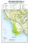 Año Nuevo State Preserve — Place to see elephant seals in season — but you have to make a reservation in advance. (VP $1 download; 8.5×11 format) Año Nuevo State Preserve — Place to see elephant seals in season — but you have to make a reservation in advance. (VP $1 download; 8.5×11 format) |
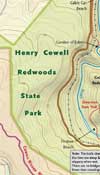 Henry Cowell Redwoods State Park — Popular camping locale close to Santa Cruz. Nice beach on San Lorenzo River. (VP free PDF; 18×24 format) Henry Cowell Redwoods State Park — Popular camping locale close to Santa Cruz. Nice beach on San Lorenzo River. (VP free PDF; 18×24 format) |
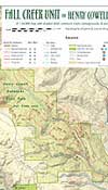 Fall Creek Unit — Little-known annex to Henry Cowell Redwoods has redwoods galore and ruins of a lime kiln. (VP $1 download; 8.5×11 format) Fall Creek Unit — Little-known annex to Henry Cowell Redwoods has redwoods galore and ruins of a lime kiln. (VP $1 download; 8.5×11 format) |
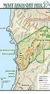 McNee Ranch State Park — Excellent ocean views on the way to the top of Montara Mountain just south of Pacifica. (VP $1 download; 8.5×11 format) McNee Ranch State Park — Excellent ocean views on the way to the top of Montara Mountain just south of Pacifica. (VP $1 download; 8.5×11 format) |
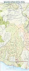 Wilder Ranch State Park — Most diverse hiking locale on the coast just north of Santa Cruz. Lots of mountain bikers. (VP free download in 18×24 format; better to buy from CalParks ) Wilder Ranch State Park — Most diverse hiking locale on the coast just north of Santa Cruz. Lots of mountain bikers. (VP free download in 18×24 format; better to buy from CalParks ) |
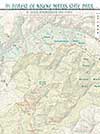 Forest of Nisene Marks State Park — Pretty redwoods south of Santa Cruz and epicenter of Loma Prieta Earthquake. (VP free download in 18×24 format; better to buy from CalParks ) Forest of Nisene Marks State Park — Pretty redwoods south of Santa Cruz and epicenter of Loma Prieta Earthquake. (VP free download in 18×24 format; better to buy from CalParks ) |