
My pal Vindu Goel is jetting off to Brooklyn this weekend to launch his new life as an tech guru for the New York Times, but he had to get one last Henry Coe hike out of his system. Not content to amble down to Frog Lake, soak up the sounds of woodpeckers and breezes floating through the tall Ponderosa pines, and stroll back along the gentle, lovely Flat Frog Trail, Vindu craved the Legendary Ass-Kicker of Coe: Mount Sizer.
I did the same hike in the winter of 2007, which made me the de facto guide — which usually guarantees at least an hour wandering blindly in the wilderness, but there are only two ways to get to Mount Sizer, the 3,182-foot summit of Blue Ridge. One requires climbing up the deadly Hobbs Road Short Cut (consensus pick as the steepest Bay Area trail); the other requires climbing 2,000 feet over about five miles via the Poverty Flat Road and the Jackass Trail, then descending the Short cut and enjoying 2,000 feet of climb over four miles back to the park HQ.
An out-and-back to Mount Sizer is 13 miles; the counter-clockwise loop we did is 14 and change; there’s 4,000 feet of elevation gain, minimum, regardless of route; a protracted climb of four or five miles at the end is unavoidable.
What’s also unavoidable: the conclusion that this is among the few Bay Area hikes which must be done, and not just to prove how much punishment your lower extremities can withstand. On clear days in the winter you can see all the way to the High Sierra from the trail near Mount Sizer. Right now there’s abundant evidence of the massive Lick Fire, which torched over 45,000 acres of the park last year. The Jackass Trail cuts right through the burn zone in a few places.
It’s one of the wildest places in Northern California you can reach on foot and get home in time for dinner. You’ll want a good meal — though most rigorous hikes dampen the appetite, this one is so extravagantly draining that the hunger instinct will running flat-out within an hour or so.
Enough chatter, let’s see the pix:
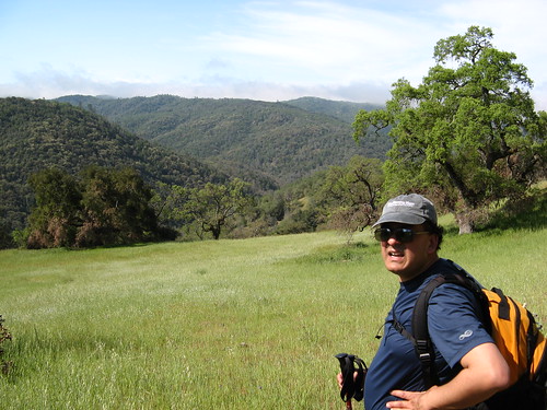
Vindu admires the view near the turn-off to Jackass Trail. If you go this way, note that the trail is very faint, though more hikers will no doubt beat it down some more in the next few weeks. It’s a bit hard to follow at times, but just keep in mind you’re heading up the spine of a ridge — as long as you keep going upward you won’t stray far from the trail.
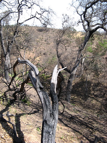
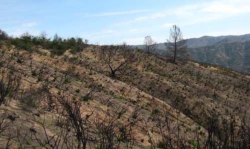
Burn damage starts showing up almost immediately along the Jackass Trail.
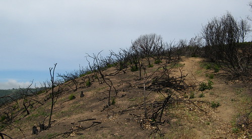
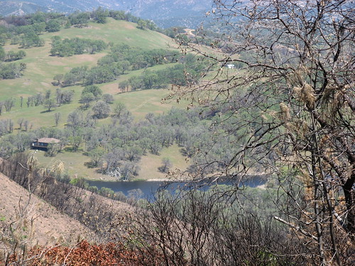
The trail follows this drainage through a burned-out area.
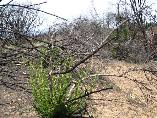
Inevitably, the green is already returning. The winter rains washed way most of the soot, leaving brown hills and the twigs that were the bases of dense shrubbery that practically explodes into flames when fire comes through. The burn exposes how how much these plants dominate the landscape — it’s a thick green carpet of vegetation no human could ever hope to traverse without a bulldozer, but the fire burns off all that biomatter and leaves a rugged landscape waiting to be reborn.
Like this, in other words.
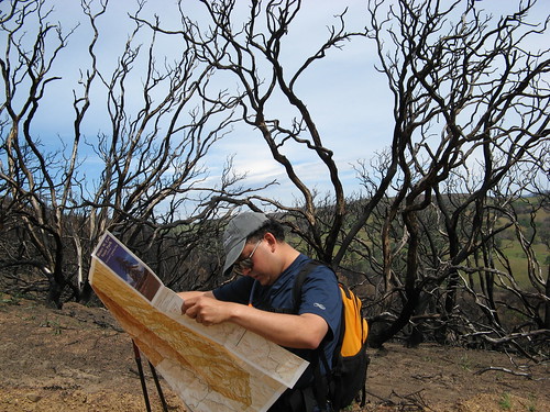
Vindu finds our place on the map on the road that ends the Jackass Trail. It’s easy to know which way to go: just head uphill.
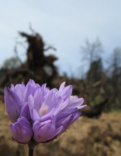
Bluedicks with burn damage in the background.
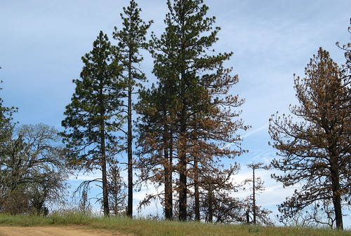
This stand of Ponderosa Pine looks a bit scorched.
Mount Sizer summit itself is, frankly, unremarkable. It has a radio tower of some sort at the top, and a little spur trail leading up to it. Why hike to a place that isn’t worth the trouble of taking a picture? Mainly because this hike is so much greater than a single high point on a ridge. We have to name it after something.
So this is Booze Lake, where the Lick Fire started.
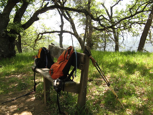
We paused for lunch at this bench at the top of the Hobbs Road Shortcut — a relentless 1.4 miles that’s only marginally less draining than going up it.
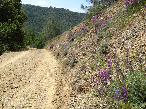
Lupines sprout on the Short Cut. A little beauty is welcome on this beast of a trail.
Once you get down to Coyote Creek, it’s advisable to rest up and prepare for the last four miles uphill to the park HQ. It’s a slog, no doubt about it, but it offers a tutorial on taming the beastly hills of Coe: Set a pace, slow down when you tire. Purge all thoughts of the hill ever ending; such thoughts add psychological duress to the strain on your feet and legs, and you don’t need any more difficulties.
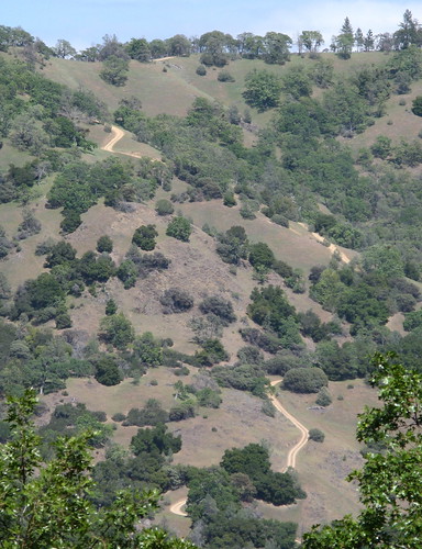
Here’s the Short Cut from across the ridge on Hobbs Road. Not many switchbacks along this route.
After about two miles of climb, Hobbs Road goes downhill for about a half-mile, crossing a creek at a trail junction that gives you two choices: 1.5 mile back to the HQ on Hobbs Road — and another 600 feet of climb — or 2.9 miles along Flat Frog Trail, one of the nicest single-tracks in the park.
Vindu said he was up for either one, but he hadn’t seen the Coe Monument, which requires the shorter, steeper route. So, up we went again. After all the climbing we’d done already it didn’t seem like that big of a deal, but it was brutal nonetheless.
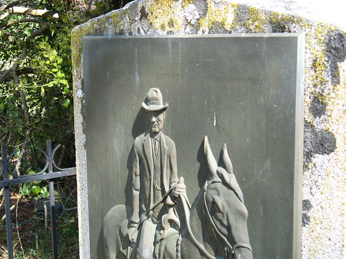
One more shot of the monument — I always have to take a picture when I’m up here.
After that it was a quick dash back downhill to the park HQ, and after that it was back to town, to send Vindu off to new journalistic vistas. Here’s hoping he gets a few weekends off to climb some of those hills upstate.
My Henry Coe links:
- Sizing up Mount Sizer: Same hike, last year.
- All Coe Day hikes.
- All Coe overnighters
- Mercury News park profile
Other Henry Coe links
- David at Random Curiosity did the Sizer out-and-back in February.
- California state parks page.
- Pine Ridge Association
- Wildflowers of Henry Coe
- Bay Area Hiker.
Thanks for leading a fine hike, Tom. It was well worth the effort for the views of the ridges and the charred terrain.
I’m glad we went. I forgot to mention the perfect weather we had; made a huge difference.
My heart was there with both you guys, even if my feet weren’t. Bon voyage, Vindu!
You picked a great hike for a farewell to the SFBA, and this the perfect time of year for it. I usually perfer to do the loop clockwise up Hobb’s road while I’m still fresh. I actually dislike very steep decents more than climbs. Blue ridge trail has always been such a nice walk in spring. When the vegetation was healthy there were always lots of birds chirping and wildflowers, but now the eastern view is better. Kind of a trade off. Best wishes to your departing friend. I will miss his colums.
Great report. I wish you or Vindu had sat on the bench, the INCH group call it the “world’s tallest bench”. How was the creek & ticks? One of many hikes I still need to do.
I once had a rental Hummer pass me on the shortcut.
In the rain.
I’ll second Randy’s note that I’d much rather go UP the shortcut than DOWN it. (Tho hitting Poverty flat road at the end of the day is no picnic either)
Ann: I’m pretty sure the picture with the backpacks is at the bench the INCH folks are talking about. It’s the only bench up there.
I went up the Short Cut once — of course it was mid-August and it was in the upper 90s, but still, I never want to climb that hill again.
Going counter-clockwise, you get to go through Jackass Trail on fairly fresh legs, which seems to me preferable. I guess I’ve done the Poverty Flat hill so many times that I’m not really interested in going up, though it is a bit shorter than the Hobbs Road return route.
I once rode my bike UP the short cut trail! HAH! More like had to push and carry it. It was gruesomely bru- TAL!
What a great send-off hike for Vindu. I did a similar hike going the other way the previous weekend with the Stanford Outing Club and it was brutal to say the least:
http://web.mac.com/cynthial1952/iWeb/Site/2008-04-05-RockHouseRidge.html
That was my third time up the Short Cut in the past year and it doesn’t get any easier. I was so sore the next several days I could hardly walk and I ended up badly bruising my right toenail coming down the alnost non-existent Black Oak Spring Trail or Rock House Ridge or both. Ouch. But I will tell you, it was absolutely beautiful out there. I always felt Henry Coe had its own beauty but I never realized just how beautiful Henry Coe could be. It was gorgeous and made all the pain worth it. Glad to see you got out there with Vindu too!
Fun article to read! I got to drive all of the area back and forth day and night during the fire brought back memories… those roads were brutal on the trucks too!, Including the fact that after a day or so we were not allowed to say “Jackass” Flat or trail on the radio anymore because some lady complained so to be PC Cal Fire made us say “Mule” Flat or trail, PC sucks!.
Speaking of sucking I personally sucked about two feet of water out of Frog pond that was a great water source we sat under that big tree w/folding chairs and a sack lunch in the shade as the truck filled.
Thanks for the great read.
Bob – Editor – Cal Fire News – http://calfirenews.com
The Lick fire actually started about 1 mile North of Booze Lake. A burn barrel burning garbage started that fire. One of the owners of Laurel springs/Booze lake actually brought the firefighters in . They couldn’t find the right trail. 5 years since last Labor Day. The recovery is amazing…