
The idea of having 80-some thousand acres all to yourself is hard to get your head around — it’s not like you can act on such knowledge. Heck, it’d take 20 years to explore it all on foot, and while you’re getting to know one part, another part’s changing. Wilderness is like that.
But if you ever go to Henry Coe State Park, the biggest state park in California, on a winter weekday, you’re bound to gain such knowledge because, frankly, nobody goes there during the week. It’s only 13 miles from the expressway but it might as well be 130, for all the tourist traffic it attracts.
Thing about Coe is, there is no easy way to enjoy it. It has a couple excellent fishing holes — each requiring five to six miles of hiking with a couple thousand feet of of uphill slogging. Only the hardest of the hard-core mountain bikers go there — it has miles and miles of jeep roads through some of the most gorgeous country this side of the Sierra, but I rarely see any bikers out there. The hills are just too evil.
Photographers, birdwatchers and amateur wild-lands biologists can have a field day, but not without serious strain. Flat fields are not exactly abundant.
I’m dwelling on the inherent Coe difficulties mainly because I hiked 14-plus miles there on Thursday and here it is Saturday morning and several major body parts are still complaining. I did a similar distance with similar elevation gain at Mount Diablo last month and felt none the worse for wear the next morning. But Diablo is one brutal haul to 3000 feet in the first few miles and the hard part is over.
Coe is one hill after another after another after another. The hard part is never over — till all the wounds heal.
So why keep going back? Because once you’ve been there, you can’t not go back. The gnarled oak trees, the hills stretching to the horizon, the breezes whistling along the ridge tops — any one of them alone might not be especially alluring, but the combination pulls hikers back to Coe like metal filings around a magnet. At times the hills feel unbearable, but at the moment of despair something will appear on the next turn of the trail to restore the motivation to move on. Might be a bobcat leaping across the trail, or a coyote shaking off the rain, or a mariposa lily hiding in the grass. You don’t walk away from this stuff unaffected. At least I don’t.
OK, so about Thursday’s hike. I did what’s known as the counter-clockwise Mount Sizer loop. It goes a few miles from the Park headquarters down a canyon to Poverty Flat. From there it’s a maybe a mile or so up Poverty Flat Road to the Jackass Trail turnoff, then 3.5 miles to Mount Sizer, the high point of Blue Ridge, and about six miles back to the park HQ. The last miles are the meanest: you give up most of the elevation gained in the six-mile slog to the Sizer Summit in less than a mile and a half down the infamous Hobbs Road Short Cut, and then you’ve got another couple thousand feet of climb back up the ridge to the park HQ. As turn-your-legs-to-rubber experiences go, it’s a doozy.
But enough words, let’s see some pictures.
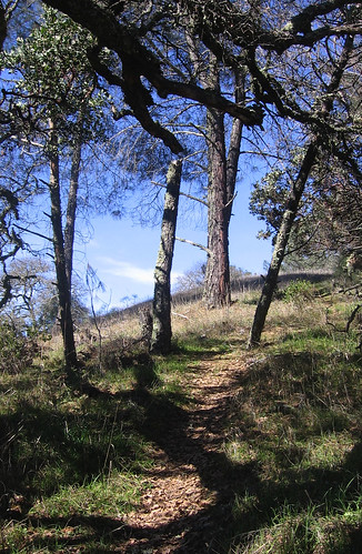
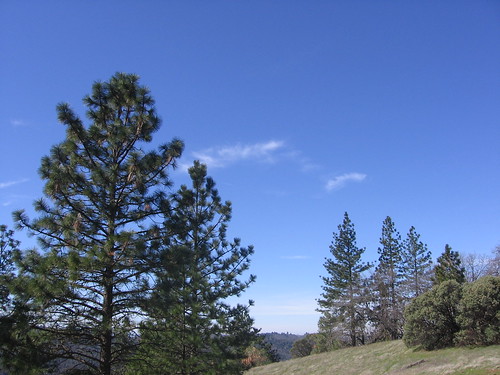
Here’s the Jackass Trail — all single-track and another Coe gem which cannot be accessed without major uphill slogs to get to it. And major slogs all the way up it. It has oaks, pines and manzanita scrub — pretty much the gamut of Bay Area flora — along the way (all that’s missing is a redwood forest).
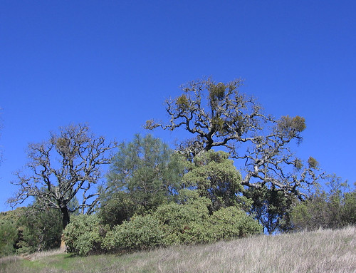
Fairly typical expression of the biodiversity. And all uphill, naturally.
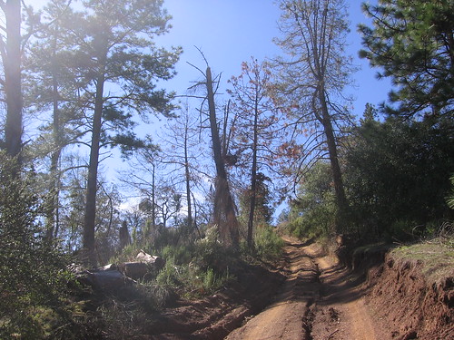
Jackass Trail ends at this old jeep road on Blue Ridge. It’s a left turn towards the ridge top. Lots more excellent trees and breezes up this way.
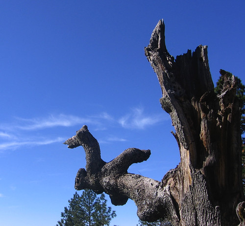
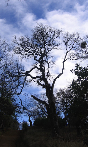
A previously unseen dead tree can make all the suffering worthwhile.
Near the Sizer summit, it’s pretty as a picture.
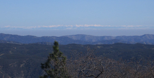
Must be the season for Sierra sightings — the fresh snow from last weekend is clearly visible more than a hundred miles across the Central Valley.
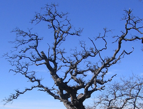
More interesting oak tree tangles.
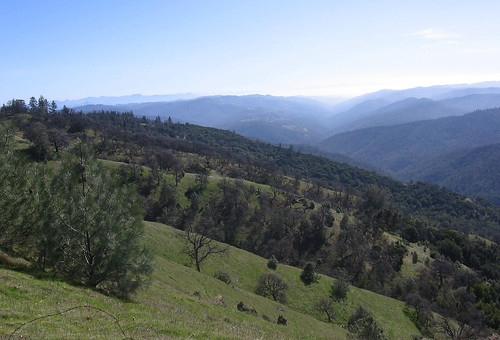
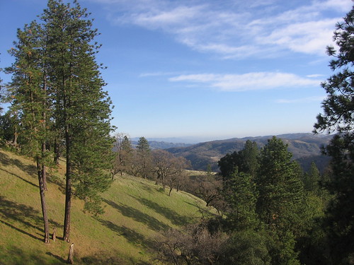
Mount Sizer summit itself is nothing special, and besides, mental preparations for the ruinous Short Cut descent must be made. Views like this from the Short Cut ease the strain a bit.
Coyote Creek awaits at the Short Cut’s end, from which it’s 4 miles of fun (by this I mean, agonizing brutality) back to the HQ. The upside is: lots more cool trees, backlit by the afternoon sun.
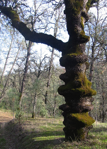
I wondered if this was some wilderness example of cellulite.
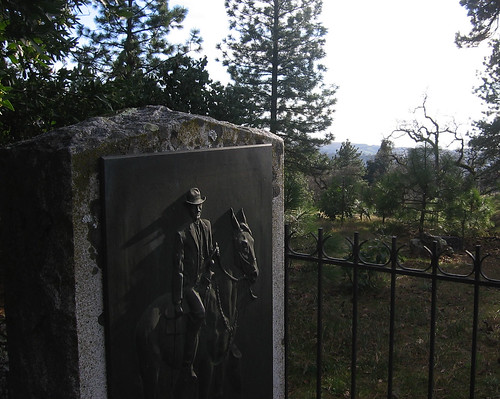
About a mile and a half from HQ is a trail junction which allows your feet to enter an argument with your legs: if the feet win, you go 1.5 (and another 700 feet of climb) by the shortest possible route. If your legs win you take the 2.9-mile route, which is mostly flat. My feet won this one, which had the side benefit of allowing me to see the Henry Coe Monument for the first time. Coe’s daughter donated a bunch of this land to the county, and putting up this monument was one of the stipulations of the donation.
A lovely scene on the last merciful downhill stretch of trail before returning to the HQ.
Yeah, so, those weren’t seven easy hours on the trail. But nothing worth having is ever easy.
Good one, Tom! 14 miles, eh! I think that would have killed me. I can only do that at Coe on a bike. I did 9 on Pine Mountain near Fairfax (Marin) on Sunday, and that kicked my ever-lovin’! Great shots. I miss Coe – been about two years now since I’ve been. Tom