
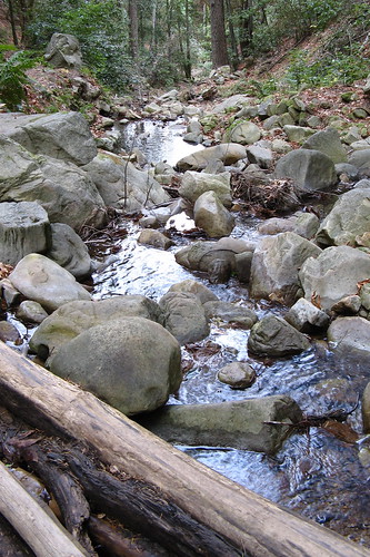
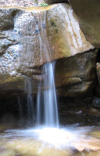
So I’m sprawled over a creek bed trying to set up my Gorillapod and get a good picture of this:
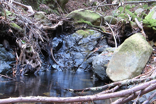
Hey, it ain’t all loveliness out there in the wilderness… but anyway: Nature’s eloquence at punishing the inept unfolds, (spills, actually) as I notice a) my camera’s showing that “battery’s about dead” icon and b) my camera bag’s hanging open and the sound of something falling out of it becomes distinctly audible.
Good news: not my car keys. Band news: it is one of my camera batteries. Down there somewhere between the rocks, with gravity nudging it ever farther into some dank nook or cranny with every handful of muck I pull up trying to find it. (Yes, I put all the muck back before I left; the bacteria are resting easy).
Takes a few minutes to figure out where it has to have gone: directly beneath a 600-pound boulder that isn’t going anywhere. There’s a pool of water below it and enough room to stick my arm in there and splash around blindly, provided I lie flat on the stream bed (thank God for low water). It’s a small pool so I find the battery after a minute or so of splashing (working fingers are great things) and save the watershed from 10,000 years of toxins leaking from a lone rechargeable AA battery.
Subconsciously my brain is causing these mini-disasters because it knows I’d have nothing interesting to say about my hikes, otherwise.
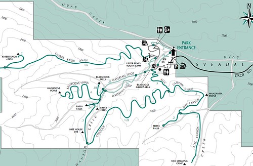
Long story short, I hiked about three hours Sunday at Uvas Canyon County Park, covering all the trails I missed last weekend. Yeah, there’s a write-up for the paper coming soon. Figured out one nice-to-know detail: the Alec Canyon Trail, which goes seemingly straight up the hillside from near the day-parking lot, is a nice place for a warm-up. Nice because you always start out feeling well-digger’s-ass cold at Uvas Canyon and the first thing on your mind is taking the edge off the chill.
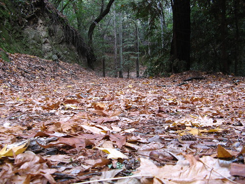
That picture above was taken at the far end of the Alec Canyon Trail — an old logging road used by pretty much nobody. Lined with fallen leaves now and tracking up and down through a deep evergreen forest, it’s a fine get-away-from-it-all walk. Just keep your camera bag zipped. Here’s a shot from ground level:
After an out-and-back on this trail I turned left on the Contour Trail, which tracks along the side of the canyon before making its way back to the Swanson Creek crossing (note for those who care about these things: Uvas Creek is not the one with all the pretty waterfalls; it’s the aforementioned Swanson). Along the way there’s an opening in the forest canopy where you can see over to Knibbs Knob, the highest point in the park.
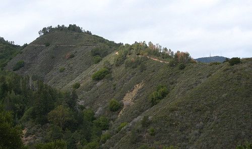
The Knob is over there on the left.
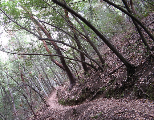
Another Contour Trail shot — I love how the trees bend over the trail. This section is primarily oak, madrone and manzanita — you have to hike higher to get to the Douglas-firs and knobcone pines.
It’s a bit tricky finding this crossing over Swanson Creek coming from this direction, which is why most of the sane hikers do the waterfalls first, then head up this way and build a big loop around the Contour and Alec Canyon trails.
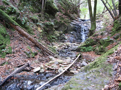
Upper Falls will be a disappointment till the winter rains show up. But it’s better than the nearby Basin and Black Rock falls, which have barely a trickle falling into the canyon.
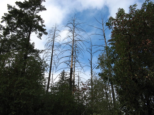
Saw these cool trees on the way up the Knobcone Trail to Knobcone Point. Not much to see at the point (the forest had the nerve to grow back and block the panoramic view), but it’s a nice climb, only mildly grueling, and over in a half-mile.
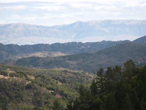
The view to the east isn’t bad, though. That’s the Diablo Range on my cam’s maximum zoom.
OK, one last chance to get cute with the cam before calling it a day.
Uvas has a mere seven miles of trails through its 1,200 acres so it’s not an obvious choice for an all-day hike — though you could try to do all the trails in the same day and log 10 or 11 miles, thanks to the out-and-backs. A better choice is to combine the waterfalls with a hike up to the ridge and back: you get enough miles and elevation for a decent workout, with plenty of quiet walking under thick forest canopy.
Tom,
Another great write-up, great photos (you’ve gotten damn good!)
Still, Gambolin’ Man’s yet to visit this watery wonderland. . .this winter, fo’sho’bro’!
PS:
The Knob looks like the spine of Las Trampas ridge, a bit. . .