
One of my rules is: always visit the graveyard.
There used to be as many as seven coal mines in these hills near Antioch in northeastern Contra Costa County. The towns that sprouted up around these mines are long gone now. What remains is Black Diamond Mines Regional Preserve, primarily a history park that happens to have some trails. You can tour an underground mine on weekends but if you show up on a Monday, gates block the entrances to all the mining attractions.
But you can get into the graveyard, where you can see things like this:
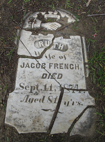
Note the age — 81 — and the year of her passing — 1874. She was born at the end of the 1700s; her parents were probably alive during the American Revolution. In her lifetime Napoleon invaded Europe, steam engines and the telegraph were invented, the American Civil War was fought and most of the original Americans were driven from their lands (though Custer would meet his end a couple years later).
A long life is admirable; a short one is heart-breaking. This was somebody’s baby girl:
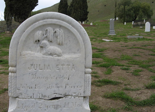
The woman living into her 80s is the rarity here. Lots of men dying in their 40s, women dying in their 30s, and children dying when they should’ve been learning to walk and talk.
Their lives were not like our lives. I’m guessing the ghosts of the Welsh miners who left hellish jobs in their hometown mines to find new hellish jobs halfway around the world in California would laugh out loud at the notion of walking these hills for recreation. In their minds the hills were just something in the way of the seams of coal — or black diamonds.
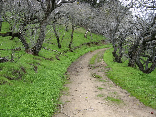
The hills are not especially high, which makes for fewer death marches on the trails, most of which are old mining roads. I did a small loop around the visitors’ center — a rugged little one-miler, if I do say so — and a bigger loop, around five or six miles — along the Black Diamond Trail to Coal Canyon Trail (note: any trail named after a canyon is worth a look) and back to where I started. The park has over 60 miles of trails, supposedly, so there’s a lot more to see.
Let’s look at some pictures that have nothing to do with dead people:
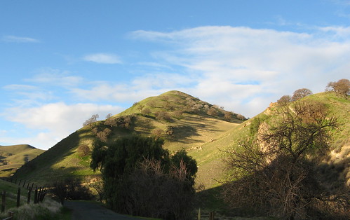
Oddly enough, the rain that drenched the rest of the Bay Area yesterday — it even snowed on Mount Hamilton — spared Black Diamond Mines, at least while I was there. I took this one just as I arrived at the park. It was overcast all day but I had no more than a few occasional sprinkles. It was cold by our standards, and the wind blowing over the bay was bone chilling at times but otherwise it was passable hiking weather.
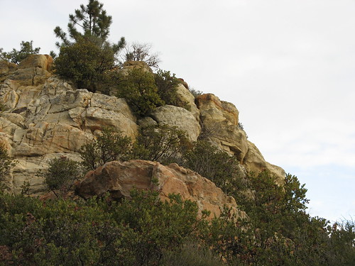
The park has a fair number of rocky outcrops like this one.
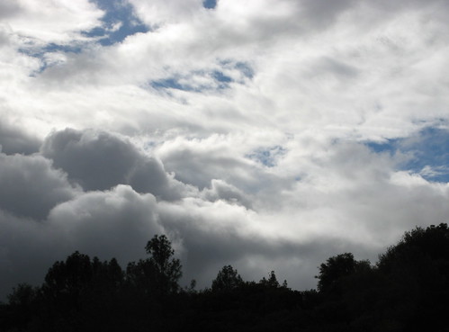
More of that weather blowing in.
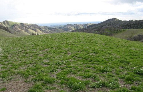
All this green in January. Not complaining.
Even more green!
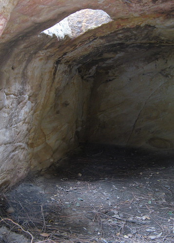
A spot on the map marks “Jim’s Place.” Sure enough, it’s a hole in the ground. Nobody knows who Jim was, just that he lived here.
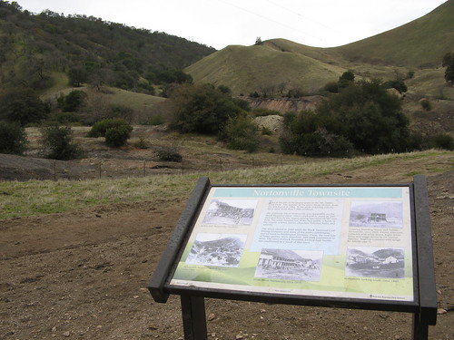
The town of Nortonville used to be here. Note, these sign boards are handy to hide under when it’s drizzly.
So there’s a first look at Black Diamond Mines. I’m heading back next weekend to do the mine tour.
The hiking rates as about average from what I’ve seen so far. Lacking high peaks and water features, it’s mostly hills and oak woodland, which I can see in abundance in the East Bay without driving more than 60 miles.
Speaking of the drive: if you’ve never been up here, take Highway 4 to the Somersville Road exit and head south on Somersville into the park. Don’t expect to see any signs pointing the way — for a park that’s on the National Register of Historic Places, it has remarkably little signage. If you go the wrong way like I did yesterday, figuring what the heck, there’ll be signs, you’ll probably end up asking somebody for directions.
Hi Tom,
I’ve followed your blog for several months now, although this is my first comment to it.
Coincidentally, my wife and I were also at Black Diamond Mines yesterday. We may have seen you — were you stopped at the Nortonville townsite signpost at about noon or 12:30? We were walking downhill past it then and saw a fellow with trekking poles there, getting ready to hike upward.
One thing that impressed us at this park was how high up the sides of the steep hills the cows can go. A herd of cows was guarding the cemetery when we passed by, and one young bull didn’t want to let us through!
Kevin: That was me all right!
I had just changed into all my rain gear because of a few sprinkles. Naturally it didn’t rain a drop all the way back.
I like Black Diamond. Nice report.
I did a short hike in Jack London State Historic Park in Glen Ellen, CA. My review on Yelp:
http://www.yelp.com/biz/jack-london-state-historic-park-glen-ellen
It’s worth checking out. Hope to go back in the Spring to do some more hiking to top of Sonoma Mtn Summit 2463′
Hi Tom
I was just searching for some family history online through the mining cities in the late 1800’s and stumbled across your blog. Wanted to let you know I like your pictures and your story is very interesting. Someday I will make it to California and hope to see what you did. Kuddos-Liz
Hay there people
I found the city of black diamond every thing is still there like it was in the 1800s, the lanterns in the houses, that black smiths shop was cool & a small little grave yard
I do not know if your just trying to preserve it or just keep it quit.
I will make this promise to you now! I will take it to my grave
because you see; I like to preserve things of the past myself
I have two questions that you may not like:
(1) what up with the grave yard in stewartville. Thows people work in coal mines also?
P.S. And do not give me that bullsh*t, there aint one!
(2) Why the hell did thay cover up the gold find in stewartville?? Because if the people that did the cleanup would have did there job
correctly, i would have not found the little gold nugget down in the ravine over were the miners came out and back behind were the one house once stood in the center? they destored stewartville over it!
P.S. the black sand gave me the first clue.