
If you like the sound of running water near the trail, the trail to be on is probably somewhere on the south side of Mount Tamalpais these days. I hiked a couple of the popular trails at Mount Tam yesterday with the globe-trotting Best Hike blogger Rick McCharles yesterday and came away determined to work more Marin hikes into my repertoire, especially at Mount Tam. It’s positively delightful up that way at this time of year.
We started out at Muir Woods National Monument, which was a major disappointment: Big Basin State Park blows away Muir Woods if you’re looking for really big, really old trees. It’s a nice trail head for the south side of Mount Tam, though, truth be told, you’d be better off starting at the Pantoll parking area in the state park and hiking down toward Muir Woods without filling up one of the scarce parking spaces down there.
OK, picture time:
The main trail at Muir Woods. It’s difficult for me to believe this is an old-growth forest — it looks more like Portola Redwoods, which is almost all second growth. The mind-boggling giants of Big Basin are conspicuously rare, and the understory is a tangle of vegetation you usually don’t associate with a mature old-growth redwood forest, where the big trees crowd out just about everything else. (Could I be blinded by my utter lack of expertise in these regards? Hey, this is the Internet, I can’t let facts get in the way of my spouting).
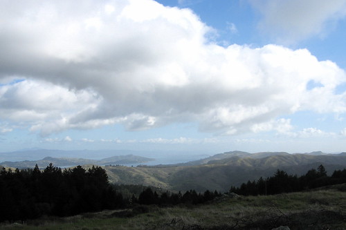
So here’s where we went: Straight up the hill via the Ben Johnson Trail. We caught the Dipsea Trail in an open area looking out over the Pacific, above, then we dived down into another canyon till we got to Steep Ravine Trail, which we took to the Pantoll trail head. From there it was a short jaunt on the Alpine Trail and a steep dive back downhill along the Bootjack Trail, which was glorious, and back to Muir Woods. Nine or 10 miles of the finest hiking the Bay Area has to offer. Might even make Rick’s “Best” list.
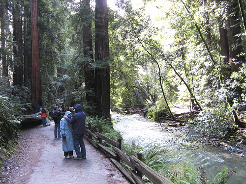
Rick tweaks his new camera before we head down the Dipsea Trail, which passes through what seems like a half-dozen distinct forest ecosystems on the down to Steep Ravine Trail. It has redwood, oak, madrone, chaparral — OK, that’s only four, but still: more diversity than you can shake a hiking pole at.
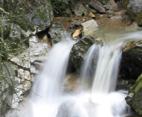
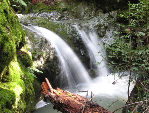
On the way down we start hearing water pouring down the canyon. We break for lunch at a bridge over the creek and head back up the Steep Ravine Trail, 1.7 miles of hiker heaven. This is one of the dozens of little cascades in the creek.
Here’s another one.
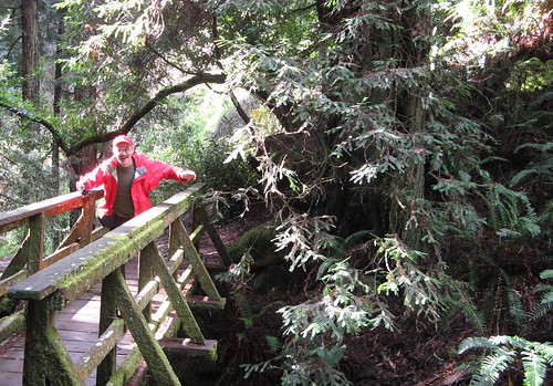
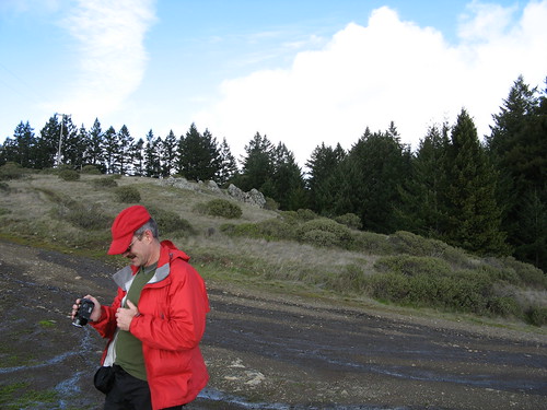
Rick gets silly at one of the creek crossings.
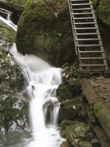
The famous ladder along the Steep Ravine Trail. I’d hate to have to come down that thing.
When we got back to Pantoll around 3 p.m., the primary preoccupation was getting back to the car before dark (which always comes early in the deep forest.). We took a short link on the Alpine Trail and took a right turn at the Bootjack Trail, which turned out to be astounding the whole way down.
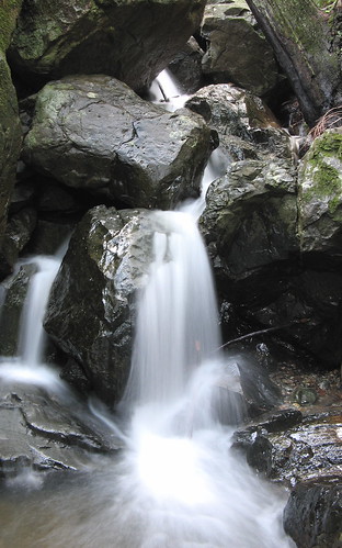
Just one of the many cascades. We were dashing down the hill pretty quickly so I didn’t get many pictures, but those last couple miles felt like a bonus — downhill, gorgeous, rushing water the whole way. Even after all those miles with well over 2000 feet of climbing (closer to 3k, I’d guess), I was a bit sad to be done with it.
Damn, where was I? (In the stuffy office, that’s where!)
Great photos, Tom! I love that mountain!
Great trail report Tom! For a few moments I was transported out of my cube and onto Mt Tam. Now .. back to earth.
i like parking at Muir Woods cuz then I can save the $6 parking fee which is at Pantoll, though there are a few free parking near Pantoll. First come, first serve. Glad I’m an early bird!
That was a great walking day, Tom. Thanks.
… Just now I am wondering how you embed flickr photos into your blog posts. Not using “blog this”.
How do you do it?
(The tool tips are there automatically.)
Ann: you can park free at Muir Woods if you have a national parks pass. But I felt a little guilty about taking up a parking space for four hours when I was only hiking a Muir Woods for about 20 minutes. If you’re in the mood for a hillclimb, park free on the road next to the Dipsea Trail head on the Panoramic Boulevard just up from Highway 1.
Rick:
1) Click on photo.
2) Click on “all sizes”
3) Click on the size you’d like to use on your page.
4) A field below will have coding you can put in your page.
I adjust my templates to make the 500 pixel width fit.
Probably the most famous waterfalls on Mt. Tam are Cataract Falls. They begin with a big falls near the Laurel Dell picnic area, but continue in a series of cascades all the way down to Alpine Lake. With all the rain we’ve been having, the falls are really running strong. Take a look at some pictures from last Saturday and Monday at http://picasaweb.google.com/mrredwood/CataractFallsMtTamalpais.
The Cataract Trail runs from Rock Springs to Alpine Lake, but if you want the short tour, go to the turnout at the Laurel Dell fire road, off Ridgecrest Blvd. You can see the biggest falls after about twenty minutes of hiking.
The best way to see the whole thing is to head up from Alpine Lake (see the bahiker article at http://www.bahiker.com/northbayhikes/cataractfalls.html), although the climb uphill is a definite cardiac event.