
You don’t get a lot of this on trails near town: the feather touch of a spider’s silk on your calves that tells you you’re the first to pass this way today.
I got some of that yesterday on the Chisnantuk Peak Trail, a hidden gem at the far southwestern edge of Calero County Park. This is one of the great unheralded trails in the South Bay: nearly four miles from the nearest trailhead, twisting its way up a hillside through shaded oak woodland and open grassy hillsides practically bursting with wildflowers in the spring.
Calero’s wildflower display is hanging in there, but the park is clearly clinging to the last green of the season. Sunday wasn’t much help: It almost seemed as if I could see the hills getting browner as the day wore on (or maybe that was me wilting in the sun).
It would’ve made more sense to find a pleasant path through some redwoods, but if I ever did the sensible thing there’d never be anything interesting to read here. And besides, you need those moments of slogging up a 20 degree slope in the scalding sun (roughly akin to a breakfast of barbed wire) to calibrate your summer-hiking misery meter.
For those who’ve never been to Calero: It’s primarily an equestrian park. The hills aren’t super high (Bald Peaks Trail, along the ridge on the park’s southern border, tops out around 1,500 feet), but the trails are pretty hilly. I managed over 2000 feet of ascent over 8.6 miles. There’s ample shade in the park’s interior, but your first and last mile will be in the sun. Here’s a map of yesterday’s hike (click for a high-res version):

The Javelina Loop is a pretty, mostly shaded hike, though it has enough uphill to move it out of “easy” range.
My hike definitely strayed into the “strenuous” neighborhood, but the suffering didn’t kick in until after I had taken in the shady downhill hike along the top half of the Javelina Trail and the riparian stroll up the Cottle Trail to the Cottle Rest Area. The hike up to the ridge on the Chisnantuk Peak Trail was no vacation — about 800 feet in a mile — but it offered ample chances to pause and snap a few wildflower shots. Only the last quarter or so was in the sun.
Let’s see the pix:
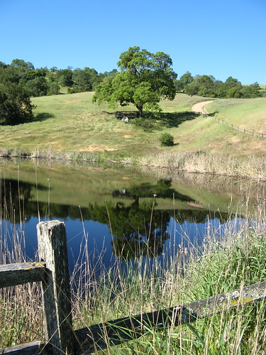
Los Cerritos Pond is one of the prettiest places in the park, and not far from the trailhead. It’d be great to sneak into the park at dawn and catch this scene with better light. Not that I’m recommending such a thing.
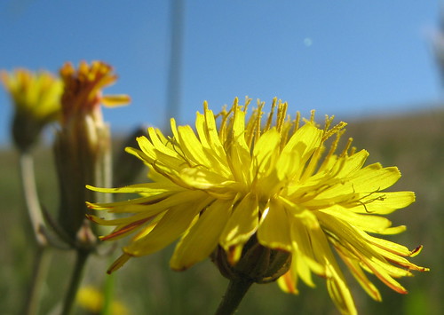
Dandelion’s don’t seem like such a nuisance out here. Lawn grass is so easy to compete with compared to the sturdier stuff growing a on hillside with no watering or fertilizer. Dandelions gone to seed are much more photogenic.
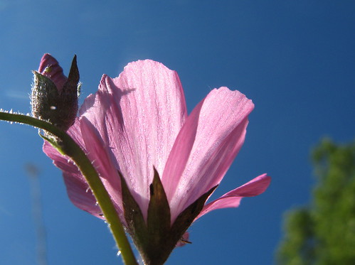
A checkerbloom along the Pena Trail. They’re abundant at Calero this year.
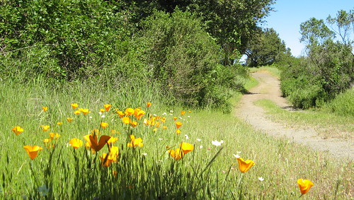
Poppies along the Javelina Loop Trail.
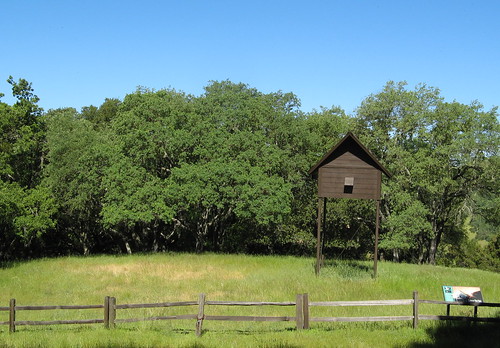
Bat enclosure on the same trail.
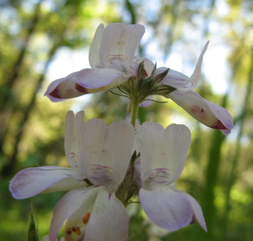
Pretty sure these are Chinese houses (though I suspect they call them something else in China).
Couldn’t identify these things … there’s some on every outing.
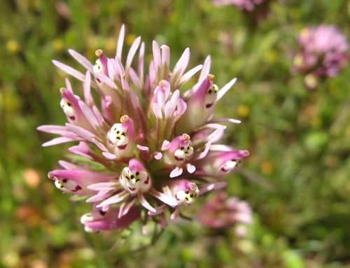
Check out the little ghost faces on this owl’s clover.
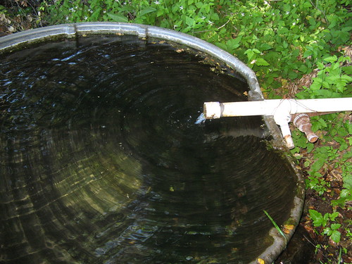
Here’s the water trough at the Cottle Rest Site. I filled my water bladder right out of the pipe … we’ll see if this gives me a bad case of the runs in a week or so.
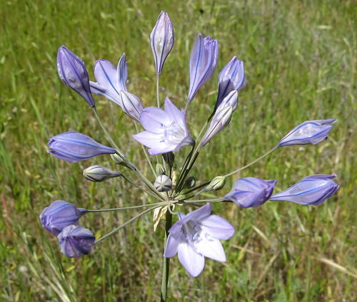
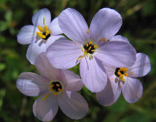
At first I thought these were blue dicks but now I’m reconsidering. Pretty, whatever they are.
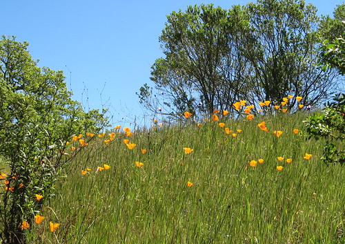
Poppies along the Chisnantuk Peak Trail.
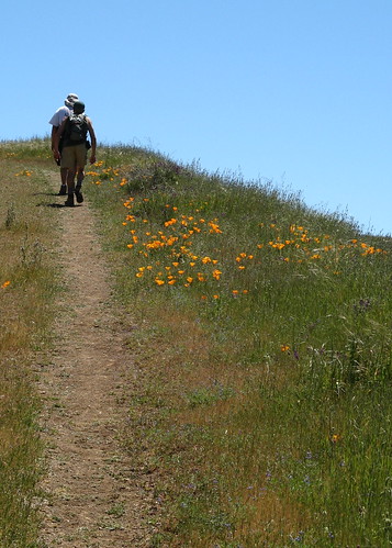
Hikers pass more poppies on the Bald Peaks Trail.

Vistas are quite nice along the Bald Peaks Trail.
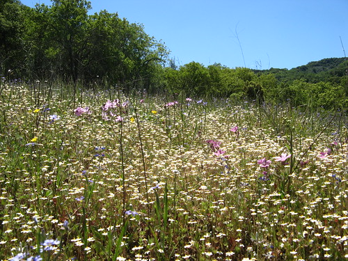
Big mass of blooms along the Canada Del Oro Trail.
So that’s about it for Sunday’s hike. There might be a few more weekends cool enough to check out Calero before the summer heat kicks in. February or March might be much better, if the trails aren’t too muddy.
Calero links:
- My park profile, originally published in the San Jose Mercury News.
- My previous Calero hikes.
- GPS tracks at EveryTrail.com.
- Dan Mitchell’s Calero pics.
- Bay Area Hiker’s Calero write-up.
- Yelp reviews.
Here’s a Google map to get you to the trailhead.
View Calero County Park in a larger map
I feel like I should know the first ‘unknown’ but I can tell you that the blue-dick-like ones are Ithuriel’s Spears.
My new favorite resource for identifying bay area wildflowers is the East Bay parks page. The PDF of all the flowers is a great resource.
http://www.ebparks.org/stewardship/plants/flowers
Looks like a nice, but burny, hike!
Your dandelion is, I think, a Rough Cat’s Ear (Hypochaeris radicata)
Chinese Houses are correct (I haven’t seen any this year!)
The one below the Chinese Houses is some type of Linanthus sp., probably Showy Linanthus (Linanthus androsaceus)
Rebecca is right about the Ithuriel’s Spears.