
 “It ain’t Mount Tam,” the guy tells me in his distinct Carolina brogue. Seems he’d lived in Sacramento awhile and had dirtied his boots on a few Bay Area trails.
I had just clambered through the gnarliest mile in recent memory (dating to last week at Linville Gorge, holder of my previous gnarliest-mile record). Two sections had fixed ropes to help keep hikers upright; it’s all above 6500 feet, just to keep the heart muscles occupied. I averaged precisely 1 mile per hour over four miles.
By the time I paused to gab with Former Sacramento Guy (at least 10 years my senior and happily hiking 12 miles on this bad-ass route), I’d concluded most Bay Area trails are polite pathways for Marin County mocha sippers — bunny slopes compared to the double-black-diamond runs of the Carolinas.
One of the first oddities I noticed in North Carolina: “Strenuous” ratings on two-mile hikes. Seems implausible, but I always finish these two-milers feeling like I’ve hiked five.
“Strenuous” in the Bay Area means trudging up old ranch roads. “Strenuous” here means gingerly selecting step-down points on sharp-angled boulders because you know a single slip will break bones. It means lots of grabbing trees to help pull yourself up and ease your way down. And enough roots to fill a library of Alex Haley novels.
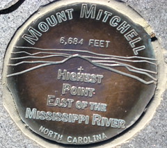
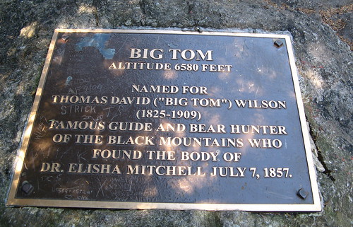
So anyway, about Mount Mitchell: It’s named after Elisha Mitchell, a 19th-century scholar who believed he had found the highest point in the East atop a ridge in the Black Mountains north of Asheville. He died in 1857 on a hike intended to bolster his claim. His body is entombed at the summit of what came to be called Mount Mitchell, elevation 6,648.
Mount Mitchell is typically fogged in; even on clear days, fierce winds often blast the peak. Then there was yesterday: Sunny and 68 degrees, gentle breezes, views stretching for dozens of miles. So much for kissing perfect hiking weather goodbye when I moved east.
Let’s see some pix:
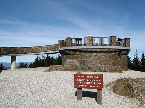
Here’s the viewing platform at the summit. This is all new, completed in the last year.
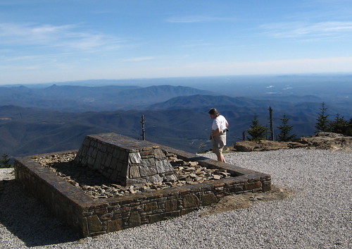
Elisha Mitchell is buried here — the tomb has been renovated too. Here’s what it looked like three year’s ago.
My hike was pretty basic: an out-and-back on the Deep Gap Trail, which tracks a ridge north of the summit for just under five miles. The nearest peak is Mount Craig, just a mile from the summit parking lot. (If you’re going, look for the picnic area and find the sign board for Deep Gap Trail.)
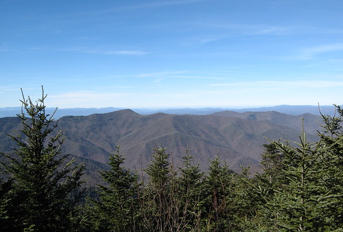
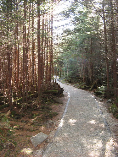
The trail is mostly tree-tunnel at first, then excellent views start to open up as you near Mount Craig.
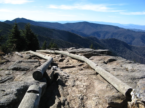
At Mount Craig, wooden rails try to keep hikers on the path and away from the nearby cliffs.
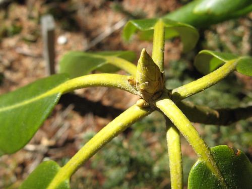
Local flora.
Got some cool blur effects here.
Big Tom is the next knob over. The trail gets very interesting after this.
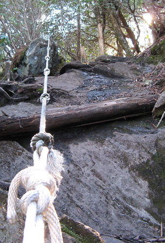
The first of two sets of fixed ropes.
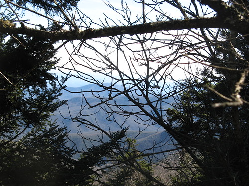
Peeking through the trees near my turn-back point. There’s a trail junction and a nice glade nearby to rest up for the walk back.
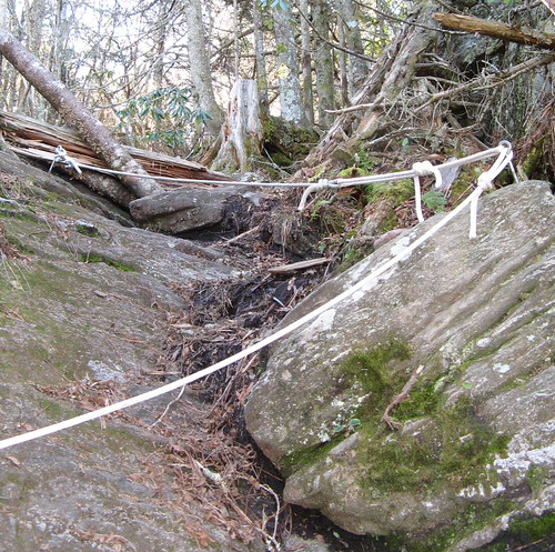
The other ropes course on the way back.
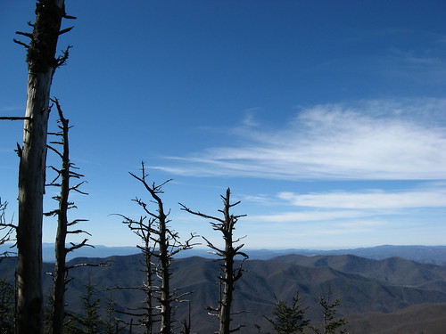
Another for my “hills, trees and sky” album.
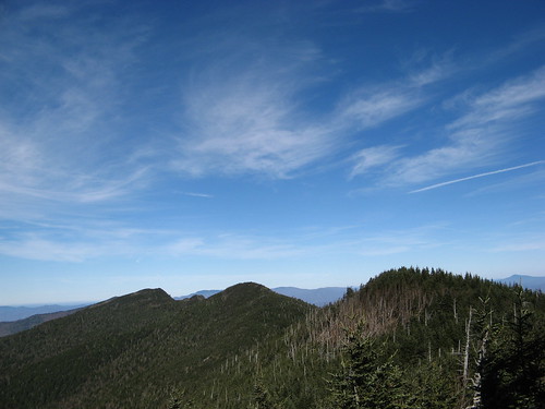
Deep Gap Trail tracks this ridge. Doesn’t look so tough from a distance, but like most ridge trails it’s full of up-and-downs without much zigzagging. Definite leg-burner.
Near the trailhead, the sun hit these trees at an angle that made them look at least a little like young redwoods.
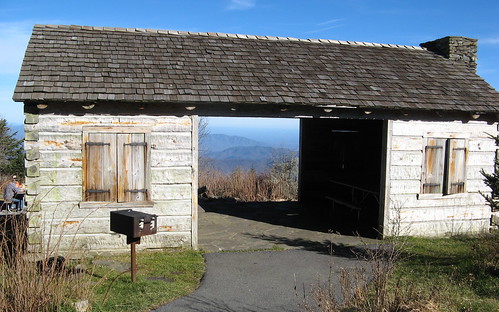
Picnic shelter near the trailhead. You’d want shelter up here most days.
So that’s a first look at Mount Mitchell State Park, which has a restaurant (closed for the season right now) and a few walk-in campsites near the summit. I would never come up here without first checking the forecast for the Asheville area. Cloudy to partly cloudy days would be better spent elsewhere, I suspect. The spectacular vistas are the main attraction; minus the views it’s just a bunch of rugged miles through the forest.
It’s counterintuitive, but the weeks right after the leaves have fallen might just be the best time to visit (depending on the weather) because the views are so much better. Peak leaf season attracts mobs of gawkers (on weekends anyway); winter will be too cold; early spring too gray; summer too hot.
Mount Mitchell links:
- My EveryTrail GPS trip.
- North Carolina State Parks page
- Mount Mitchell State Park Map (PDF download).
- History of Black Mountains and Elisha Mitchell
- Pictures of summit observation deck construction
Google map to get you there.
View Mount Mitchell State Park in a larger map
Looks and sounds like a blast, Tom! I imagine, with that rugged terrain, there’s lots of incredible water flowing over rock…..where are those pictures?
I found out today that Elisha Mitchell fell to his demise at a site now called Mitchell Falls, so I’ll have to look that one up.
I spent all my time yesterday at the summit, so the water would have to be a bit farther down the hill. Interestingly, I saw tons of places where water was seeping through granite .. the whole “weeping rock” phenomenon.
We were up by Mt. Mitchell a few weeks ago, and man that weather will turn on you faster than an angry pitbull. It was 70 and sunny when we first got there, and with in an hour & 1/2, the temp had dropped to pretty close to 38, with about 5 feetr of visibility!
Great blog btw!! Hope you dont mind that I linked you.
Steve: link is much appreciated, actually. The more folks from around here who see it, the better.
I knew the first time I saw the Smokies over 25 years ago I’d have to get back in these hills someday. It’d good to have it actually happening.
I love ridge routes like that. We did the westridge in Big Basin a couple of weeks ago and had an interesting experience at the summit. I sure would like to give this one a run.
Randy: if you’re ever in Asheville for any reason, Mount Mitchell is quite accessible from there, just 30 miles or so north on the Blue Ridge Parkway. Weather is the wild card… it’s fogged in much of the year (especially in summer I suspect, from the humidity rising from ground level).
Ropes! On second thought, why bother with the hiking when reading your blog is excellent fun…
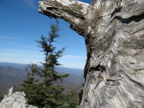
Good to see you haven’t lost your knack of finding a dead tree or two in your travels. Looks intriguig, to say the least. My NE backpacking buds are always telling me how truly gnarly some of those trails are. Sure looks like they’re right!
Deep Gap is a real bad-boy of a trail. Hardest 9 miles I know of, around here at least. First time I came out of there, I felt like kissing the ground in the parking lot.
One that you might want to try is the Colbert Ridge Trail, which basically comes west off Hwy 80 to intersect with USFS 179 in Deep Gap. When you were in the Gap, did you notice two sort-of-bushwhacked trails leading to the north and east, respectively? The east one is Colbert Ridge. Pretty vistas all along, not so Herculean.