
From the San Jose Mercury News, January 2008
Zack Taich needed to notch one more good deed to become an Eagle Scout.
Mike Malone, his mentor and assistant scoutmaster, thought the South Bay needed a trail celebrating the region’s history.
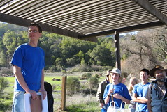
Together, the Sunnyvale duo – the younger a Homestead High senior and the elder a longtime author and high-tech journalist – made a little history of their own: a first-ever guide to hiking through the rusty remains of San Jose’s mercury-mining heritage at Almaden Quicksilver County Park.
The mining operations at Almaden Quicksilver pose two struggles for hikers: the steep slog up into the hills and the scattershot locations of the surviving remnants. Even if you find them, you don’t always know what you’re seeing. The Santa Clara County Parks Department put up interpretive panels at a few sites, but not all. The map at the park’s trail heads is cryptic at times.
 Taich and Malone couldn’t do anything about the climb or the sites, but they could – and did – do something about the map. The result of their work is a brochure that guides hikers along a 6.5-mile route taking in most of the major mining sites and telling the story of a time when men with picks and black powder extracted mercury from the rugged hills.
It’s a fascinating tale: Miners — most from Mexico but also from Europe and South America — came to the New Almaden mines, where they blasted chunks of cinnabar ore and distilled the “quicksilver,” essential for prospectors seeking gold and doctors taking children’s temperatures. They held contests to prove who could pound a spike the deepest into a granite slab.
From 1845 to 1976, seven New Almaden mines produced nearly 84 million pounds of mercury, Taich’s brochure notes. It was the second-most productive mercury mining operation in the world. It wasn’t all progress: Mercury contamination makes it unsafe to eat any fish caught in the Guadalupe Reservoir at the park.
Taich latched onto the story of Almaden Quicksilver’s mines because he needed a public service project to become an Eagle Scout before he turned 18 last December. When his first idea, a clothing drive at his synagogue, didn’t pan out, he turned to Malone – who has written books on the history of Silicon Valley and the rise of Apple and Hewlett-Packard – for advice.
“I didn’t want to, you know, make a bench for the church or something like that. I wanted something meatier,” Taich recalls. “We both started looking around the Santa Clara County Parks Web site, and we stumbled on Almaden Quicksilver, and it just seemed like the perfect choice – mine relics and tunnels and not too far from San Jose. I was on the phone with Ranger (Bill) Burr within that week.”
Last summer, Taich, Malone and their fellow Scouts in Troop 466 in Sunnyvale installed 15 numbered redwood posts corresponding to points on Taich’s map. (Copies of the map should be in the slots at the trail board at the park’s Hacienda trail head).
Putting the map together meant weeks of back-and-forth with park staff to make sure his words matched the historical record. His sister, Jessica, a sophomore studying graphic design at American University in Washington, D.C., handled the design and layout.
“She happened to be the lowest bidder on the project,” he says. “She worked for free.”
Tim Taich, Zack’s dad, general counsel of Activant Solutions, a business software developer, provided moral and financial support. Though lots of people helped out, he says Zack deserves the most credit.
“Zack met several times with the ranger and park interpreter to plan the project and learn about the park. He organized and prepared tasks, and enrolled over a dozen volunteers in the project. Zack could not have done the project on his own, given the amount of work and variety of skills required. At the same time, without him, there would be no project.”
There’d also be no project if Malone hadn’t been so fascinated with the patches and medals the Boy Scouts of America award to Scouts who hike historic trails. Designated historic Scouting trails are common throughout the United States but rare in the West, and rarer still in California.
Malone found a moribund Scout trail in Monterey, and got busy bringing it back to life. After that, Malone wanted a medal for Scouts who hike a historic trail closer to home. Taich’s call for advice gave him his chance. Taich’s sister designed a medal that will be sold at the Boy Scout Shop in San Jose and the Almaden-Quicksilver Museum to raise money for both organizations.
“Based on the success of this project, I intend to begin duplicating it, perhaps once or twice per year, around the rest of the Bay Area,” Malone says. “I only hope I can find Scouts as bright and committed as Zack.”
Taich is moving on to planning for college and getting on with his life, but he hopes his guided Almaden Quicksilver tour will have a lasting impact.
“I started out this project having never heard of the park, and now, not only do I know a lot about the park, but I really have a sense of ownership in it,” he says. “If redwood (in the guide posts) lasts as long as it’s supposed to, and if the parks keep printing the maps like they say they will, I’ll be able to take my kids and show them what I was able to put together before I was 18. I think that would be pretty cool.”
(A PDF of Zack’s map is here.)
Trail tips: Almaden Quicksilver County Park
Rugged climbs and tangled oaks define the hiking experience at Almaden Quicksilver County Park.
Standard precautions: Poison oak is common, especially on single-track trails. Old mining roads can be steep and tiring. Keep your distance from ruins of the mining era. Watch for mountain bikers – and mountain lions.
Hike suggestions
Easy: The New Almaden Trail from the Mockingbird Hill Lane entrance takes a nice up-and-down route through the woods for about a half-mile to Randol Creek – you can turn back from there or head uphill. A 2.5-mile out-and-back to the Buena Vista Mine site is a bit more rugged, but worth the effort.
Moderate: You can’t go wrong on the 6.5-miler in Zack Taich’s history hike. It passes all the must-see mining sites, and has expansive views of the Santa Cruz Mountains. Trail head is at the park’s Hacienda entrance just past the village of New Almaden.
Hard: For an all-day trek that’ll have your feet filing formal protests, grab a map at the Hacienda entrance and hike to the Guadalupe Reservoir on the park’s far side, and return. A basic route departing on the Mine Hill Trail and returning on the Randol Trail is about nine miles, but options for ramping up a route to 12 or 15 miles are wide open.
PARK PROFILE
Acres: 4,152
Miles of trails: 34-plus
Hours: 8 a.m. to sunset
Limitations: Dogs must be leashed
Parking: Free
Driving directions: Mockingbird Hill entrance: From Highway 85, take the Almaden Expressway exit south 4.5 miles to Almaden Road. Go 0.5 miles on Almaden Road to Mockingbird Hill Lane, turn right and go 0.4 miles to the parking area.
Hacienda entrance: From Highway 85, take Almaden Expressway 4.5 miles, and turn right on Almaden Road. Go 3 miles along Almaden Road through the village of New Almaden to the parking area on the right.
On the Web: www.newalmaden.org