
The daring adventurers of California’s past — who energetically cut down most of the trees, polluted most of the streams and killed off all the grizzly bears — did do something beneficial for ensuing generations: they spent lifetimes buying up huge tracts of land that their well-meaning heirs either sold or donated to local governments a few generations later.
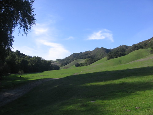
These days forests thrive, streams run relatively clean, and the grizzly is on the state flag, so it’s all good. And the Bay Area has a seemingly inexhaustible supply of former ranches that are now parks, open space districts and wilderness areas, one of which is the Las Trampas Regional Wilderness near San Ramon. The park is just shy of 4000 acres with Bollinger Creek in the middle and Rocky Ridge to the west and Las Trampas Ridge to the east. In early February I did a hike with some of my Two-Heel Drive readers on the Las Trampas side of the park, and I decided on Saturday to check out the rest of the park.
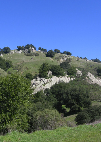
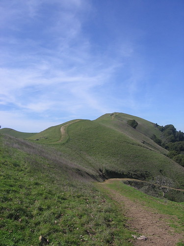
The two ridges may be next door neighbors, but they’re night-and-day different. The eastern ridge is mostly thick manzanita brush-style vegetation, and the trails are mostly shaded. The western ridge is mostly open country, but the trails are much rougher because cattle make a mess of them, especially during the rainy season. Both sides have an abundance of interesting rock formations (each is the crest of a separate fault zone, as I understand it) and grueling climbs to the ridge tops. Hiker heaven, is what we call it.
But enough gabbing, let’s get to the pictures.
There’s an easy trail up this way following the Bollinger Creek. I couldn’t hold my head up in the hiking blogosphere if I took the easy way, mind you.
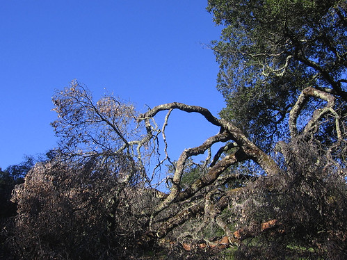
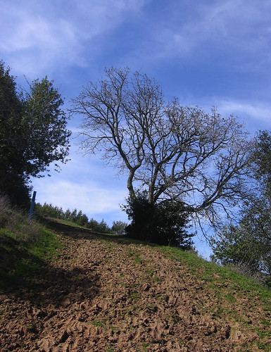
Instead, I headed southeast along the Elderberry Trail, where I saw no elderberries but did appreciate the looks of this falling-down oak tree.
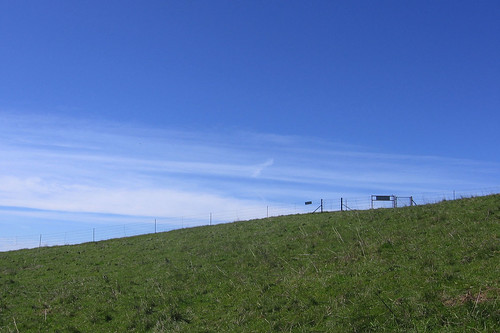
I went about halfway up the Elderberry Trail and took a shortcut over to the Cuesta Trail, which wended its way toward another trail to the top of Rocky Ridge, which is next to this expanse of land guarded by the managers of an East Bay watershed who require you to get a permit to hiker over there. It’s just as nice on the red-tape-free zone on the east side of the fence, though there is that “grass is geener” thing that makes you automatically desire to go someplace where you’re not supposed to be; a sign said those caught without their papers would be cited.
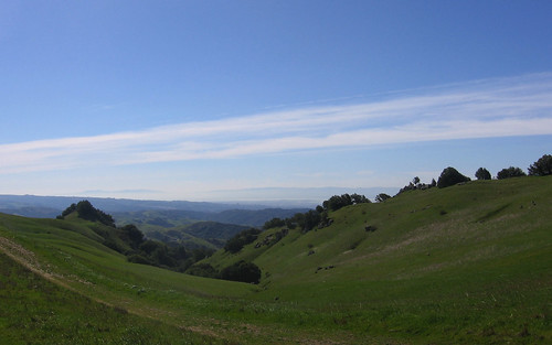
The view up here is excellent; San Francisco and the bay are just over the hill. I like cities as much as the next guy but I like ’em even better from hilltops several miles away.
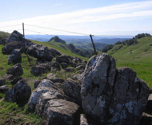
Why they call it Rocky Ridge.
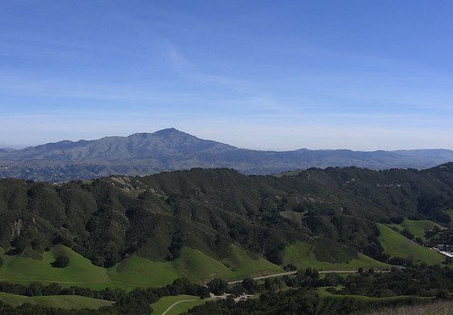
Las Trampas Ridge to the east, with Mount Diablo behind. Diablo seems larger from a distance than up close, when you’re too close to take it all in.
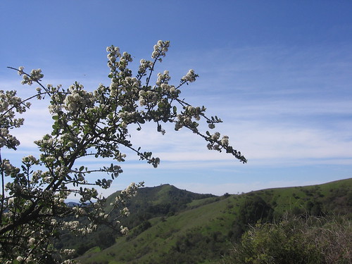
Land and sky near the start of the Sycamore Trail — one of the best trails in the park. It tracks along a rocky hillside, then dives down into a canyon. Lots of tricky footwork required, which keeps it interesting so long as you keep your footing.
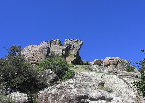
Excellent Rocks above Sycamore Trail.
A bush jutting out over the trail, which zigzags down the hillside, crosses a creek and intersects with the Devil’s Hole trail. I never saw anything that looked like a “devil’s hole,” but I did experience the hellish ascent back up to Rocky Ridge. It’s a tad under 900 feet in a mile and half; I’ve done worse but it’s no picnic.
Lots o’ rocks on the way up.
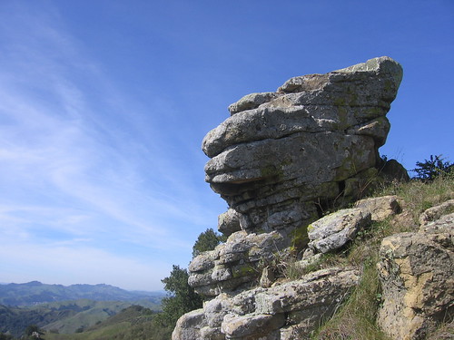
This was my favorite — looks like a cartoon character’s face.
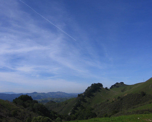
Looking back toward the rocky spine that the Sycamore Trail passes.
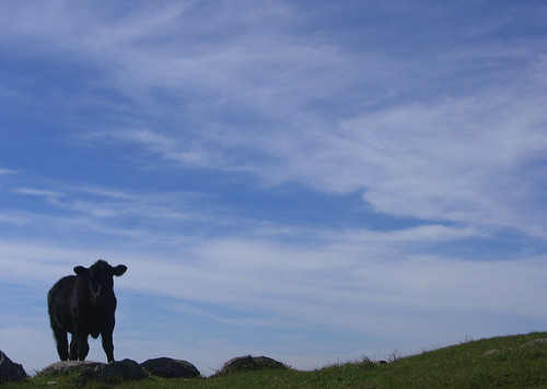
A young angus bull contemplates his next move (or bowel movement, whichever comes first). Cattle in these parts seemed a little testy; I gave ’em a wide berth.
Rocky Ridge Trail eventually intersects with Elderberry Trail, where I turned back toward the park staging area.
Various cows, deer and horses have made parts of the trail quite picturesque. The ankle-deep mud was less fun.
So those are the highlights of the west side of Las Trampas. It’s not quite wildflower season yet, but I imagine the sunny open stretches along the Rocky Ridge will be a sight to behold in a month or so.
Tom, how were the overall trail conditions at Las Trampas? Did you hit a lot of mud or was it spotty? At some point I plan to return to further explore Las Trampas but I hope the trails will be better than walking through industrial strength muck!
Also, I have a request of people in general. I am anxious for the wild flowers and I am hoping that people will report in when and where they find good displays. Thanks!
Areas on the west side where cattle have been grazing are still very mucky in places, especially the shade, but there’s enough sun and dry trail in the open to compensate. You’ve got gaiters so it’s not really a super big issue unless it rains four or five days in a row before you go.
Thanks Tom and yes I do have gaitors although a couple of the snaps broke on them. The velcro still works though! I haven’t decided yet when I will return to Las Trampas, probably March or April. I haven’t been able to go hikig for the last two weekends at all and I need to get out there!