
This week’s hike is more prep work for an upcoming column in the local paper. Sorry if it sounds like a broken record, but if I blog about stuff for which there is an actual paycheck I can delude myself that my blogging is a paying enterprise — which it is, it just pays 12 cents an hour. Look, you can live in most of Africa on those wages.
My destination was Big Basin Redwoods State Park, one of the Bay Area’s most beloved hiking locales, judging from the throngs who take the 12-mile loop hike out to Berry Creek to see a series of three way-cool waterfalls. Normally I’m not one to go against the crowd — I like to gape at car wrecks like everybody else — but four previous hikes to the falls convinced me that perhaps I should see what’s up with the other 70-plus miles of trails in the park. This outing yielded one of the glaringly obvious observations that have made this blog a must-read among the Global Hiking Elite: The way to avoid crowds at popular parks is to hike on unpopular trails.
(An aside: from here on in, local readers will have to suffer explanations of trails they already know about, and far-flung readers will have to suffer accounts of trails they will never see for themselves. Hey, nobody said belonging to the Global Hiking Elite would be a cakewalk.)
Anyway, on to this weekend’s miles at Big Basin:

I actually did three separate hikes, starting with the short, flat, sixth-tenths of a mile Redwood Trail (that’s the base of th 329-foot Mother of the Forest, the tallest tree at Big Basin. The fattest is called Father of the Forest. Melissa, my wife, thinks it should be the other way around.) This little loop goes around one of the most astounding collections of gigantic trees on this coast — and it’s not really all that crowded because the Real Hikers are out there gaping at the waterfalls.
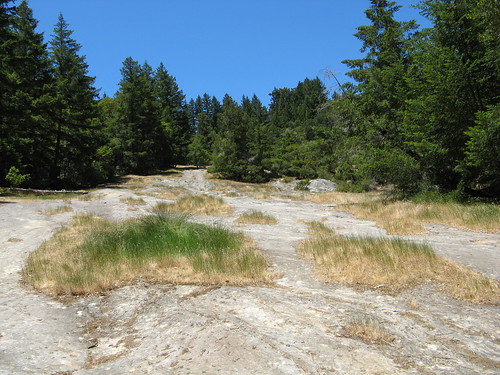
After that I headed for the Pine Mountain Trail, which snakes up a hillside behind the Blooms Creek Campground for a couple miles with about 1,100 feet of elevation gain to an excellent rocky knob called Buzzard’s Roost. On a summer Saturday morning with perfect weather I saw two people on the way up and four more at the top, and about the same number on the way down. The hike is steep and gnarly in a few places, but it’s on my must-hike list now. (Someday my reach and sway will be so great that I’ll have to avoid mentioning these places for fear of the environmental damage from the ensuing multitudes — at current audience growth rates this point should be reached in the year 2037).
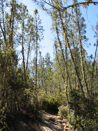
These spindly, moss-covered trees appear on the way up.
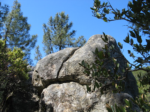
For a park that’s all about the trees, it has remarkable rocks along the Pine Mountain Trail.
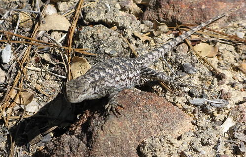
This lizard is the closest that I came to any wildlife.
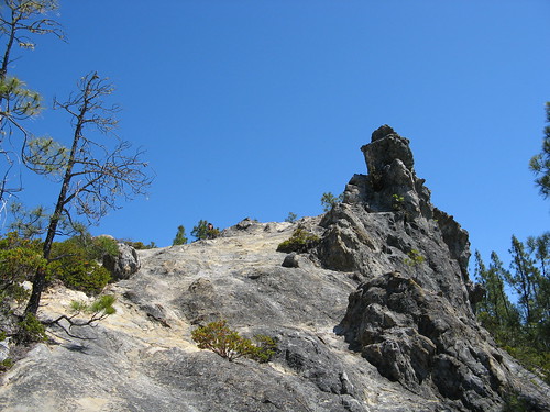
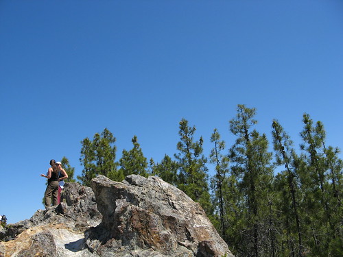
This is the first look at Buzzard’s Roost — which is merely a steep climb on a dry day with shoes that have good traction. i wouldn’t try it in wet weather.
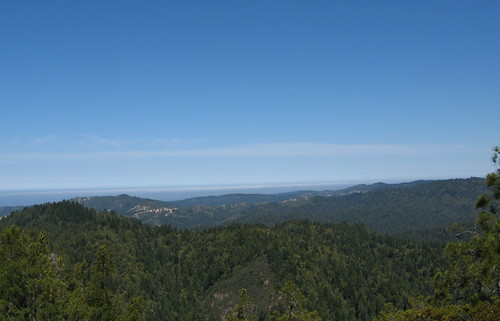
Pretty good view all the way out to the ocean.
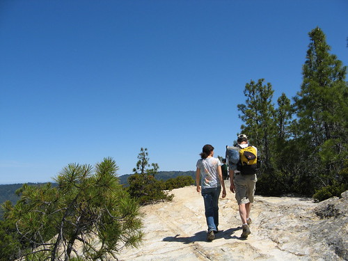
A pair of hikers at the top of Buzzard’s Roost.
More of those excellent rocks.
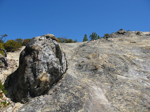
One more look at the approach to Buzzard’s Roost.
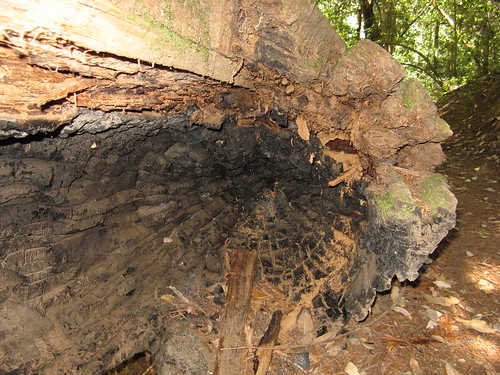
Heading back down the trail, I see a redwood trunk hollowed out by fire and ages of decay.
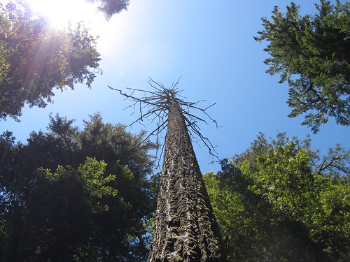
The dead trees are very tall around here.
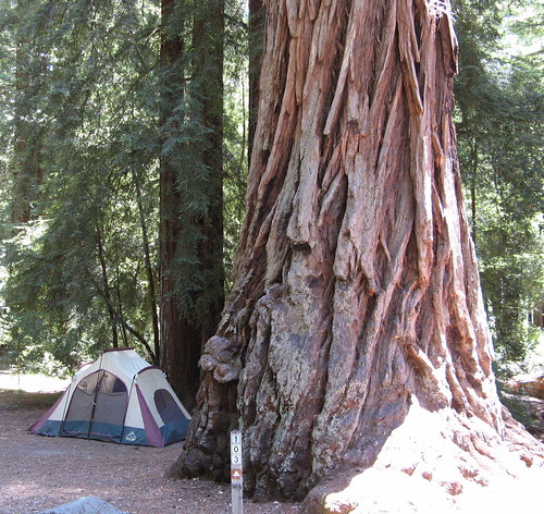
Back down at the campground, I took this pic to give an idea of how much bigger an ancient redwood is compared to just about everything else.
That wrapped my second hike. The third followed the mostly flat Sequoia Trail to Sempervirens Falls, which is barely a trickle at this time of year, to a place called Slippery Rock, over to a road crossing, back down in the woods to the Skyline-to-the-Sea Trail — about five miles. The pix:
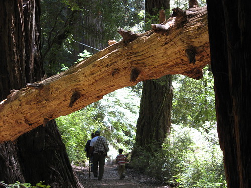
A family hikes the Sequoia Trail, which is much nicer than it should be; it’s mostly parallel to a park road and part of passes through the upper reaches of a walk-in campground. The canopy of ancient redwoods seems to absorb those distractions.
Sequoia Trail is easy till it reaches Slippery Rock, a scramble you wouldn’t want to try in wet weather. Big Basin’s status as a state park was born here, in 1902, when a bunch of preservationists met here and made up their minds to protect these old redwoods from the advancing civilization. Big Basin, California’s first state park, was the result of their get-together.
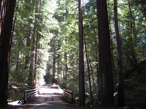
Once you get to the top of Slippery Rock, the trail resumes and crosses the main road into Big Basin. Then it dives down a ravine filled with more stately old redwoods. It was barely more than a mile and a half from the park headquarters and I had it all to myself. At this bridge, Sequoia Trail intersects with the Skyline-to-the-Sea Trail, where I headed back to the HQ.

Another mighty ancient redwood, right next to the trail.
Can’t speak for the other “far-flung” readers but I personally find it comforting that someone’s out there hiking the good hike while I’m stuck behind a desk on the opposite coast.
And hey, some far-flung readers, like me, may find themselves in the situation of attending a friend’s wedding on the opposite coast and then find your local hikes to be very informative and useful when squeezing in non-wedding activities to maximize the use of vacation days (Haven’t quite decided yet where to visit, but Mt. Tamalpais is on the short list, and it seems necessary to find redwoods and visit the Sonoma coast as well.)
Always enjoyable, Tom!
Rachael: thanks for the feedback; I often forget that tourism is one of the biggest Bay Area industries.
Speaking of Tourism: you really can’t go wrong at Mount Tam, though it is a bit crowded on weekends; Muir Woods is another fave; come to think of it, I’ve never even been there, so that’ll be another for my must-hike list.
Thanks for the info, Tom! Just got back, and I can say that if you do visit Mt. Tam, try for a Thursday morning around 8 and you will have the place to yourself. Also visited Armstrong Redwoods, and got to see the coast.
Now that I’m back on this coast, it is all too easy to look around at our (relatively small) trees and hills and think “wimpy wimpy wimpy.” The west just does that to me.