
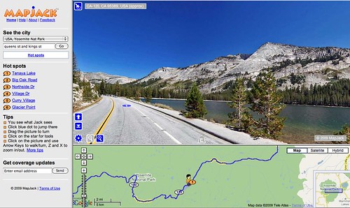
Mapjack can take you on virtual roadtrips. It’s primarily a test of concept right now but it has most of the main roads at Yosemite mapped out. This one’s at Tenaya Lake:
The pull-down menu at the top left under “See the city” has options for San Francisco, San Jose, Palo Alto, Sausalito, Oakland, Lake Tahoe and a bunch of cities in Thailand.
It’s basically a sexed-up version of Google’s “street view” feature, but it is very engaging. You can see the view from the highway all the way up and down the High Country highway. It goes to Glacier point, but not Tunnel View. Fun to play with, in any case.
Link via Yosemite Blog, which also posted this way-cool video of an SUV obliterated by a sequoia at Sequoia National Park last month.
Producers of the video hang out here.
While I’m at it, you might be interested in Yosemite Steve’s Twitter feed.