
Bring a windbreaker. Leave your expectations of what a state park oughta be at home. McNee Ranch State Park has perhaps a half-dozen picnic tables, a similar number of dedicated parking spaces, one porta-potty, a couple old fire roads for trails, few choices for loops. And it has the wind: Nothing between here and Tokyo to block those Pacific breezes.
The hike to the top of Montara Mountain is not characterized by switchbacks. It’s mostly straight up the hill, over 1,800 feet of slog from sea level. Plenty of mountain bikers to dodge. Typically it’s fogged in.
I’ve listed all the complaints first to scare off the rookies and casual googlers, and perhaps leave some room on the trails for the rest of us (of course my readership would only add seven people a year to the trails anyway, but you’re in the habit of indulging me if you’ve read this far, so what the heck). Must say I enjoyed this hike top to bottom. On the steep parts, I slowed to a shuffle and took a few wildflower pictures.
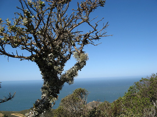
All along I had simply breathtaking views up and down the Pacific Coast. It’s still early in wildflower season so the blooms were scant.
This patch of the Pacific Coast is pretty remote from nine-tenths of the Bay Area; chances are you’d pass a half-dozen perfectly fine trailheads on the way to McNee Ranch from just about anywhere but Pacifica. These are some scenarios that might make it worth the effort:
- Sunny days: Check the weather forecast for Pacifica. If there’s no fog or rain or storms, you’ll have a fantastic view pretty much the whole way.
- Training: 1,800 feet of no-nonsense climb from sea level. It’s a bit slippery on the way back down in places and you’ll have to step aside for a few mountain bikers.
- Springtime wildflower season: The next two months should be positively gorgeous, before summer’s warmth fogs the coast in.
- Something to do while your family’s kicking back at the beach.
Let’s look at some pictures from Sunday’s hike.
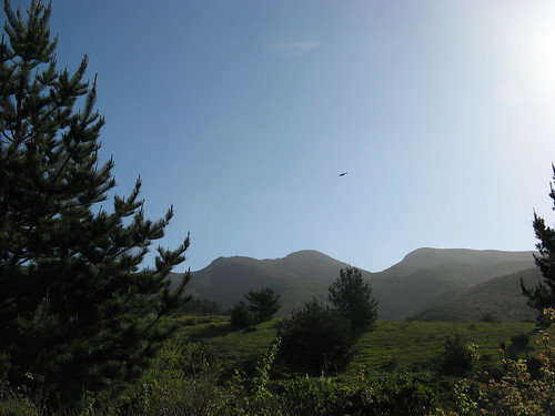
Looking up toward the Montara Mountain summit in the first hour of my hike. Signs for North Peak Access Road guide the way to the summit.
Blue sky fading into ocean blue. It looks better from a few hundred feet up the hill. A few of these open areas allow unobstructed blasts of ocean breezes. You face a tough choice: hiking hard enough to stay warm will just make you sweat and shiver all the more when these breezes rip through. I decided to just walk very slow and soak up the scenery and kept my light insulated jacket on most of the way.
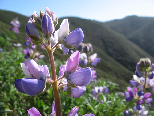
Miniature lupines are the most abundant right now.
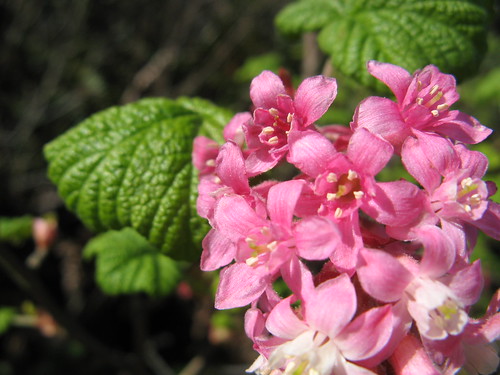
A passing hiker kindly informed me these are flowering currants.
Once you get to the top, there’s the usual array of satellite dishes and antennae poking out of the peaks. My GPS told me the highest point was around 1,880 feet at North Peak.
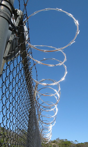
The sun was creating cool reflections in the razor wire at North Peak.
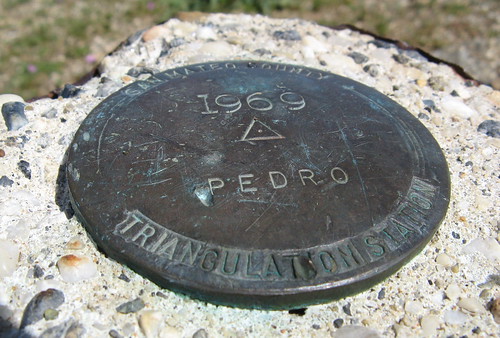
Here’s a triangulation marker from one of the knobs at the summit. This is nice little peak (called Peak Mountain on maps) because it’s got no communications gear and it looks out over the ocean more directly (you’ll know it if you get up here — it’s got a bunch of use trails trailing off from the main road).
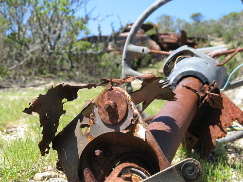
There’s two rusting hulks of dead vehicles up here. One is upside down; this is the steering column from the other, a Dodge pickup truck riddled with bullet holes.
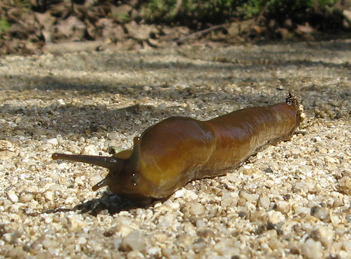
On the way back down I noticed this brown banana slug making its way across the road on a layer of slime. Given that these slugs are typically taxicab yellow, I wondered about the prevalence of creatures developing natural camouflage, and thought perhaps this explained why Northern Europeans who live among so much snow are so pale-skinned. I couldn’t account for the darker complexion of the Inuit peoples, though, so I dropped the idea.
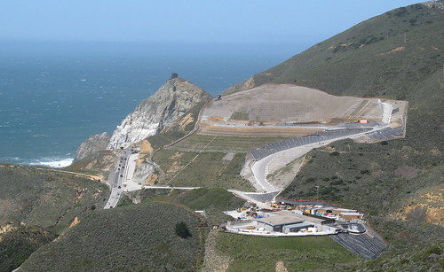
There’s a massive construction project happening just north of here. They’re tunneling through the mountain because a section of Highway 1 nearby keeps trying to wash into the Pacific Ocean.
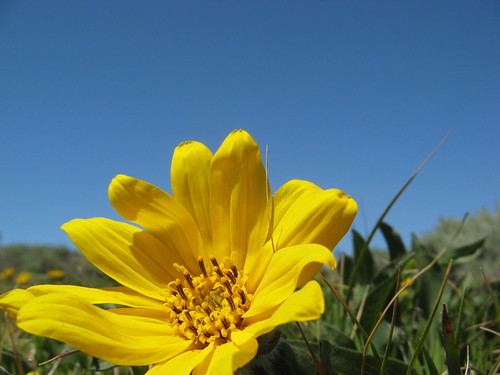
Nicest pic of the day: a coast daisy along the Gray Whale Cove Trail. This trail goes to Gray Whale Cove State Beach, and there’s a parking lot nearby.
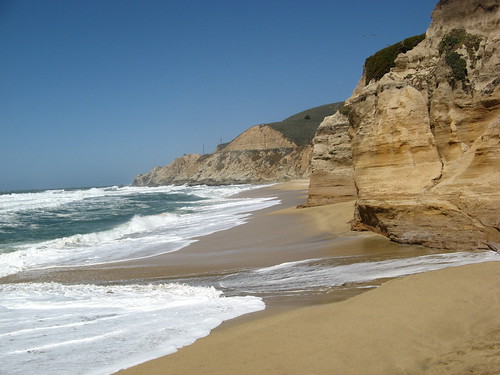
I had to stop by the beach when I was done. To come all this way and not check out some crashing-wave action is absurd. Speaking of which, my GPS unit determined that this spot was 22 feet below sea level. (I realize 20 feet is within the tolerances of GPS calculations, it just struck me as amusing that it told me I’d need a submarine to stand here safely).
More Montara Mountain/McNee Ranch links:
- My GPS track at Every Trail.
- Pacifica Trails (images here.)
- Buy a map for a buck at Virtual Parks.
- Bay Area Hiker.
- Kevin Gong’s hiking page.
Here’s a Google map for driving directions:
Vivid shots, nice write-up(s), Tom! I’ve done that hike once and loved it!
The scenery really compensates for lack of single-tracks and steep old fire roads. View up there is astounding.
PIctures don’t really do justice to the grandeur of it.
Your pictures just get better and better. Are you using a point+shoot or a DSLR?
thuy, you’re too kind (but please continue!)
Camera is a point-and-shoot — a Canon A710 that Fedak donated to the cause a year ago when my previous cam got busted on a hike at Big Basin. It has image stabilization, which in combination with the shutter release timer enables pretty good macro shots in ample light without a tripod. The cam is hanging in there fine after 7,300 images. Not too shabby.
Last week I mistakenly took my A510, a previous generation of the same camera, so this week’s are bound to look a bit more vivid — though I must say the A510 did a pretty good job w/macro shots even w/out any image stabilization.
If it’s the sort of thing you’re interested in, you may be interested to log your find of that triangulation marker ‘pedro, 1969’, per the comments and link here. I presume you still have your photo coords.
And that page also links to several nearby geocaches – if you’re interested in those. All the more reason to return to that pretty and unfamiliar locale.
SO you too could be a more interested fellow. Amazing what global networks of connected computers, combined with expensive mostly military satellites, affords to us taxpayers.-Ron (in a slightly sardonic mood)
Nice hike on a beautiful day!
When I hiked Montara Mountain, we left from the San Pedro Valley Park trailhead in Pacifica – it’s a nice singletrack for a couple of miles before it joins the fireroad from McNee Ranch.
Adam: I almost went that way, but figured I’d better do the main route first.
Incidentally I also added your blog to my “a-list” of bay area hikers.
cool! doing this hike today; looking forward to it. 🙂
was curious about your comment on the role of camouflage in the evolution of skin pigment, so i poked around for a sec. you may or may not be completely bored by this:
http://daisystanton.blogspot.com/2010/04/was-reading-this-guys-great-hiking-blog.html
end of nerding.
thanks for all the great hike writeups!