
Mount Tamalpais
Big hill looming over the southern end of Marin County. You can park near the peak and hike less than a mile to the top, but it’s more fun to walk up from one of Mount Tamalpais State Park’s many trail heads. Elevation: 2,572 feet to East Peak. I hiked it in February 2007. You can park in Mill Valley and hike to the peak, as this write-up describes.
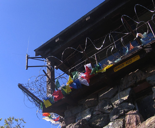
Above: Fire lookout, East Summit
Mount Diablo
Biggest peak in the Bay Area, blazing hot in the summer, windblown and occasionally snowcapped in winter, biggest thing on the East Bay skyline. Elevation: 3,849. My favorite summit hike: Three Peaks from a trailhead in the town of Clayton. Here’s a blogger’s snowy hike there in February 2009.
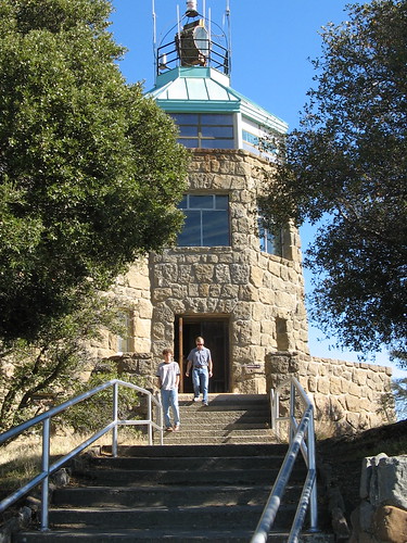
Summit Kiosk at Mount Diablo.
Mission Peak
Fremont’s signature peak is a great workout hike, though you’ll have to fight crowds on the weekends. No easy, gentle strolls to the top. Elevation: 2,497 feet. I’ve hiked there dozens of times. Nice page of Mission Peak info here.
Mission Peak
Mount Sizer
Remote peak in Henry Coe State Park most notable for the notorious “Short Cut” nearby, one of the region’s most beastly trails. Elevation: 3,182 feet. Great way to burn a day on the trail; I recommend the 14-mile counter-clockwise loop. Calipidder did a similar hike in 2007.
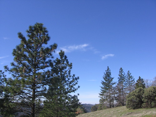
Trees near Mount Sizer.
Montara Mountain
Big hill just south of Pacifica has awesome views when the coast is clear. Hike to the summit is all fire roads, but the mind-boggling vistas overcome all objections. Elevation: 1,898 feet (you’ll do it all if you hike up from the beach). I did my first hike there a couple weeks back. Here’s a Dinesh Desai’s “Everest by the Bay” hike at Montara.
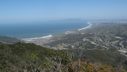
Pacific Coast from Montara Mountain
Black Mountain
High point of the Montebello Ridge Open Space in the Santa Cruz Mountains offers views of the Pacific, San Francisco and Silicon Valley on clear days. Very windy at the top. Elevation: 2,800 feet.. Fourteen-mile out-and-back from Rancho San Antonio County Park is a fave, though it’s also accessible from the Montebello OSP parking lot on Page Mill Road, a six-mile out-and-back. Here’s a summary at SummitPost.
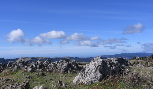
Rocks at Black Mountain Summit
Rose Peak
High point on the Ohlone Wilderness Trail is accessible only by a 20-mile out-and-back, or by backpacking to nearby Maggie’s Half Acre and camping overnight. Elevation: 3,817 feet. My last visit was in the spring of 2007. Here’s a trip report at the Bay Area Hiker discussion board.
Mount St. Helena
It’s a bit of stretch to say the highest point in the Wine Country is in the Bay Area, but the peak is mentioned in many Northern California hiking guides and many are tempted to check it out. Elevation: 4,343. It’s a 10-mile out-and-back from Jack London State Park. I got most of the way to the top there in the summer of 2006. That Other Tom writes about it at the S.F. Chron.
Hmmm, I’ll have to add Sizer & Black Mountain to my list of hikes to do.
The rest on your list are totally worthy indeed, alhtough I haven’t done any of the longer routes to Diablo’s summit. Having biked up it a few dozen times, that’s possibly enough for me 🙂 St. Helena on a nice day is absolutely gorgeous, although if you take two cars, the Palisades Trail (a 10-mile shuttle hike that ends in Calistoga) is a nicer hike still, especially in spring.
It’s a shame that Mt. Hamilton has no hiking whatsoever at/near its summit, and that Mt. Uhmunum is inaccessible, although recent reports of cleanup efforts are hopeful.
I’ve bagged all but the last two. At some point I want, or rather hope to bag Rose Peak. I t seems the older I get the harder it gets. I’ve never been good at the hills and they aren’t getting any easier for me. And my sedentary desk job isn’t helping either. Anyway, having hiked and suffered up the first bunch of ’em all I can say is this is a worthy list!
Hi Tom:
I was searching Bay Area Peaks and came to this page. Then, I found that you have a link (under ‘Montara Mtn.’) to my write up on Montara Mtn. The link is broken as I recently had to move my entire web site. The correct link is
http://dineshdesai.info/everestbay/index.htm
Dinesh Desai
P.S. I miss your column in the Mercury.
Dinesh: Thanks, I fixed that link (and about four others on the site.)