
I knew this climb would not be a picnic — three miles of trail and 2,000 feet of ascent separate Calloway Peak from the Boone Fork trailhead at mile 299.5 on the Blue Ridge Parkway. Don’t let the short distance fool you: just as the Grandfather Mountain map/brochure advises, this is an all-day outing with multiple scrambles, obstacles and photo ops.
 According to my GPS unit, I averaged 1.6 mph while moving, and half of that was downhill. Hey, I’ve always said I was slow, but if I have to drive 95 miles before I plant the first step, I’m not going to spend much time thinking “gee, what can I do to get this hike over with?”
One of the cool/cruel things about Grandfather Mountain is the role of luck — if fortune smiles you’ll have a hundred miles of clear skies and pleasant mountain breezes to cool your climb. If you call tails on a heads day, though, you could experience driving rain, dense fog, gale-force winds or tree-splitting thunderstorms, and that’s assuming you have enough sense to avoid the blizzards and ice storms of winter. Best advice: check the weather forecast and hope for the best.
About Saturday’s hike: From the Boone Fork trailhead, I took the Tanawa Trail over a bridge and took a quick right turn on the Nuwati Trail, filled out a registration sheet, and took the gentle climb to the Cragway Trail.
Cragway Trail is a steep, snaggle-toothed mile with excellent vistas. It ends at Flat Rock junction, where a right turn on the Daniel Boone Scout Trail leads all the way to Calloway Peak. This is more serious hiking: one precarious rock crossing and three ladders near the summit. I stayed on the Boone Scout Trail almost all the way back, till I turned left for the last half-mile to the parking lot.
High time we looked at the pictures:
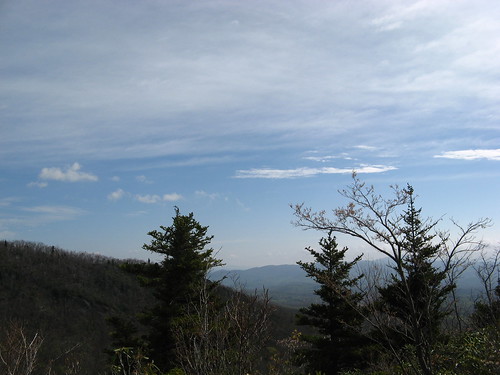
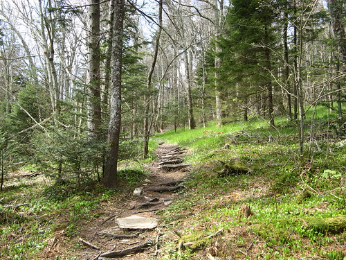
One of many views along the Cragway Trail — which is better climbed on fresh legs than descended on tired ones (it’s great hiking either way, even with the occasional scramble).
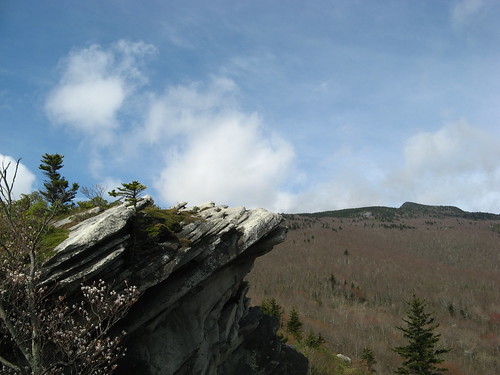
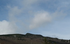
One of the many excellent crags. Those clouds coming over the hill would eventually cover the peak entirely; this was the last clear vista of the day.
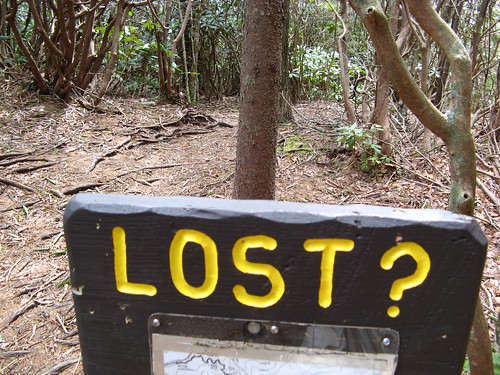
A handy sign at the end of the Cragway Trail at the Flat Rock junction. It’s all Daniel Boone Scout Trail from here to the top.
It’s all pine forest after the Flat Rock junction. A smattering of wildflowers are coming in along the trail.
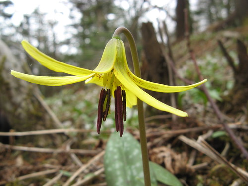
These start out as a ball and open as the day progresses, only to bend over and hide their prettiest parts. Took some finagling of the camera to get this shot (posted out of sequence — this is on the return leg in the afternoon).
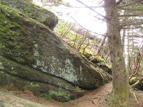
How you know you’re close to the summit: this huge rock forces hikers to negotiate a nasty stone slope.
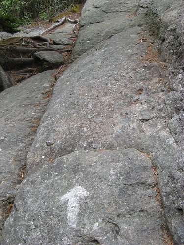
This arrow does not mean “hike right here” — the rock’s at a plant-you-on-your-fanny angle. The footing nearby is a bit better, passable with careful traversing. I’d hate to try this when the rock’s wet.
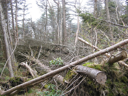
An ice storm on Christmas Eve came through the Blue Ridge like a wrecking ball. Must’ve taken some burly state park workers to clear this trail.
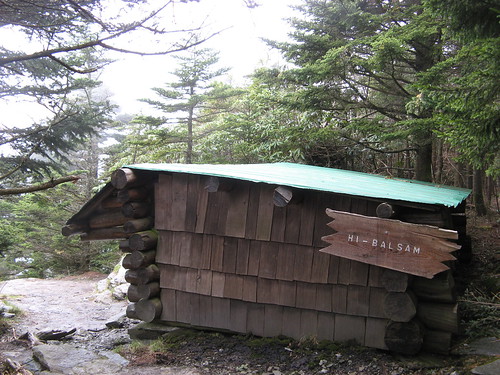
Hi-Balsam Shelter looks out over the Blue Ridge, though the view was all pea soup yesterday.
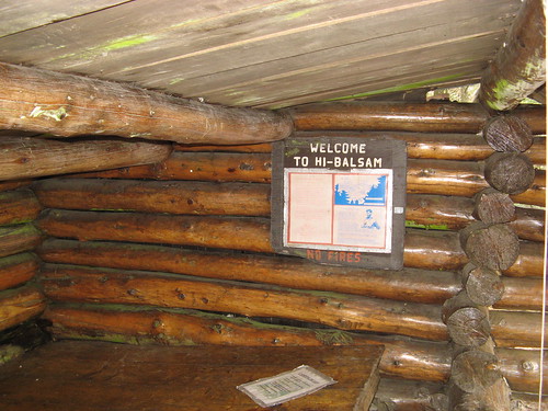
A look inside the shelter. You could ride out a serious blow in here.
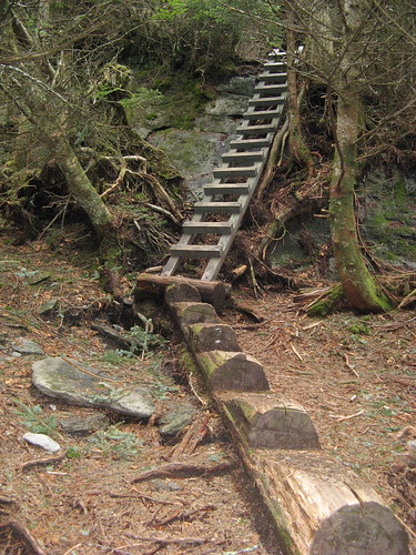
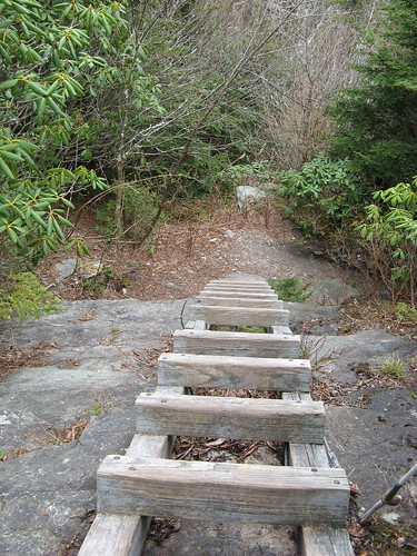
First of three ladders to the top.
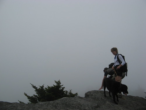
Two hikers and Labrador retriever at Calloway Peak.
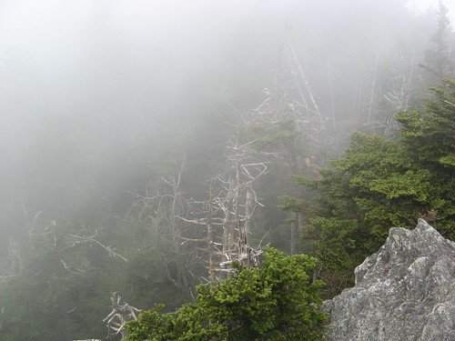
About all we could see from the peak. Time to head back down the hill.
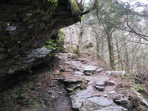
A rocky overhang along the way down.
Second ladder. I did a butt-crawl descent, which seemed safer than a stand-up.
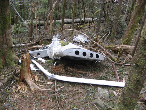
Wreckage from a small-plane crash is visible if you know where to look. Easiest way to spot it is on the return leg — off to the left not far beyond the third ladder (the first ladder on the way up).
The wreckage has been there since 1978, when the pilot got lost in the clouds and hit the tree canopy. It was fatal. The ruined fuselage is nearby, but I’m not posting a pic out of respect for the pilot’s survivors. Even if they never find this page, it’s creepy to show the exact location of somebody’s last breath. (The plane’s tail tag is N735MB if you’re morbidly curious.)
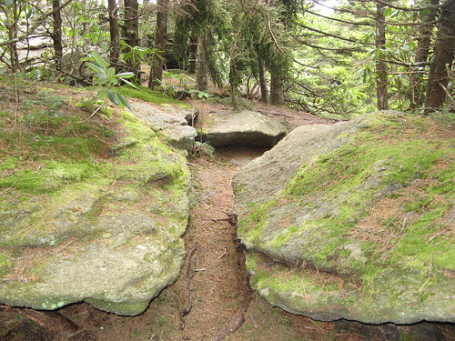
Back on the trail: I like the way it cuts through these rocks.
From here it was back the way I came, but returning on the Boone Scout Trail after the Flat Rock junction. This leg of the Boone Scout Trail is all tree-tunnel, nice for a relaxing downhill jaunt but not much in the scenery department. It ends at the Tanawa Trail, where it’s a left turn and a flat half-mile back to the parking lot.
Grandfather Mountain links:
- Everytrail GPS tracks for this hike.
- My previous Grandfather Mountain hikes.
- Grandfather Mountain web site
- Grandfather Mountain trail map (13 mb PDF download).
Google map of Saturday’s hike:
View 05-01-2010-Grandfather Mountain in a larger map
Oh man, it may be a rough one but this looks like a beautiful hike Tom. And I am planning to finally get out for a hike next weekend come whatever. Your pictures just really make me want to get out on the trail!
Mr. Tom Mangan,
I live in the Bay Area and I wanted to thank you for the “Twoheel” site. I look at it every week for hikes to take-I did not know there were so many places to hike until I saw Twoheel.
Beginner hiker-more prone to becoming an avid hiker because of your site.
Laura
Laura: thanks for the kind words … sorry I’m not providing new Bay Area content but if you’re just starting out you’ve got plenty of material to work with.
Cynthia: hope I’m inspiring you to get back on the trail. We never had trails like this in the Bay Area to speak of. Rocks, roots, steep crazy routes, etc… the views aren’t always as great but the trails in many was are far more interesting and challenging.
Tom, you are most definitely inspiring me to get back out there. And I have to admit that I am never happier than when I am out on a trail. I also find that even though my muscles might be sore from the effort, I still feel like a million bucks for a couple of days after a hike. I guess it’s the endorphins working.
And I also must say that everywhere I have ever gone, I have always found that the new area had much to offer. It looks like you have found the same. Your pictures of the hiking trails out there are just wonderful!
Looks like an awesome hike – much better than taking the drive up to Grandfather Mountain. I’ll have to make it out there this fall when the weather gets a little nicer.
Awesome story!
I started my own hiking blog at http://www.ultimatehikingguide.blogspot.com
Check it out! I think you’ll dig it!
Am going to do it this weekend. Thanks for the weather link.
We just completed this hike with our 3, 6, and 11 year old. Our 11 year old smoked us and 6 and 3 year old were excited about the trail, despite the ominous weather (thunder & minor rain). We found it moderately easy but with our late departure our 3 year need to get in the carrier for a nap. They found the plane crash interesting. They also thought the ladders were cool. They also like the blueberries/huckleberries on the trail quite tasty.
A friend and I did this same loop 7/21/2012. Thanks for your pics and descriptions. You are spot-on with everything. It took us nearly 5 hours of hiking to make this round trip.