
I have as much fun finding these trails as I do hiking on them. They’re all tucked way, way back in the countryside, and while there are reasonably direct routes (like less than a half-dozen turns from a major highway), I much prefer the challenge of navigating a mad tangle of two-lane blacktops. The brain’s more hike-ready if I’ve gotten lost three times on the way to the trailhead.
I hiked Saturday in the upper half of Pilot Mountain’s River Section and Sunday in the lower. Had the trails mostly to myself, except for one group of people on horseback and a few folks out fishing. Frankly, despite crazy-hot weather and the risk of encountering the occasional copperhead or cotton-mouth, August might well be the best time to visit because nobody else is there.
You have your bugs buzzing, birds chirping, waterways burbling, all under thick, shady tree cover. The trails are easy by North Carolina standards, though there are a few streams to cross and hills to negotiate. A hiking pole is handy.
All in all, a great place to just get away from everybody without having to drive a hundred miles and deal with a bunch of crazy-complicated mountain trails (and even more complicated human beings).
The upper sections get you in the mood for adventure right away: you have to drive across two streams, creating way-cool tire splashes. The water’s rarely more than about 10 inches deep — I’ve seen many sedans make it through, but I wouldn’t risk it in a ground-hugging sports car. Even if you do make it across with no problems, a storm blowing through could complicate your return trip immensely.
After the second stream crossing there’s a privy and sign board over on the left, and the nearby entrance to Horne Creek Trail, an excellent flat walk along a rocky stream. On Saturday, I kept things simple and took Horne Creek Trail to Yadkin River Trail, then walked along the river till I got a stream inlet that looked a bit risky to cross, so I retraced my steps the whole way with only a couple small detours; covered about six miles. Sunday was simpler still: about three miles of walking in the lower section of the park.
Let’s check out the pictures:

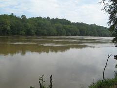
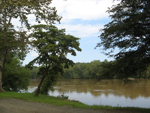
The Yadkin River divides the two sections of the park. It was muddy and fast-moving Saturday because of last week’s thunderstorms. Typically the river’s much more of an olive green color; the water supposedly is shallow enough to wade across to nearby islands but I’ve never felt brave enough to try it. This section is looking upriver toward Bean Shoals.
The water was already knee high just a foot or so from shore; an old fisherman told me his kids (he was in his 70s, so they were grownups) had waded in waist-deep water out to the shoals in the main channel to see if they could get any bites. Not my idea of fun, especially when the water’s so muddy.
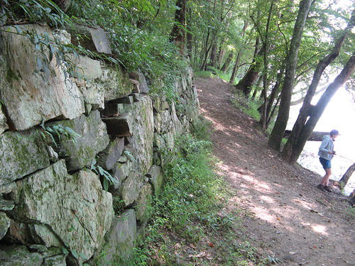
I saw these remnants from an attempted pre-Civil War canal project the first time I came here. Not sure why they never finished it.
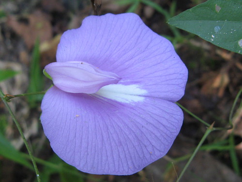
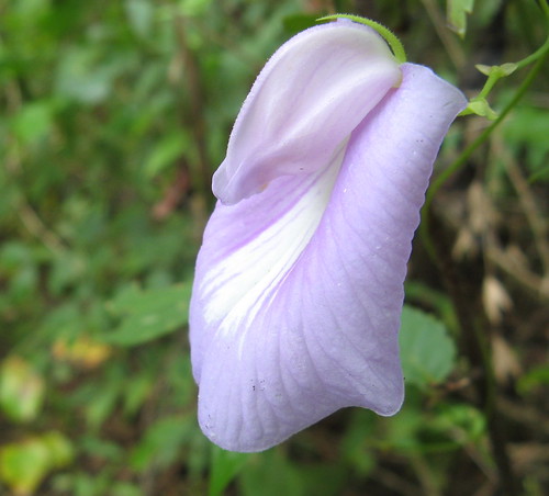
Just happened to notice this very cool purple wildflower — who says they only bloom in the spring? (By the way, can anybody ID this?)

Another of these cool golf-ball-looking mushrooms.
On Sunday I started out at the Yadkin River canoe put-in point. There’s another canoe access point about a half-mile from our house; if I had boat I could start here and row home. It’s about 30 miles.
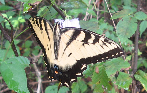
Probably one of my best butterfly pictures to date. It was hiding behind a purple wildflower like the one I saw Saturday. It flew off and then returned, which I didn’t expect. It also sat still long enough to have its picture taken. Must’ve been some killer nectar at that flower.
Here’s where the butterfly lit.
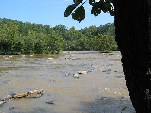
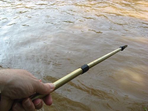
More rocks in the Yadkin.

A tree hangs out over the shore at the end of an unnamed loop on the lower half of the River Sections. The trailhead is at the top of a bluff; you take the Ivy Bluff Trail down to the water’s edge, then you just amble along and soak up the scenery. Note if you come this way: The Ivy Bluff Trail has one really steep section that’s a little tricky on the way down — a hiking pole comes in extra handy here. On the way back you can take the horse trail (follow the white blazes) for a nice climb back up to the trailhead.
That’ll do it for this week. I might take next week off — the North Carolina Beer Festival is on Saturday right across the street. The prospect of hundreds of beers to sample and no worries about driving home could produce a Sunday not conducive to hiking.
Links for this weekend’s outing:
- My first River Sections outing.
- All my Pilot Mountain State Park hikes.
- EveryTrail GPS travelogue.
- EveryTrail guide — Pilot Mountain Summit Trails.
- Pilot Mountain State Park homepage.
- Park map (PDF download)
Google map:
View Pilot Mountain State Park River Sections in a larger map
Good post, Tom – looks like a cool and pretty place to spend some time out amblin’ in good ol’ Mother Nature!
Nice trip report and pictures. That first main picture of the Yadkin looks like it’s extremely flooded – not sure the recent thunderstorms would make the water level rise that much though. Could just be the camera angle.
That’s just the camera angle — the river isn’t out of its banks.
Tom,
We just started a hiking and outdoors guide and your blog is our first hiking blog because it is a great one! We listed you here:
http://www.hikingsanfrancisco.com/hiker_community/outdoor_resources/outdoor_resources.php
It would be great to do a longer review+interview if possible.