
Got this one right the first time (for once): There’s a parking lot at either end of the 4.5-mile Stone Mountain Loop. I started at the Upper Lot Trailhead and did what’s become instinctive: followed the arrows to the waterfalls. Stone Mountain State Park has a series that kept me busy for a good two hours before I started moving in the general direction of the Mountain.
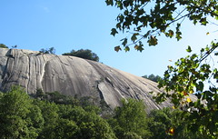
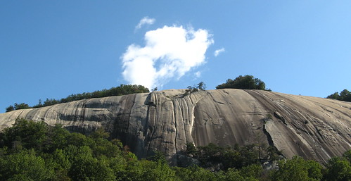
So I’m wandering down the tree-tunnel trail after my waterfall gazing’s done and I’m noting the woods seem to be thinning, as if there might be a clearing around the next bend. Then I look up to my right and see a mass of granite blotting out the sky beyond the treetops.
“Holy shit, look at that,” I heard myself saying aloud before I took a second to make sure there might be a troop of Cub Scouts nearby (not that it would’ve affected the outcome; my potty mouth has a mind of its own). I had seen pictures and studied up on this massive granite dome, but a couple hours in the woods put my brain on vacation, leaving me unprepared for the dome’s visual impact. Felt like God just left it there for our general amazement.
There’s another much easier way to reach this point: park at the Lower Lot Trailhead and stroll in from about a half-mile away. All flat, nothing to it. Maybe it’s just as astounding that way, but I doubt it.
Stone Mountain Loop is straightforward: 4-plus miles with a mean climb to the top, a relaxing walk back down, a break at an old homesteader’s settlement, a couple easy miles through the forest, and options to check out the waterfalls. Follow the signs and the orange blazes and you can’t go wrong. It’s typically described as “strenuous” but it’s more like a moderate hike with couple strenuous sections.
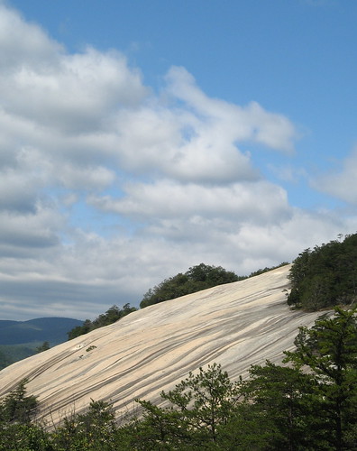
That’s if you stay on the trails. If you get off the trails anywhere on the granite face of Stone Mountain, one slip could really, truly, honestly kill you dead. Am I being emphatic enough?
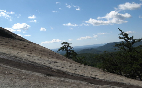
Stone Mountain, being a granite dome, doesn’t appear to have any cliffs you can walk up to and safely admire the view. From the top it just starts sloping down, gradually getting steeper the further it descends. It’s never quite 90 degrees vertical, but it’s close enough to make this one of the top rock-climbing destinations in these parts. I’m guessing it’s reasonably safe with the right training and climbing gear.
But if Joe Hiker strays out onto the rock face with nothing to hold onto, it’s easy to descend to a point where he can’t climb back up. If his luck holds, a rescue squad can save his fanny, but it’s no stretch to imagine a minor slip turning into a major tumble that ends with death due to blunt-force trauma. And it looks like Joe would never know he was in trouble till it was too late.
Here’s a sample of the slope from the trail near the Lower Trailhead Lot. The trail is super steep through here, but there are lots of stairs and a few cables. There are many places like this near this path, all with these slopes that practically beg you to tempt fate and start exploring.
OK, so I tried to get cute here.
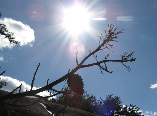
Yeah, I had nice weather.
If only the climb ended up there. (Pretty close, though).
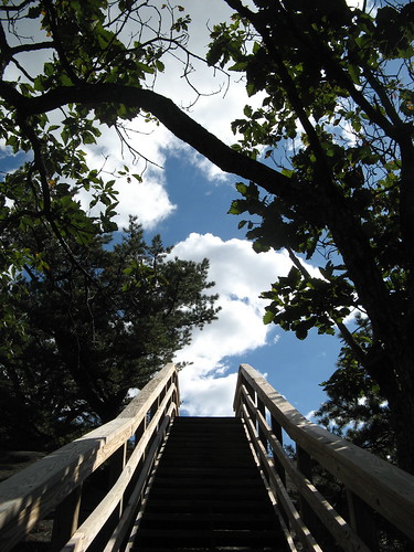
OK, here’s the top.
See how harmless it looks?
This shot conveys the reality: it gets super steep super fast.
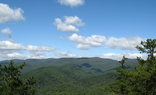
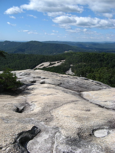
So that’s the top of the rock face. Let’s see some of the other sights along the trail.
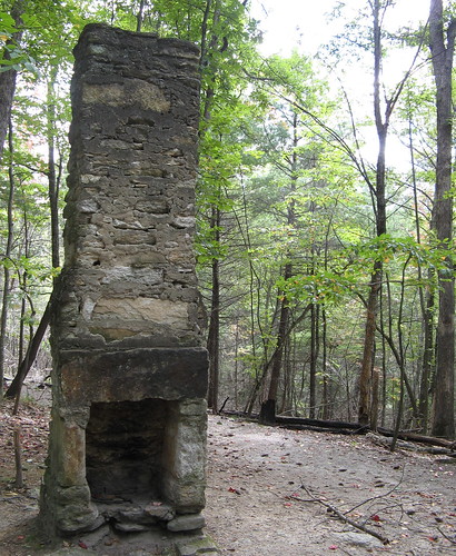
This struck me as interesting: the trail is going through what used to be somebody’s living room.
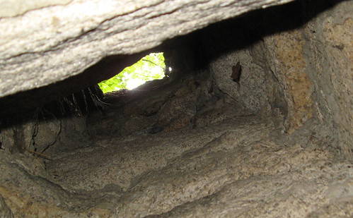
Couldn’t resist: Yes, the chimney hole is still open.
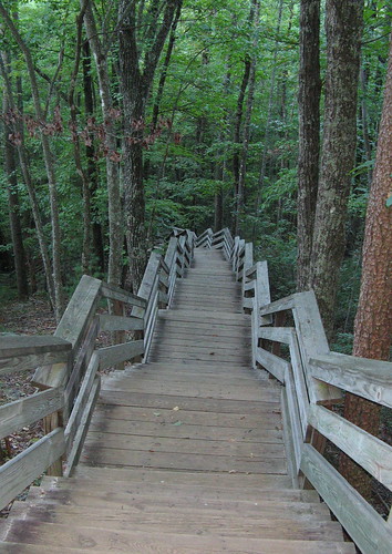
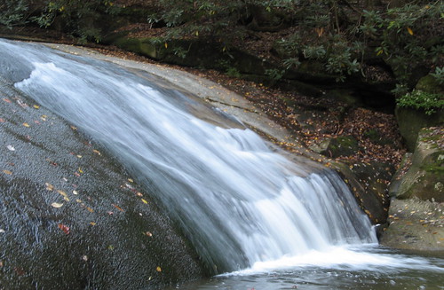
This stairway dives down into the woods near a 200-foot cascade not far from the Upper Lot Trailhead. It’s an impressive fall, but the light there was all wrong so none of my pictures came out.
This one didn’t come out too bad, though.
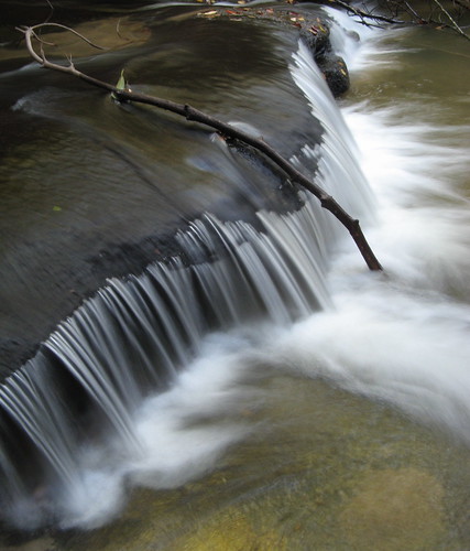
There’s a spur trail to what’s called “Lower Falls” and “Middle Falls.” This is the lower one; it takes two stream crossings to get here.

Saw a few interesting wildflowers nearby.
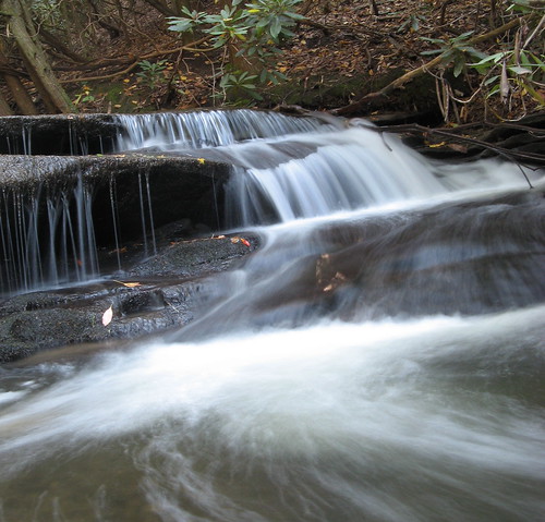
Another shot near the Lower Falls.
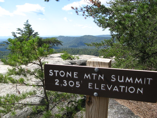
OK, one more look at Stone Mountain:
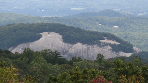
Here’s a look at Stone Mountain from a few miles away as the crow flies, from the Blue Ridge Parkway:
Some fine Stone Mountain links for all the Googlers out there.
- EveryTrail GPS tracks.
- North Carolina Outdoors guide to Stone Mountain.
- Stone Mountain geology, from Sherpa Guides.
- SummitPost guide to Stone Mountain.
- North Carolina state parks page.
- Park map (PDF download).
- Stone Mountain Waterfalls
And the required Google map:
View Stone Mountain State Park in a larger map
Nice post, Tom. Thanks.
Rick: I’m just trying to elevate your opinion of the East of the Rockies mountains.
Like I said in my earlier post, America’s diminuitive Uluru (but wrong type of rock!)
I’m very happy that you made it to Stone Mountain and I agree with your description that it is a moderate hike with a couple of strenuous sections. Next time you go, take the Wolf Rock Trail to Wolf Rock and Cedar Rock. On days that the crowds are on Stone Mountain, these two are usually deserted, but just as fantastic.
Welcome to our neck of the woods& the (ever expanding) Atlanta area.
(blowing my own horn) If you want a trail map see http://asterix.cs.gsu.edu/blog/?p=12.
Actually I like Kennesaw mountain a lot better if you’re in the area, but you have to see Stone Mountain at least once.
rob
Experienced this trek yesterday with the aid of your GPS track over on EveryTrail. Many thanks!
Clinton: Glad to be of help, and glad to see some people are using the EveryTrail tracks.