
Three weeks of gross lassitude and all-around laziness ended Sunday with a seven-mile hike at Pilot Mountain State Park (site of my first-ever North Carolina hike.)
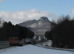
Pilot Mountain two days after the Blizzard of ’09 blew through. Most of the snow’s gone now.
I was so out of shape that I skipped Pilot Mountain’s main attraction — the Big Pinnacle, which from a distance looks uncannily similar to a Big Nipple — and concentrated on a moderate loop along the Grassy Ridge Trail, Mountain Trail and Grindstone Trail.
It’s mostly standard walking-in-the-woods fare without much eye candy, but when I’ve sat on my fanny for most of a month, my cranky bones need a gentle reintroduction. Hiking to be hiking, for sure, but hey, they’re my feet. I’ll punish ’em as I choose.
I got off to a chilly start but the day warmed up nicely — sunny without much breeze, ideal hiking weather.
I started out on the Grassy Ridge Trail, across the road from the Park HQ. Grassy Ridge will take you to the connector trail for the southern section of Pilot Mountain State Park — an extra six miles one way that I wasn’t interested in exploring just yet.
May as well get to the pictures:
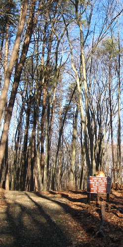
Here’s a turn on the Sauratown Trail, which ends 22 miles distant at Hanging Rock State Park (last seen here and here).
My other New Year’s resolution (the main being to work off about 10 pounds of flab recently amassed) is to check out the Sauratown Trail, which was built by industrious local equestrians and hikers (official site here). Much of it is on private land whose owners were talked into allowing hikers and horse people pass through. It’s also the Mountains to the Sea Trail connector for this part of North Carolina.

An old tobacco barn on the Grassy Ridge Trail. It has a rumor of a roof on it and might be a better-than-nothing shelter in a storm (though not much better).
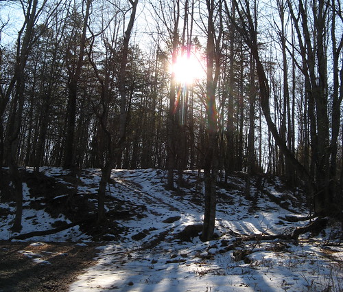
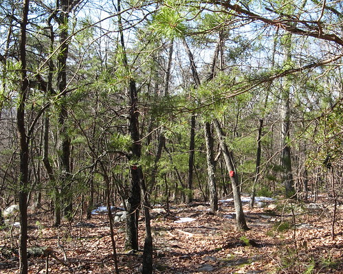
Still some snow along the Grassy Ridge Trail. If you go this route you’ll eventually run into a country road with a big white house on the other side. The trail takes a hard right and parallels this road a short stretch, then comes out on the road again across from the parking lot for the Pilot Mountain connector trail. The Mountain Trail is about 20 yards down the road on the right.
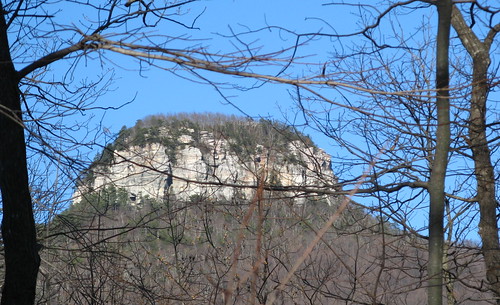
One nice thing about winter hiking: you can see stuff blocked by leaf cover the rest of the year. This view of the Big Pinnacle is near the entrance to the Mountain Trail.
Once cool thing about low-altitude hiking: moving up into the evergreens at about 1500 feet of elevation. A welcome break from the leafless gray.
Mountain Trail is a nice stretch described as “strenuous” on park signs and maps, but it’s not really all that bad. The only strain in winter is finding the trail with no cut through the forest undergrowth to guide your way. It’s all blazed but you’ll have to pay attention, especially when the trail turns.
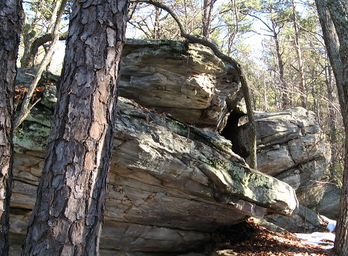
As always, excellent rocks eventually show up at Pilot Mountain.
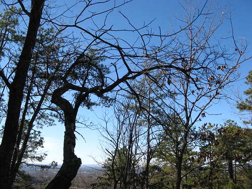
The sky was a blue I’d normally expect in California.
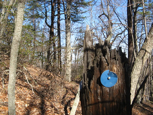
Blaze on a broken tree along the Grindstone Trail, which ends at the Pilot Mountain Campground if you follow all the blue blazes. If you park at the HQ it’s about a mile of road walking back to your car. There may be another way through the woods to return to the park HQ, but I didn’t see it on this outing.
That should do it this week. Hope you all had a wonderful Christmas (even if it’s not the official holiday of your chosen faith); don’t get crazy on New Year’s Eve.
Links for this week’s hike:
-
EveryTrail GPS plot.
Pilot Mountain State Park official page. (Download PDF map here.)
Here’s a Google map of Pilot Mountain’s trail heads.
View Pilot Mountain State Park trailheads in a larger map
Wish that we lived closer to something that spectacular. Mostly low country around here, so it really makes high country look big when you get a chance to visit. After some years in the lowlands I even got my acrophobia back.
Looking forward to Spring, right now we’ve got six inches of that blizzard still on the ground and it’s cold.
Nice story, nice photos. Hope we can do the hike someday, haven’t been back to NC for a few years though.