
Good trail, great idea: Seems some local hikers and horse people decided there was no good reason not to have a trail connecting Pilot Mountain and Hanging Rock state parks, which are, after all, a mere dozen miles apart as the crow flies. So they contacted a bunch of property owners and talked ’em into allowing a trail cutting through their lands.
They created the Sauratown Trails Association in 1988 and started digging. Today there’s a 22-mile trail connecting the two state parks; total mileage is around 35, counting the various loop trails. They’ve done an impressive job from what I’ve seen — nice grading, good signage, enough blazes to keep you on your way, a trail map and guide for each of the trail’s 16 sections.
I’ll grant you that a trail crossing private landowners’ pastures and timber is not exactly wilderness, and there’s not exactly a surplus of scenic splendor in the lands between the two state parks. You cross a bunch of country roads, you hear a lot of traffic near the busier routes, you could forget your camera with no regrets. The remarkable thing is that they built it anyway, a clear example of not letting a shortage of greatness get in the way of doing some good.
The trail is pretty well documented, but I haven’t been able to find a Google map with GPS tracks for the whole distance — so I’ve started one of my own.
View Sauratown Trail in a larger map
The three little colored lines on the left are sections 16, 15, and 14 (west to east; click and zoom for a closer look). The dots represent parking areas near the end of each section. The circuit route at the far right is the Sauratown Loop Trail in Hanging Rock State Park, which I hiked by accident early in October.
So about the hike: First, aren’t you glad I waited till now to start whining about how absurdly cold it’s been here since New Year’s? I realize we’re supposed to have frosty mornings down here in Dixie — but the creek’s-froze-solid mornings are entirely unnecessary. I could’ve had 15-degree mornings anywhere north of the Ohio River if I was into that kinda thing. (Fortunately I blew all my REI gift cards and the rest of my holiday bounty on a new mountaineering jacket from Outdoor Research, figuring I’d need some rain gear before winter was out, so I at least have something to fight off the wind. I had more layers than a wedding cake Sunday morning, and needed them all).
(… hey, what would a blog be without pointless bellyaching…?)
OK, enough stalling. Let’s see some pictures. I started at the western edge of Section 16.
Here’s the trail into Pilot Mountain State Park, just across the road from the Corridor Trail parking lot (the Corridor Trail goes down to the Yadkin River — a nice place to wet your feet in the summer). Mother Nature generously provided a 20 mph breeze through here to make sure I was fully awake and appreciating the glory of her creation. I wanted to smack her.
Actually this is a fine stretch of trail: mostly gentle downhill for just under two miles.
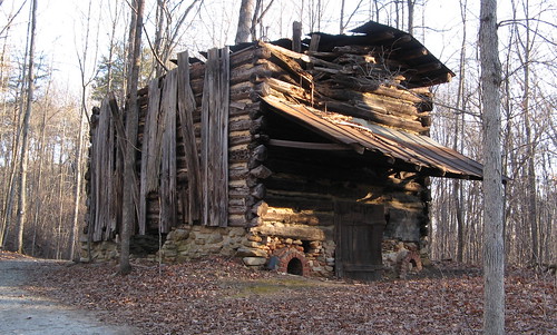
Yes, this is the same decrepit tobacco barn I took a picture of two weeks ago. I had better light, I swear.
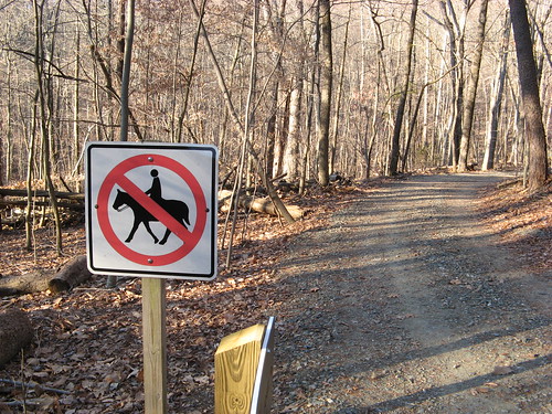
This sign tells you to halt your horse, lest you ride it all the way to the Pilot Mountain park headquarters and find there’s no room in the men’s room for him to do his business. The right turn here passes a sign heralding the Sauratown Trail. It’s more downhill till you come to the U.S. Highway 52 overpass.
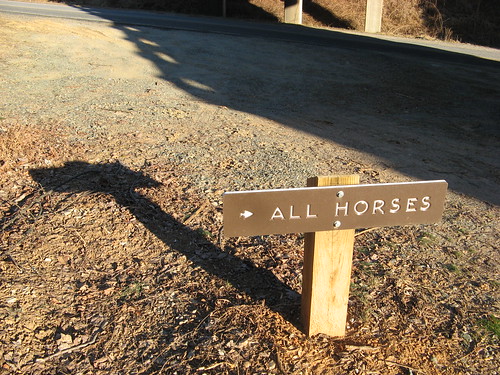
When all else fails, pretend you’re a horse (drawing the line at leaving your droppings on the trail of course). Basically you bear right, follow the road under the overpass and cross about 50 yards down. Section 15 starts just beyond a row of mailboxes.
My mindset changed as soon as I got here — no longer in the state park, moving into the borrowed lands which remain so only as long as hikers and horse people behave.
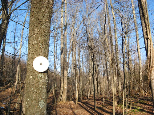
The white blazes’ll keep you on the path of righteousness (a good place to be on Sunday morning when you should be in church. I grant myself an exception because the trail is my church; I fully expect Gore-Tex wings in the afterlife.)
About a half-mile up this part of Section 15, a road crossing appears. It’s not 100 percent obvious where the trail continues, but….
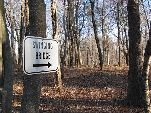
… I’m checking out the swinging bridge, that’s all there is to it. Actually I start seeing white blazes again pretty soon, and then there’s the bridge.
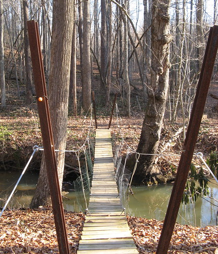
You’d never take a horse across this (there’s a water crossing nearby). It’s a bit of a bouncy walk across.
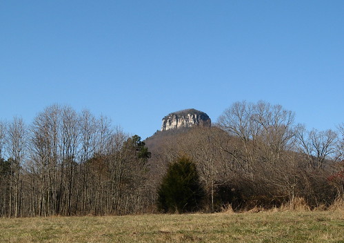
Another look at Pilot Mountain’s Big Pinnacle. The trail hugs the timber at the edges of meadows rather than crossing them.
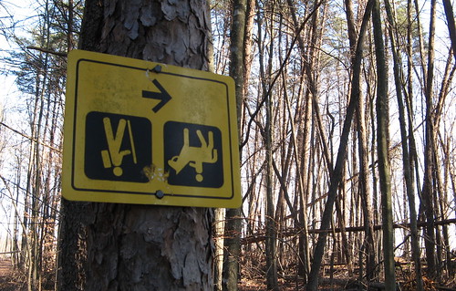
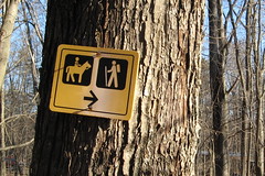
At first I thought practical jokers had been at work here, then I noticed the sign was nailed firmly to the tree. Follow the arrow.
Note if you’re on Section 15: one property owner has an electrified fence to discourage folks from rambling onto his land. There’s no barbed wire, just parallel rows of shiny metal and yellow connectors lashing them to fence posts. I don’t think you want to find out how much juice is coursing through there; might be no worse than a hard fist to the face, but if you’re into pain, save it for your personal dungeon.
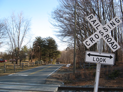
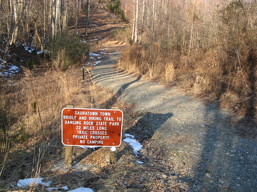
Section 15 ends at an old state highway. There’s parking lot over to the right, and this crossing near Coon Road at the left. Cross the tracks and the trail resumes with Section 14 on the right.
Section 14 is less than a mile one way. You walk till you hit another country road, cross it and wander down a ways till another trail sign appears for Section 13: it’s 2.85 miles one way, according to the sign. At this point I avoided the temptation to hike nearly 15 miles in one day; I turned back and retraced my steps for a pleasant 9-miler.
I’m planning a return trip next weekend; I suspect the trails are more interesting on the east end near Hanging Rock.
Links for this week’s hike:
- Everytrail GPS track.
- Sauratown Trails Association.
- Trail descriptions, by section.
- Map download (PDF)