
I hiked to this section of Pilot Mountain State Park a few weeks back, but the 13 miles of getting there and returning didn’t leave much energy for exploration. This time I just drove up to the River Sections and wandered a few narrow, sandy trails along the Yadkin River. Rain in the forecast kept everybody else away so I had the park mostly to myself.
 The hiking’s easy to moderate — flat near the river, a few climbs up and down the nearby bluffs. Crowding at the mountain section of the park is a serious issue during spring and summer, I’ve been told, so these more remote river sections might offer a break from the multitudes in peak hiking season (Click here for driving directions ).
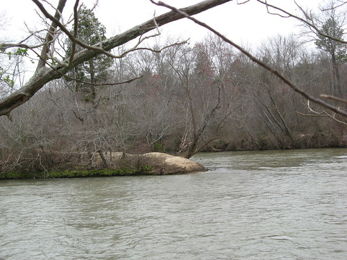
Most of the Yadkin is flat, shallow and sedate — but one of the most interesting bends in the river passes through Pilot Mountain’s River Section. No rapids or waterfalls, but abundant rocks jutting up, plus a couple islands (one of which has two campsites set aside for paddlers only). The current looks too strong to venture across at this time of year, but the wading opportunities are no doubt more promising in summer when the water’s lower and the tributary creeks have seen the last of the spring showers.
I started out on the southern side of the river. There’s only a couple miles of trail here, but there is a great place to launch canoes or kayaks on a road down to the river’s edge nearby. If had a boat, I could float from there to a stop on the Yadkin River Trail about a half-mile from my doorstop. Of course that would require me to start a paddling blog, but no clever titles spring to mind so I’ll stick with this one.
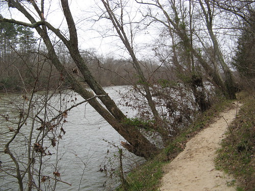
Ivy Bluff Trail goes down to the water’s edge. It’s very steep in a few places, and one little spur to a river overlook ends abruptly at a rock outcropping — watch your step, there’s a drop-off of at least 20 feet at the edge of the rock.
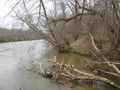
The Yadkin River from the outcropping. From here it’s a rightward bend in the trail, which goes down by the riverside.
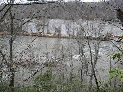
Eastern end of the big island in the middle of the river.
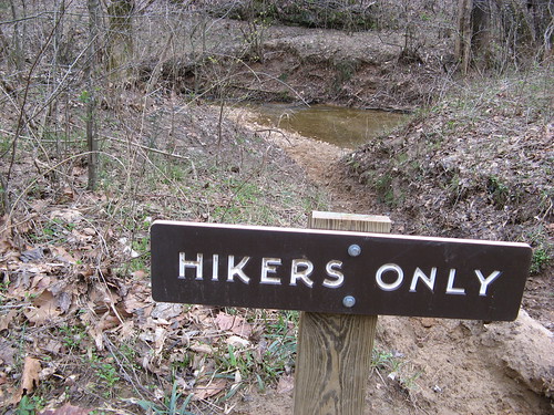
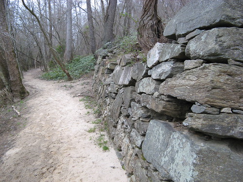
My kind of trail! There’s a little creek near here that flows into the Yadkin.
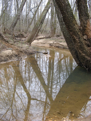
Very clear water in the creek right here.
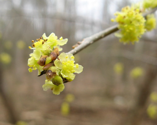
Macro shot of a bud on a sapling — someday there’ll be leaves here, I suspect.
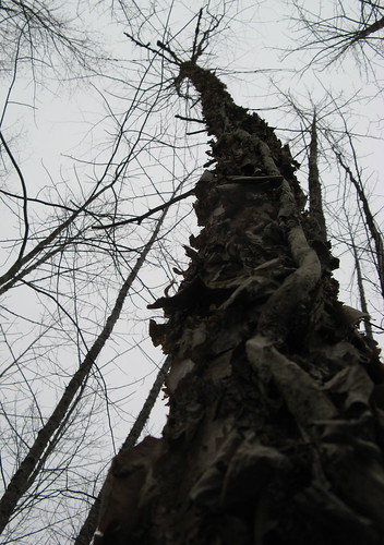
This ragged tree reminded me of that story about Jack and the Beanstalk.
I wandered around a bit and managed to log about 2 miles of hiking on the southern section, then I got back in the car and headed over to the northern section. There’s a road that goes almost to the river’s edge. You have to ford a small stream three times — avoid the urge to gun the throttle and see how large of a splash you can make. (If go this way, stay mindful of recent rains. The creek drains pretty quickly, leaving about six inches of water at the fords most of the time, but the water could be considerably deeper after several days of rain.)
The road ends at a circle drive not much more than a stone’s throw from the river’s edge.
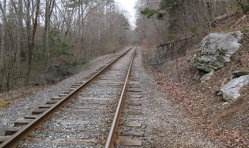
You have to cross these tracks to reach the river. I’m posting this as a reminder that trains still run these tracks, so use common sense around them.
If slip on this trail, you could fall right into the river.
These are remains of the Bean Shoals Canal project, started in and abandoned in the 1820s.
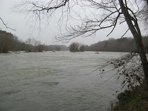
Looking westward along the river. The gray skies, light rain and wide expanse of the Yadkin made it look vaguely ominous, like perhaps this whole valley had been flooded.
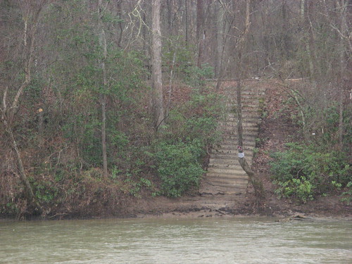
The river island again: there’s a series of steps up to a couple campsites set aside for paddlers only.
Clearly the best time to visit these trails is in the summer, when wading across the river offers a welcome break from the sweltering heat. The river islands practically beg you to wander over and kick back with a sketchbook.
Links for Pilot Mountain State Park:
Google map of the River Sections:
View Pilot Mountain State Park River Sections in a larger map
Good one, Tom! I love those river scenes that remind me of my Indiana youth!
This is a great hike! Love the photos and detailed trail review.