
McAfee Knob might well be the most-documented stop along the Appalachian Trail. (Click for the essential turn-by-turn guide at Hiking Upward.com). A rocky slab juts out from a rock face, creating a perfect promontory for snapshots giving the impression you’re braving extreme danger to be there. OK, so if you fall off the edge your chances aren’t good but otherwise it’s a reasonably safe outing.
McAfee Knob belongs on any avid hiker’s Life List, but it’s way-popular and right down the road from a metro area of over 300,000 people (Roanoke, VA). Go anytime if you don’t mind the throngs, but if you want a memorable outing:
- Avoid the most crowded times: Weekend afternoons during peak leaf-peeping season (late October-early November), for example.
- If you can’t get there on a weekday, show up first thing Sunday morning while everybody else is in church.
- Pick a sunny to partly sunny day. No point hiking up there when the Knob’s fogged in.
- Take somebody with you to take your picture at the Knob.
- If you want to meet some thru-hikers, try late May to early June.
With the public service message of this post now concluded, we can get on to what happened Sunday, best summarized in one word: sweat.
I left the house an hour before sun-up and hit the trailhead on Highway 311 west of Salem, VA (Roanoke is just up the road) at about 7:30 — plenty early enough to be in my church while everybody else was in theirs, but from the first step there was no denying this would be one moist outing.
Also: It’s uphill the whole way — over 1,100 feet of ascent somewhat mercifully stretched out over four miles. While not nearly as grueling as the ascent from Neels Gap to Blood Mountain, it’s still a vigorous workout.
On to the pictures:
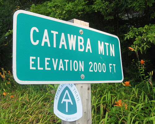
This sign at the trailhead tells you you’re in the right place. Crossing the road is the last flat section of the hike.
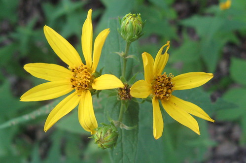
It’s still wildflower season, but they’re becoming more rare. I also saw a few wild blackberries (well, I think that’s what they were).
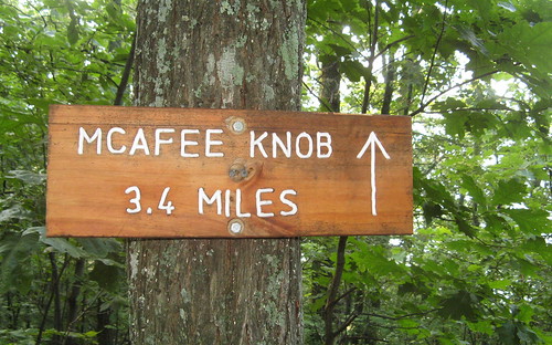
A trail board about a third of a mile up the trail has a map and more signs pointing you along the way.
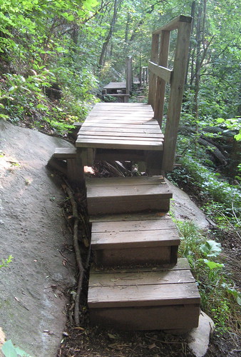
These trail bridges made me thankful for the local folks who maintain this section of the Appalachian Trail. Otherwise there’d be a lot more navigating sections of steep sloping rock face. Unfun.
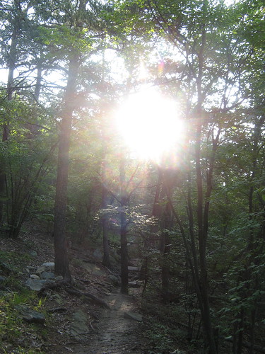
Posted in honor of the blazing morning sun.
Two Appalachian Trail shelters are on spur trails along the way. Just stay on the main trail and avoid the turns toward the shelters and you’ll stay on the right route.
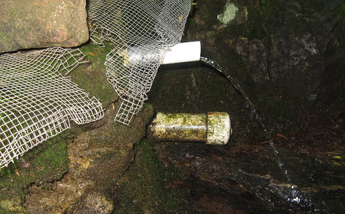
A trickle from a spring near the Catawba Mountain shelter.
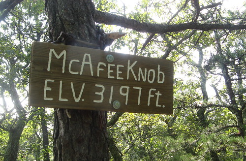
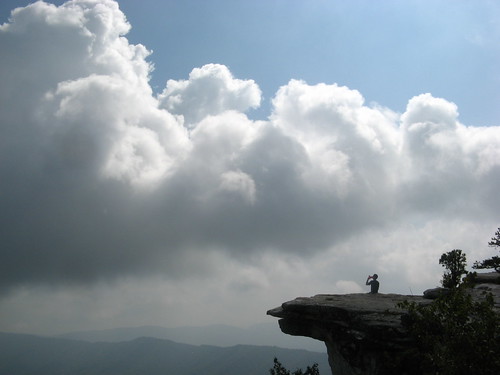
This sign tells you the climbing’s done. Just explore side trails over to the cliffs. Watch your step; it’s a long way to the ground below.
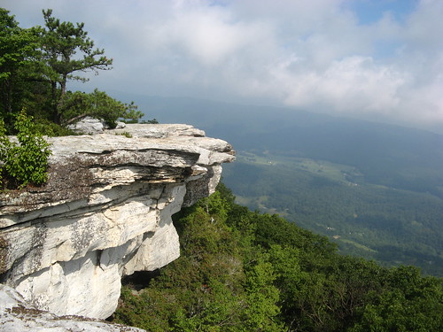
Here’s the most famous outcrop at McAfee Knob. I was hiking solo and didn’t feel like bugging fellow hikers to take my picture. Just for fun I tried inserting stuff into the frame to see if it made it any more interesting.
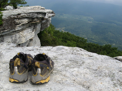
Shoes.
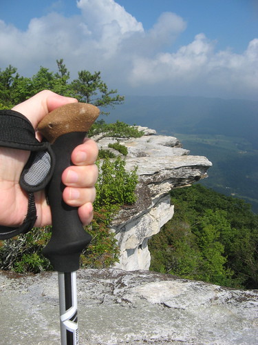
Hiking staff handle.
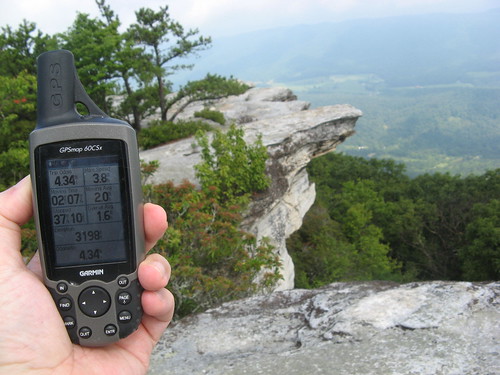
GPS receiver. Hmm, wonder if should I start charging these companies product-placement fees.
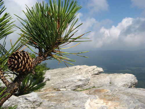
Pine cones are reliably photogenic.
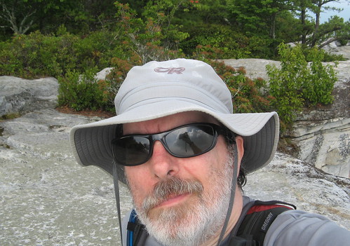
I also tried to take a self-portrait with the outcrop in the background. I had no luck on that account, but it did amuse me to see the reflection of my camera in my sunglasses lens.
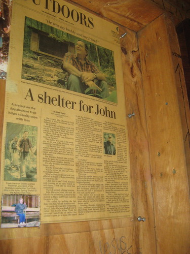
On the way back I stopped by the Johns Spring Shelter, where this newspaper clipping told the story of the guy who got the shelter built in honor of his son, a thru-hiker named John Haranzo who committed suicide in 2001. Text of the story is here.
By the time I got back to the parking lot it was well north of 90 degrees F under a punishing sun. The parking lot was still almost full, so you can imagine how jammed it gets on weekends when the weather’s friendlier.
That’ll cover it for this week. Links for this hike:
- EveryTrail GPS track.
- All my Appalachian Trail hikes.
- Hiking Upward trail guide.
- McAfee Knob images on Tumblr.
Google map:
View McAfee Knob on the Appalachian Trail in a larger map
Nice Hike Tom, I need to start exploring Virginia some as well.
Thanks Chris. Lots of hikes in Virginia are within a couple hours’ drive.
Mountains aren’t as high in Va, however, so you don’t get the cooling effect we get in the 5K-and-above peaks in the southern Blue Ridge.
It’s great Tom, and the pictures are really beautiful. I would love mention here, the yellow flower that you have pic here I guess that flower I am having at my home.